Area Overview for RG2 6AT
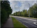
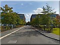
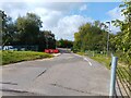
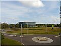
Photos of RG2 6AT
Area Information
RG2 6AT is a small residential postcode area in England, covering 5.3 hectares and home to 1700 residents. Its compact size means it is a tightly knit community, with a population density of 708 people per square kilometre. The area is characterised by a mix of housing stock, though the data suggests a focus on family-oriented living, given the median age of 47 and the prevalence of adults aged 30–64. While the area lacks large-scale amenities, its proximity to Reading’s transport hubs and retail centres makes it a practical choice for commuters. However, residents should be aware of the critical flood risk, with 91.06% of the area classified as high risk, and a similarly concerning crime score of 20 out of 100. These factors may influence decisions about property investment or daily life. Despite this, the area’s small footprint and direct access to nearby towns could appeal to those seeking a quieter, more manageable environment within reach of urban resources.
- Area Type
- Postcode
- Area Size
- 5.3 hectares
- Population
- 1700
- Population Density
- 708 people/km²
The property market in RG2 6AT is defined by a 48% home ownership rate, indicating that nearly half of residents rent their homes. This suggests a rental market that may be more active than owner-occupied, though the data does not specify the proportion of buy-to-let properties. The accommodation type is predominantly houses, which are likely to be family homes given the median age of the population. In a small area of 5.3 hectares, this housing stock may be limited in scale, making the immediate surroundings critical for buyers seeking more options. The high flood risk and crime concerns could influence property values, with potential buyers needing to weigh these factors against the convenience of nearby amenities. For those prioritising family-friendly living, the presence of a primary school nearby may add appeal, though the lack of secondary schools could be a consideration.
House Prices in RG2 6AT
Showing 9 properties
| Address | Type | Beds | Baths | Last Sale Price | Last Sale Date | |
|---|---|---|---|---|---|---|
| Flat 8, 3 Flagstaff Road, Reading, RG2 6AT | Flat | 2 | 2 | - | - | |
| Pyning, Smallmead Road, Reading, RG2 6AT | Flat | 2 | 2 | - | - | |
| Flat 5, 3 Flagstaff Road, Reading, RG2 6AT | Flat | - | - | - | - | |
| Flat 7, 3 Flagstaff Road, Reading, RG2 6AT | Flat | - | - | - | - | |
| Flat 4, 3 Flagstaff Road, Reading, RG2 6AT | Flat | - | - | - | - | |
| Flat 3, 3 Flagstaff Road, Reading, RG2 6AT | Flat | 1 | 1 | - | - | |
| Flat 6, 3 Flagstaff Road, Reading, RG2 6AT | Flat | - | - | - | - | |
| Flat 2, 3 Flagstaff Road, Reading, RG2 6AT | Flat | 1 | 1 | - | - | |
| Flat 1, 3 Flagstaff Road, Reading, RG2 6AT | Flat | - | - | - | - |
Energy Efficiency in RG2 6AT
The lifestyle in RG2 6AT is shaped by its proximity to retail and transport hubs. Within practical reach are five retail venues, including Tesco Reading, Costco Reading, and Aldi Unit 6 Gateway Retail Park, offering a range of shopping options. These facilities cater to daily needs, from groceries to larger purchases, reducing the need for long trips. The area’s rail connections, such as Reading West and Theale stations, provide easy access to nearby towns and cities, enhancing mobility. While the data does not mention parks or leisure facilities, the lack of protected natural areas or planning constraints suggests that the area is not constrained by environmental restrictions. However, the absence of named parks or recreational spaces means that residents may need to travel for outdoor activities. The compact nature of the area ensures that amenities are within walking or short driving distance, supporting a convenient, though limited, lifestyle.
Amenities
Schools
The nearest school to RG2 6AT is Green Park Village Primary Academy, a primary school with a good Ofsted rating. This provides families with a locally available option for early education, though no secondary schools are listed in the data. The presence of a primary school with a positive rating may be a key draw for families with young children, ensuring access to quality education without long commutes. However, parents of older children may need to look beyond the immediate area for secondary schooling, which could affect long-term residential decisions. The absence of additional schools suggests that the area’s educational offerings are limited to primary level, requiring careful planning for families with children of varying ages.
| Rank | School | Type | Entry gender | Ages |
|---|
Explore more schools in this area
Go to Schools tabDemographics
The community in RG2 6AT is predominantly composed of adults aged 30–64, with a median age of 47. This suggests a mature, stable population, likely with established careers and families. Home ownership stands at 48%, indicating a mixed market where nearly half of residents rent. The accommodation type is primarily houses, which may reflect a preference for larger living spaces or family homes. The predominant ethnic group is White, though no data is provided on other demographics. The population density of 708 people per square kilometre implies a moderately compact settlement, but the small area size means the community is not densely packed. For quality of life, the absence of specific deprivation data means it is unclear whether the area faces socioeconomic challenges, but the high crime risk score of 20/100 suggests potential concerns about safety that could affect daily living.
Household Size
Accommodation Type
Tenure
Ethnic Group
Religion
Household Composition
Age
Household Deprivation
NS-SEC
Explore more demographic insights in this area
Go to Demographics tabPlanning
Planning Constraints
- Flood RiskPremium
- Ramsar Wetland SitesPremium
- Area of Outstanding Natural BeautyPremium
- Protected Nature ReservePremium
- Protected WoodlandPremium