Area Overview for RG2 6BY
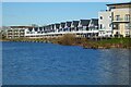
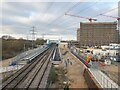
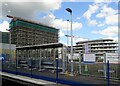
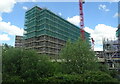
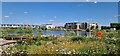
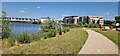
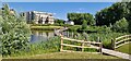
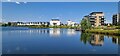
Photos of RG2 6BY
Area Information
RG2 6BY is a compact residential postcode in England, covering 6,170 square metres and home to 1,700 residents. Its high population density of 708 people per square kilometre reflects a tightly knit community, though the area’s small size means it is more of a residential cluster than a sprawling suburb. Located near Reading, it benefits from proximity to the city’s amenities, including major retail hubs and transport links. The area is characterised by a mature demographic, with a median age of 47 and a majority of residents aged 30–64. This suggests a community of established professionals and families, many of whom own their homes. While the area lacks natural or protected landscapes, its strategic location near railway stations and supermarkets makes it practical for daily living. However, potential buyers should note the critical flood risk and high crime rates, which may influence long-term considerations. For those prioritising convenience and connectivity, RG2 6BY offers a blend of accessibility and a settled local environment.
- Area Type
- Postcode
- Area Size
- 6170 m²
- Population
- 1700
- Population Density
- 708 people/km²
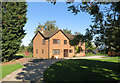
RG2 6BY is predominantly a housing area, with 48% of residents owning their homes and the remaining 52% likely to be in the rental market. The accommodation type is primarily houses, which may appeal to families seeking space and privacy. Given the area’s small size and high population density, the housing stock is likely to be tightly packed, with limited scope for expansion. This suggests that properties here are typically family homes, possibly with gardens, though the exact size or layout of individual homes is not specified. For buyers, the mix of owner-occupation and rental properties indicates a balanced market, though the high population density could mean competition for available homes. The proximity to Reading’s amenities may also make this area attractive to those seeking a base near the city but with a quieter residential feel.
House Prices in RG2 6BY
Showing 40 properties
| Address | Type | Beds | Baths | Last Sale Price | Last Sale Date | |
|---|---|---|---|---|---|---|
| Flat 3, 54 Flagstaff Road, Reading, RG2 6BY | Flat | 2 | 2 | - | - | |
| Flat 203, 54 Flagstaff Road, Reading, RG2 6BY | Flat | 2 | 2 | - | - | |
| Flat 104, 54 Flagstaff Road, Reading, RG2 6BY | Flat | - | - | - | - | |
| Flat 101, 54 Flagstaff Road, Reading, RG2 6BY | Flat | - | - | - | - | |
| Flat 205, 54 Flagstaff Road, Reading, RG2 6BY | Flat | - | - | - | - | |
| Flat 306, 54 Flagstaff Road, Reading, RG2 6BY | Flat | - | - | - | - | |
| Flat 103, 54 Flagstaff Road, Reading, RG2 6BY | Flat | 1 | 1 | - | - | |
| Flat 302, 54 Flagstaff Road, Reading, RG2 6BY | Flat | - | - | - | - | |
| Flat 206, 54 Flagstaff Road, Reading, RG2 6BY | Flat | - | - | - | - | |
| Flat 102, 54 Flagstaff Road, Reading, RG2 6BY | Flat | - | - | - | - |
Energy Efficiency in RG2 6BY
RG2 6BY offers a range of practical amenities within reach, including five retail outlets such as Tesco Reading, Costco Reading, and Morrisons Daily. These supermarkets provide easy access to groceries and daily essentials, supporting a convenient lifestyle. The area’s proximity to multiple railway stations—Reading West, Reading, and Theale—ensures residents can travel efficiently to work, shopping, or leisure destinations. While the data does not specify parks or leisure facilities, the presence of retail and transport options suggests a focus on functionality over expansive recreational spaces. The compact nature of the area means amenities are closely clustered, reducing the need for long commutes. However, the absence of detailed information on green spaces or cultural venues leaves room for further exploration of lifestyle options beyond the immediate vicinity.
Amenities
Schools
The nearest school to RG2 6BY is Green Park Village Primary Academy, a primary school with a Good Ofsted rating. This provides families with a solid educational option for younger children, though no secondary schools are listed in the data. The presence of a primary school with a positive rating suggests that the area is suitable for families with young dependents, offering a foundation for early education. However, the absence of secondary school information means parents may need to look further afield for secondary education, potentially increasing commuting times. The single school listed reflects the area’s small size, but its quality rating indicates a reliable local resource for primary-level learning.
| Rank | School | Type | Entry gender | Ages |
|---|
Explore more schools in this area
Go to Schools tabDemographics
The population of RG2 6BY is 1,700, with a median age of 47, indicating a community skewed towards middle-aged adults. The most common age range is 30–64, suggesting a mix of professionals and families with school-age children. Home ownership stands at 48%, meaning nearly half of residents rent, which may reflect the area’s mix of owner-occupied and rental properties. The predominant accommodation type is houses, aligning with the demographic profile of settled households. The predominant ethnic group is White, though no specific diversity metrics are provided. The high population density of 708 people per square kilometre implies a compact, possibly urbanised residential layout. This density, combined with the age profile, suggests a community focused on stability and proximity to services. However, the lack of detailed diversity data means broader social dynamics remain unexplored.
Household Size
Accommodation Type
Tenure
Ethnic Group
Religion
Household Composition
Age
Household Deprivation
NS-SEC
Explore more demographic insights in this area
Go to Demographics tabPlanning
Planning Constraints
- Flood RiskPremium
- Ramsar Wetland SitesPremium
- Area of Outstanding Natural BeautyPremium
- Protected Nature ReservePremium
- Protected WoodlandPremium