Area Overview for RG2 0WZ
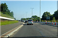
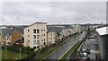
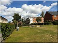
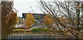
Photos of RG2 0WZ
Area Information
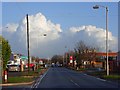
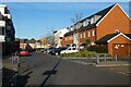
Living in RG2 0WZ means inhabiting a compact, residential postcode area in England that covers 8,903 square metres. With a population of 1,700 people, this small cluster of homes has a population density of 708 people per square kilometre, suggesting a tightly knit community. The area is defined by its proximity to local amenities and transport links, making it practical for daily life. Residents benefit from nearby retail outlets and rail stations, which are key for commuting and shopping. While the area is small, it is positioned to offer accessibility to broader regional networks. The demographic profile—primarily adults aged 30–64—suggests a stable, established community. For those considering homes in RG2 0WZ, the balance between compact living and nearby infrastructure is a defining feature.
- Area Type
- Postcode
- Area Size
- 8903 m²
- Population
- 1700
- Population Density
- 708 people/km²
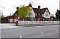
The property market in RG2 0WZ is characterised by a 48% home ownership rate, with houses being the primary accommodation type. This suggests a mix of owner-occupied homes and rental properties, though the exact proportion of rentals is not specified. The small area size and limited population indicate a constrained housing stock, likely centred on individual family homes. For buyers, this means competition may be high, and properties are likely to be in established, low-density settings. The focus on houses rather than flats or apartments points to a market that prioritises private space over high-density living. Proximity to rail stations and retail amenities adds to the appeal for those seeking a balance between suburban comfort and urban connectivity.
House Prices in RG2 0WZ
Showing 39 properties
| Address | Type | Beds | Baths | Last Sale Price | Last Sale Date | |
|---|---|---|---|---|---|---|
| 53 Woolhampton Way, Reading, RG2 0WZ | Semi-detached | 4 | 2 | £526,000 | Mar 2024 | |
| 45 Woolhampton Way, Reading, RG2 0WZ | house | - | - | £550,000 | Dec 2023 | |
| 31 Woolhampton Way, Reading, RG2 0WZ | Semi-detached | 4 | 2 | £500,000 | Sep 2023 | |
| 27 Woolhampton Way, Reading, RG2 0WZ | Semi-detached | 3 | 1 | £500,000 | Mar 2023 | |
| 49 Woolhampton Way, Reading, RG2 0WZ | house | - | - | £650,000 | Mar 2023 | |
| 47 Woolhampton Way, Reading, RG2 0WZ | Terraced | 4 | 4 | £490,000 | Sep 2021 | |
| 41 Woolhampton Way, Reading, RG2 0WZ | Terraced | 4 | 3 | £480,000 | Nov 2020 | |
| 43 Woolhampton Way, Reading, RG2 0WZ | Terraced | 3 | 3 | £480,000 | Nov 2020 | |
| 37 Woolhampton Way, Reading, RG2 0WZ | house | - | - | £459,950 | Nov 2018 | |
| 11 Woolhampton Way, Reading, RG2 0WZ | Semi-detached | 3 | 2 | £433,500 | Nov 2018 |
Energy Efficiency in RG2 0WZ
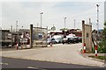
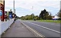
Residents of RG2 0WZ have access to five nearby retail outlets, including Morrisons Whitley, Aldi Whitley, and Makro Reading. These stores offer a range of shopping options, from groceries to larger retail needs. The proximity to rail stations like Reading West and Earley adds convenience for travel, whether for work, leisure, or visiting nearby attractions. While the area lacks detailed data on parks or leisure facilities, the presence of multiple retail and transport options suggests a practical, community-focused lifestyle. The mix of shops and stations supports daily routines, making RG2 0WZ suitable for those prioritising accessibility and convenience.
Amenities
Schools
The nearest school to RG2 0WZ is Green Park Village Primary Academy, a primary school with an Ofsted rating of ‘good’. This single school serves the area’s primary education needs, though the absence of secondary schools nearby may require families to travel for higher education. The mix of school types—only primary in this case—suggests that residents must look beyond RG2 0WZ for secondary schooling options. For families prioritising proximity to schools, the quality of the primary institution is a positive, but the lack of secondary options could influence long-term housing decisions.
| Rank | School | Type | Entry gender | Ages |
|---|
Explore more schools in this area
Go to Schools tabDemographics
The community in RG2 0WZ is predominantly composed of adults aged 30–64, with a median age of 47. Home ownership stands at 48%, indicating a mix of owner-occupied and rental properties. The accommodation type is primarily houses, reflecting a suburban or semi-rural character. The predominant ethnic group is White, which aligns with broader regional trends. While the data does not specify deprivation levels, the population density and age profile suggest a mature, settled population. This demographic structure implies a focus on stability over transient living, with families and long-term residents forming the core of the area.
Household Size
Accommodation Type
Tenure
Ethnic Group
Religion
Household Composition
Age
Household Deprivation
NS-SEC
Explore more demographic insights in this area
Go to Demographics tabPlanning
Planning Constraints
- Flood RiskPremium
- Ramsar Wetland SitesPremium
- Area of Outstanding Natural BeautyPremium
- Protected Nature ReservePremium
- Protected WoodlandPremium