Area Overview for RG2 0RP
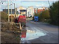
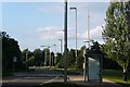
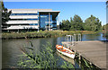
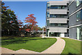
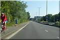
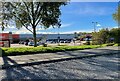
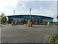
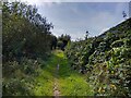
Photos of RG2 0RP

Area Information
RG2 0RP is a compact residential postcode in England, spanning 83.6 hectares and home to 1,700 residents. With a population density of 708 people per square kilometre, it is a tightly knit area where proximity to amenities and services is a defining feature. The postcode covers a small cluster of homes, predominantly single-family properties, catering to a mature demographic. Daily life here is shaped by its strategic location near key transport hubs and retail centres, making it convenient for both commuters and those prioritising accessibility. The area’s character is defined by its balance of residential tranquillity and practical connectivity, with residents able to access essential services within short distances. While the community is relatively small, it offers a blend of suburban comfort and urban convenience, appealing to those seeking a stable, well-served environment. The presence of a primary school with a ‘good’ Ofsted rating further underscores its suitability for families. However, the area’s compact nature means that buyers should consider its limited size when evaluating long-term living needs.
- Area Type
- Postcode
- Area Size
- 83.6 hectares
- Population
- 1700
- Population Density
- 708 people/km²
The property market in RG2 0RP is characterised by a 48% home ownership rate, indicating that nearly half of the area’s properties are owner-occupied. The accommodation type is primarily houses, which suggests a market skewed towards single-family homes rather than apartments or terraced housing. Given the area’s small size and limited housing stock, the market is likely to be competitive, with limited scope for new developments. Buyers should consider that the area’s proximity to transport links and retail amenities may offset its compact nature, making it attractive to those prioritising convenience over expansive living space. However, the low home ownership rate also implies a significant rental market, which could affect property values and availability. For those seeking a long-term residence, the predominance of houses may appeal to buyers looking for private, family-friendly homes, though the area’s size means that immediate surroundings are critical for accessing additional housing options.
House Prices in RG2 0RP
Showing 4 properties
| Address | Type | Beds | Baths | Last Sale Price | Last Sale Date | |
|---|---|---|---|---|---|---|
| 19 Island Road, Reading, RG2 0RP | house | - | - | £192,000 | Oct 2014 | |
| 18 Island Road, Reading, RG2 0RP | house | - | - | £162,000 | Oct 2014 | |
| 17 Island Road, Reading, RG2 0RP | house | - | - | £181,000 | Aug 2014 | |
| 16 Island Road, Reading, RG2 0RP | house | - | - | £220,000 | Aug 2014 |
Energy Efficiency in RG2 0RP
The lifestyle in RG2 0RP is shaped by its proximity to retail and transport hubs. Within walking distance are five retail outlets, including major supermarkets like Tesco Reading, Morrisons Whitley, and Aldi Whitley, ensuring that daily errands are easily manageable. The area’s rail network, with five stations including Reading West and Earley, offers convenient access to broader regional connections, supporting both commuters and those who rely on public transport. While the data does not specify parks or leisure facilities, the presence of multiple retail and transport options suggests a practical, service-oriented lifestyle. The compact nature of the area means that amenities are closely clustered, reducing the need for long commutes. However, buyers should consider whether additional recreational or green spaces are available beyond the immediate postcode, as this is not detailed in the data.
Amenities
Schools
The nearest school to RG2 0RP is Green Park Village Primary Academy, a primary school with a ‘good’ Ofsted rating. This provides families with a locally available option for early education, though no secondary schools are listed in the data. The presence of a primary school with a positive rating is a key consideration for families prioritising education quality, though parents may need to look beyond the immediate area for secondary schooling. The school’s performance suggests a focus on foundational learning and a supportive environment, which could be a draw for buyers seeking a family-friendly community. However, the absence of further educational institutions in the data means that prospective residents should investigate nearby options to ensure a full range of schooling is accessible.
| Rank | School | Type | Entry gender | Ages |
|---|
Explore more schools in this area
Go to Schools tabDemographics
The population of RG2 0RP has a median age of 47, with the majority of residents aged between 30 and 64. This suggests a community of established professionals and families, rather than a younger or retired demographic. Home ownership stands at 48%, indicating that nearly half of properties are owner-occupied, while the remaining are likely rented. The accommodation type is predominantly houses, reflecting a preference for standalone homes over flats or apartments. The predominant ethnic group is White, with no specific data on other demographics provided. The population density of 708 people per square kilometre implies a mix of close-knit living and shared spaces, though the area’s small size means it is not densely populated compared to larger urban centres. This profile suggests a stable, middle-aged community with a focus on family-oriented living, though the lack of diversity data limits deeper analysis of social dynamics.
Household Size
Accommodation Type
Tenure
Ethnic Group
Religion
Household Composition
Age
Household Deprivation
NS-SEC
Explore more demographic insights in this area
Go to Demographics tabPlanning
Planning Constraints
- Flood RiskPremium
- Ramsar Wetland SitesPremium
- Area of Outstanding Natural BeautyPremium
- Protected Nature ReservePremium
- Protected WoodlandPremium