Area Overview for RG2 0PA
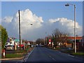
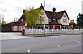
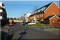
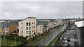
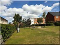
Photos of RG2 0PA


Area Information
RG2 0PA is a small, tightly packed residential postcode area in England, covering just 3,806 square metres. Its compact size means it’s a quiet, intimate neighbourhood with a population of 1,389 people, translating to a remarkably high density of 364,952 people per square kilometre. This makes it one of the most densely populated areas in the country, where proximity to amenities is a defining feature. Daily life here revolves around the nearby railway network, with stations like Reading West and Earley providing swift access to the city. The area’s retail presence is notable, with stores such as Morrisons Whitley and Aldi Whitley within easy reach. While the population is small, the concentration of services and transport links suggests a community that values convenience. The median age of 47, with a majority of residents aged 30–64, indicates a mature, settled demographic. For those considering living in RG2 0PA, the blend of residential density and accessibility to urban hubs like Reading offers a unique balance of seclusion and connectivity.
- Area Type
- Postcode
- Area Size
- 3806 m²
- Population
- 1389
- Population Density
- 8166 people/km²
The property market in RG2 0PA is characterised by a high concentration of flats, with 26% of homes owned outright by residents. This suggests that the area is more aligned with rental markets than owner-occupied ones, though the exact proportion of rental properties is not specified. The limited availability of homes, combined with the area’s small size, means buyers should consider the immediate surroundings for more options. Flats dominate the housing stock, which may appeal to those prioritising convenience and proximity to amenities over larger living spaces. Given the population density and the prevalence of flats, the market is likely competitive, with demand driven by the area’s transport links and retail access. Buyers should also note that the compact nature of RG2 0PA may limit scope for expansion or redevelopment, making it a niche market for those seeking a tightly knit community with easy access to Reading.
House Prices in RG2 0PA
Showing 95 properties
Energy Efficiency in RG2 0PA
Living in RG2 0PA means having access to a range of retail and transport amenities within walking or short driving distance. The area is served by five retail outlets, including Morrisons Whitley and Aldi Whitley, providing everyday shopping convenience. For those who prefer to avoid driving, the nearby railway stations—such as Reading West and Earley—offer frequent services to Reading’s city centre and surrounding areas. While the area itself is small, its proximity to larger retail hubs like Makro Reading ensures that residents are never far from essential services. The presence of multiple rail options also supports a lifestyle that balances local convenience with urban connectivity. The compact nature of the area means that daily errands can be completed quickly, though those seeking larger parks or leisure facilities may need to venture slightly further. Overall, RG2 0PA offers a lifestyle that prioritises efficiency and accessibility.
Amenities
Schools
| Rank | School | Type | Entry gender | Ages |
|---|
Explore more schools in this area
Go to Schools tabDemographics
The community in RG2 0PA is predominantly composed of adults aged 30–64, with a median age of 47. This suggests a population that is largely established, with many likely to be in their peak working years. Home ownership is relatively low at 26%, indicating that a significant portion of the housing stock is rented. The accommodation type is primarily flats, which aligns with the area’s high population density. The predominant ethnic group is White, reflecting a homogenous demographic profile. With 1,389 residents in a space of just 3,806 square metres, the area’s compact nature means residents are likely to know their neighbours well. However, the lack of specific data on deprivation or diversity metrics means the broader socioeconomic context remains unexplored. For buyers, the prevalence of flats and rental properties suggests a market that may cater more to tenants than long-term homeowners.
Household Size
Accommodation Type
Tenure
Ethnic Group
Religion
Household Composition
Age
Household Deprivation
NS-SEC
Explore more demographic insights in this area
Go to Demographics tabPlanning
Planning Constraints
- Flood RiskPremium
- Ramsar Wetland SitesPremium
- Area of Outstanding Natural BeautyPremium
- Protected Nature ReservePremium
- Protected WoodlandPremium