Area Overview for RG2 0JE
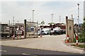
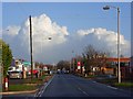
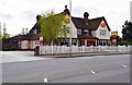
Photos of RG2 0JE
Area Information
RG2 0JE is a compact residential postcode in England, covering just 9,647 square metres and home to 2,138 residents. Its high population density of 221,613 people per square kilometre reflects a tightly knit community, where proximity to amenities and services is a defining feature. The area’s small size means it is likely a cluster of homes within a larger town or city, with a focus on convenience rather than sprawling development. Daily life here is shaped by its proximity to retail, transport, and educational hubs. With a median age of 47, the population skews towards adults aged 30–64, suggesting a stable, established community. This is a place where families and professionals coexist, with a strong emphasis on accessibility to nearby facilities. The area’s mix of homes and its limited size make it a microcosm of urban living, where every resident is within walking distance of essential services, from grocery stores to railway stations.
- Area Type
- Postcode
- Area Size
- 9647 m²
- Population
- 2138
- Population Density
- 4228 people/km²
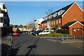
The property market in RG2 0JE is defined by its small size and the dominance of houses over other accommodation types. With a home ownership rate of 37%, the area is not heavily reliant on rental properties, though the figure suggests a mix of owner-occupied and rented homes. The presence of houses indicates a preference for single-family dwellings, which may appeal to families seeking space and privacy. However, the area’s limited size means the housing stock is constrained, potentially leading to competition among buyers. For those considering the market, the small postcode area implies that properties are likely concentrated in a specific location, possibly within a larger town or city. Buyers should also consider the proximity to nearby amenities, as the area’s compact nature means homes are likely situated near essential services, rail links, and schools. This makes RG2 0JE a practical choice for those prioritising convenience over expansive living spaces.
House Prices in RG2 0JE
Showing 4 properties
| Address | Type | Beds | Baths | Last Sale Price | Last Sale Date | |
|---|---|---|---|---|---|---|
| 401 Basingstoke Road, Reading, RG2 0JE | Semi-detached | - | - | - | - | |
| 399 Basingstoke Road, Reading, RG2 0JE | Semi-detached | - | - | - | - | |
| 397 Basingstoke Road, Reading, RG2 0JE | Semi-detached | - | - | - | - | |
| World Turned Upside Down Ph, 387 Basingstoke Road, Reading, RG2 0JE | Leisure | - | - | - | - |
Energy Efficiency in RG2 0JE
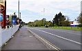
The lifestyle in RG2 0JE is shaped by its proximity to retail and transport hubs. Within the area, residents have access to five notable retail venues, including Aldi, Morrisons, and Lidl, offering everyday shopping convenience. These stores provide a range of goods, from groceries to household essentials, reducing the need for long trips to larger centres. The area’s rail connectivity is a key feature, with five nearby stations, including Reading West and Earley, which link to broader transport networks. This makes commuting to nearby cities or towns straightforward. While the data does not mention parks or leisure facilities, the compact nature of the area suggests that residents may rely on nearby public spaces or larger town amenities for recreation. The combination of retail, rail, and proximity to schools creates a practical, community-focused lifestyle, where daily needs are met without significant travel.
Amenities
Schools
Residents of RG2 0JE have access to three primary schools within the area: Whitley Park Junior School, Whitley Park Infant and Nursery School, and Whitley Park Primary and Nursery School. The latter holds an Ofsted rating of 'good', indicating a standard of education that meets expectations. The presence of infant, junior, and primary schools suggests a comprehensive early-years and primary education setup, catering to children from nursery age through to the end of primary schooling. This cluster of schools is particularly beneficial for families with young children, as it minimises the need for long commutes to educational institutions. The 'good' rating at one of the schools provides reassurance about the quality of teaching and resources available. However, no secondary schools are listed in the data, meaning parents may need to look beyond RG2 0JE for secondary education options.
| Rank | School | Type | Entry gender | Ages |
|---|
Explore more schools in this area
Go to Schools tabDemographics
The community in RG2 0JE is predominantly composed of adults aged 30–64, with a median age of 47. This age group makes up the most common demographic, indicating a mature, settled population. Home ownership rates are relatively low at 37%, suggesting a significant portion of residents rent their homes. The area is characterised by houses rather than flats or apartments, reflecting a traditional housing stock. The predominant ethnic group is White, with no specific data provided on other ethnicities. This demographic profile implies a community with established roots, where many residents may have lived in the area for years. The absence of detailed diversity statistics means the area’s cultural composition remains largely unexplored in the data. For those considering RG2 0JE, the age profile and home ownership figures suggest a balance between long-term residents and newer arrivals, with a focus on stability over rapid change.
Household Size
Accommodation Type
Tenure
Ethnic Group
Religion
Household Composition
Age
Household Deprivation
NS-SEC
Explore more demographic insights in this area
Go to Demographics tabPlanning
Planning Constraints
- Flood RiskPremium
- Ramsar Wetland SitesPremium
- Area of Outstanding Natural BeautyPremium
- Protected Nature ReservePremium
- Protected WoodlandPremium