Area Overview for RG2 0JA
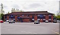
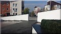
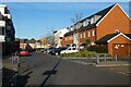
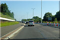
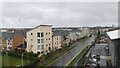
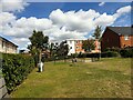
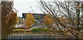
Photos of RG2 0JA

Area Information
RG2 0JA is a compact residential postcode in England, covering just 2.7 hectares and home to 2,138 residents. Its high population density — 78,650 people per square kilometre — reflects a tightly knit community, though the area’s small size means it is a specific cluster rather than a sprawling suburb. The postcode’s character is defined by its proximity to local amenities and transport links, with residents enjoying access to multiple railway stations and retail hubs. Daily life here is shaped by its demographic profile: the median age is 47, with adults aged 30–64 forming the majority. This suggests a stable, established community, though the low home ownership rate (37%) indicates a significant proportion of residents may be renting. The area’s housing stock is predominantly houses, which, given its limited size, may mean properties are closely spaced. For buyers, RG2 0JA offers a blend of convenience and compact living, but its small footprint means proximity to surrounding areas is key for expanding one’s lifestyle options.
- Area Type
- Postcode
- Area Size
- 2.7 hectares
- Population
- 2138
- Population Density
- 4228 people/km²
RG2 0JA is a small area with a home ownership rate of 37%, suggesting that a majority of properties are rented rather than owner-occupied. The accommodation type is predominantly houses, which, in such a compact postcode, may mean homes are closely spaced and potentially smaller in size. This dynamic could make the area appealing to buyers seeking a specific property type, though the limited land area (2.7 hectares) means the housing stock is unlikely to be extensive. The low home ownership rate also indicates a rental market that may be competitive, with landlords potentially prioritising long-term tenants. For buyers, the challenge lies in navigating the small footprint of the area, which may require considering nearby zones for additional space or amenities. The focus on houses rather than flats or apartments could also influence property values and desirability among specific buyer demographics.
House Prices in RG2 0JA
Showing 50 properties
| Address | Type | Beds | Baths | Last Sale Price | Last Sale Date | |
|---|---|---|---|---|---|---|
| 343 Basingstoke Road, Reading, RG2 0JA | Semi-detached | 4 | 2 | £435,000 | Apr 2023 | |
| 291 Basingstoke Road, Reading, RG2 0JA | house | - | - | £445,000 | Jan 2023 | |
| 279A Basingstoke Road, Reading, RG2 0JA | Flat | - | - | £320,000 | Sep 2022 | |
| 333 Basingstoke Road, Reading, RG2 0JA | Semi-detached | 3 | - | £350,000 | Nov 2021 | |
| 301 Basingstoke Road, Reading, RG2 0JA | house | - | - | £256,500 | Mar 2021 | |
| 379 Basingstoke Road, Reading, RG2 0JA | Detached | 3 | 1 | £320,000 | Feb 2021 | |
| 287 Basingstoke Road, Reading, RG2 0JA | Semi-detached | 1 | 1 | £350,000 | Jan 2020 | |
| 319 Basingstoke Road, Reading, RG2 0JA | Semi-detached | 3 | 2 | £375,000 | Nov 2018 | |
| 371 Basingstoke Road, Reading, RG2 0JA | house | - | - | £320,000 | Dec 2016 | |
| 293 Basingstoke Road, Reading, RG2 0JA | house | - | - | £325,000 | Nov 2016 |
Energy Efficiency in RG2 0JA
RG2 0JA’s lifestyle is shaped by its proximity to retail and transport hubs. Within practical reach are five retail outlets, including Aldi Whitley, Morrisons Whitley, and Makro Reading, offering a range of shopping options. These stores cater to daily needs, from groceries to household goods, reducing the need for long journeys. The area’s rail network, with five stations including Reading West and Earley, provides easy access to broader destinations, supporting both commuting and leisure travel. While the data does not mention parks or leisure facilities, the presence of multiple retail and transport options suggests a focus on convenience over expansive green spaces. Residents may find the area ideal for those prioritising accessibility to shopping and transport, though those seeking extensive recreational amenities might need to explore nearby zones.
Amenities
Schools
Residents of RG2 0JA have access to three primary schools: Whitley Park Junior School, Whitley Park Infant and Nursery School, and Whitley Park Primary and Nursery School. The latter holds an Ofsted rating of ‘good’, reflecting a standard of education that meets acceptable benchmarks. The presence of multiple primary schools, including a nursery, suggests the area is well-suited for families with young children, offering continuity in education from early years through to junior levels. However, no secondary schools are listed in the data, which may require families to look beyond the immediate area for comprehensive schooling. The concentration of primary schools indicates a focus on early education, though buyers should consider the availability of secondary options when evaluating the area’s suitability for long-term family needs.
| Rank | School | Type | Entry gender | Ages |
|---|
Explore more schools in this area
Go to Schools tabDemographics
The population of RG2 0JA is 2,138, with a median age of 47, indicating a mature demographic skewed toward adults aged 30–64. This age group constitutes the most common cohort, suggesting a community with established careers and families. Home ownership is relatively low at 37%, implying that many residents are renters, which could influence the local property market’s dynamics. The predominant accommodation type is houses, though the area’s small size (2.7 hectares) means housing is likely to be densely packed. The predominant ethnic group is White, though no specific data on diversity or deprivation is provided. The high population density — 78,650 people per square kilometre — raises questions about living space per household, though this is typical for urban or semi-urban clusters. For buyers, understanding the age profile and ownership rates is crucial, as they shape the area’s social fabric and property demand.
Household Size
Accommodation Type
Tenure
Ethnic Group
Religion
Household Composition
Age
Household Deprivation
NS-SEC
Explore more demographic insights in this area
Go to Demographics tabPlanning
Planning Constraints
- Flood RiskPremium
- Ramsar Wetland SitesPremium
- Area of Outstanding Natural BeautyPremium
- Protected Nature ReservePremium
- Protected WoodlandPremium