Area Overview for RG2 0FP
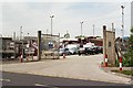
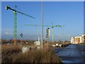
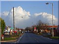
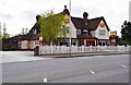
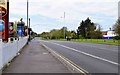
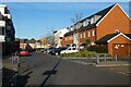
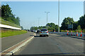
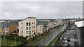
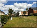
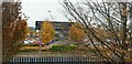
Photos of RG2 0FP
Area Information
RG2 0FP is a compact residential postcode in England, covering 4,128 square metres and home to around 1,700 residents. Its population density of 708 people per square kilometre suggests a tightly knit community, where daily life is shaped by proximity to local amenities and transport links. The area is characterised by its small-scale nature, with homes primarily in the form of individual houses rather than high-density developments. Residents here are predominantly adults aged 30–64, reflecting a mature demographic. While the area lacks large-scale commercial hubs, its practical reach includes essential services such as supermarkets, rail stations, and schools. For those seeking a balance between residential tranquillity and accessibility, RG2 0FP offers proximity to Reading’s urban amenities without the congestion of city centres. However, its small size means the housing stock is limited, and buyers should consider the area’s constraints when planning long-term living arrangements.
- Area Type
- Postcode
- Area Size
- 4128 m²
- Population
- 1700
- Population Density
- 708 people/km²
RG2 0FP is a small area with a limited housing stock, primarily consisting of houses rather than flats or apartments. Home ownership here is at 48%, which is slightly below the UK average, suggesting that nearly half of properties are rented. This mix of ownership and rental properties may appeal to buyers seeking a balance between stability and flexibility, though the area’s compact size means the market is not vast. The predominance of houses indicates a focus on traditional family homes, which may be more attractive to buyers prioritising space and privacy over urban convenience. However, the small scale of the area means buyers should consider the limited availability of properties and the potential for competition. Those seeking a rental property may find opportunities, but the data does not specify the proportion of the market that is rental-focused.
House Prices in RG2 0FP
Showing 29 properties
| Address | Type | Beds | Baths | Last Sale Price | Last Sale Date | |
|---|---|---|---|---|---|---|
| 19 Gweal Avenue, Reading, RG2 0FP | Semi-detached | 4 | 2 | £475,000 | Dec 2025 | |
| 11 Gweal Avenue, Reading, RG2 0FP | Terraced | 3 | 2 | £431,000 | Jul 2024 | |
| 21 Gweal Avenue, Reading, RG2 0FP | Terraced | 4 | 3 | £458,000 | Nov 2022 | |
| 17 Gweal Avenue, Reading, RG2 0FP | house | - | - | £430,000 | Dec 2021 | |
| 5 Gweal Avenue, Reading, RG2 0FP | Terraced | 4 | 2 | £350,000 | Oct 2017 | |
| 9 Gweal Avenue, Reading, RG2 0FP | Terraced | 3 | - | £245,000 | Jun 2013 | |
| 3 Gweal Avenue, Reading, RG2 0FP | house | 1 | 1 | £241,000 | Apr 2009 | |
| 7 Gweal Avenue, Reading, RG2 0FP | house | - | - | £250,000 | Mar 2009 | |
| Flat 3, 1 Gweal Avenue, Reading, RG2 0FP | Flat | 1 | 1 | - | - | |
| Flat 1, 23 Gweal Avenue, Reading, RG2 0FP | Flat | 1 | 1 | - | - |
Energy Efficiency in RG2 0FP
RG2 0FP offers a range of nearby amenities within practical reach, including retail and transport hubs. The area is served by five retail outlets, including Aldi Whitley, Morrisons Whitley, and Makro Reading, providing access to grocery and household essentials. These stores cater to daily needs, reducing the necessity for long trips to larger shopping centres. For transport, the proximity to multiple railway stations, such as Reading West and Earley, ensures convenient travel to Reading and surrounding areas. While the data does not mention parks or leisure facilities, the presence of retail and rail links suggests a lifestyle focused on practicality and accessibility. The compact nature of the area means amenities are closely clustered, supporting a convenient, low-maintenance daily routine for residents.
Amenities
Schools
The nearest school to RG2 0FP is Green Park Village Primary Academy, a primary school with a good Ofsted rating. This provides a solid foundation for young children, though no secondary schools are listed in the data. The presence of a primary school within practical reach is a significant advantage for families, reducing the need for long commutes. However, parents seeking secondary education for their children may need to look beyond the immediate area. The absence of additional schools suggests that the community’s educational infrastructure is focused on early years, which could be a consideration for families planning for long-term schooling needs. The good Ofsted rating indicates that the primary school meets quality standards, offering reassurance for parents prioritising educational outcomes.
| Rank | School | Type | Entry gender | Ages |
|---|
Explore more schools in this area
Go to Schools tabDemographics
The population of RG2 0FP is predominantly adults aged 30–64, with a median age of 47. This suggests a community of established professionals and families, rather than students or retirees. Home ownership stands at 48%, indicating a mix of owner-occupied and rental properties, though the data does not specify the proportion of renters. The area is largely composed of houses, with no mention of flats or apartments. The predominant ethnic group is White, though no further breakdown of diversity is provided. The high population density of 708 people per square kilometre implies a compact, possibly multi-generational living environment. While no explicit data on deprivation is available, the demographic profile suggests a stable, middle-income community. The absence of younger residents or younger families may influence local services and amenities, though the presence of a primary school indicates some provision for children.
Household Size
Accommodation Type
Tenure
Ethnic Group
Religion
Household Composition
Age
Household Deprivation
NS-SEC
Explore more demographic insights in this area
Go to Demographics tabPlanning
Planning Constraints
- Flood RiskPremium
- Ramsar Wetland SitesPremium
- Area of Outstanding Natural BeautyPremium
- Protected Nature ReservePremium
- Protected WoodlandPremium