Area Overview for RG2 0DJ
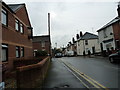
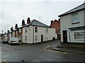
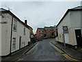
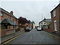
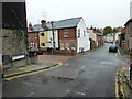
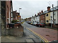
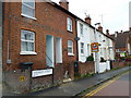
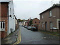
Photos of RG2 0DJ
Area Information
RG2 0DJ is a compact residential postcode in England, covering 6,708 square metres and home to 1,283 residents. Its high population density of 191,257 people per square kilometre reflects a tightly knit community, where the majority of residents are adults aged 30–64. This area is characterised by a focus on family-oriented living, with houses forming the primary accommodation type. Daily life here is shaped by proximity to essential services, including multiple retail outlets and rail stations, which provide easy access to nearby towns and cities. The area’s small size means it is likely to have a strong sense of local identity, with residents familiar with one another. While the population is relatively small, the presence of several primary schools and a mix of retail and transport options suggests a balance between residential tranquillity and practical connectivity. For those seeking a community with established infrastructure and a focus on convenience, RG2 0DJ offers a blend of compact living and accessible amenities.
- Area Type
- Postcode
- Area Size
- 6708 m²
- Population
- 1283
- Population Density
- 13559 people/km²
The property market in RG2 0DJ is defined by a low home ownership rate of 33%, suggesting that the majority of residents are renters rather than homeowners. This could indicate limited availability of owner-occupied properties or a preference for rental housing in the area. The accommodation type is primarily houses, which contrasts with the higher proportion of rental properties, hinting at a potential mismatch between housing supply and demand. As a small postcode area, the housing stock is constrained, meaning buyers may need to look beyond RG2 0DJ for larger options. The focus on houses may appeal to families seeking space, but the limited number of owner-occupied homes could make the market competitive for those prioritising property ownership. For buyers, this suggests a need to consider nearby areas or be flexible with property types, as the immediate surroundings may offer more varied choices.
House Prices in RG2 0DJ
Showing 80 properties
| Address | Type | Beds | Baths | Last Sale Price | Last Sale Date | |
|---|---|---|---|---|---|---|
| 35 Tippett Rise, Reading, RG2 0DJ | Flat | 2 | 1 | £220,000 | Dec 2025 | |
| 43 Tippett Rise, Reading, RG2 0DJ | Flat | - | - | £165,000 | Jun 2025 | |
| 15 Tippett Rise, Reading, RG2 0DJ | Flat | - | - | £155,000 | Apr 2025 | |
| 22 Tippett Rise, Reading, RG2 0DJ | Flat | 2 | 1 | £220,000 | Jan 2025 | |
| 46 Tippett Rise, Reading, RG2 0DJ | Maisonette | - | - | £230,000 | Jul 2024 | |
| 78 Tippett Rise, Reading, RG2 0DJ | Flat | - | - | £125,000 | Jun 2024 | |
| 65 Tippett Rise, Reading, RG2 0DJ | Flat | - | 1 | £123,000 | Dec 2023 | |
| 60 Tippett Rise, Reading, RG2 0DJ | Flat | - | - | £170,000 | Dec 2023 | |
| 69 Tippett Rise, Reading, RG2 0DJ | Flat | 1 | 1 | £135,000 | Jul 2023 | |
| 36 Tippett Rise, Reading, RG2 0DJ | Flat | 2 | 1 | £195,000 | Jun 2023 |
Energy Efficiency in RG2 0DJ
Residents of RG2 0DJ benefit from a range of nearby amenities that support both practical needs and leisure. The area is within reach of major retail outlets, including Tesco Reading, Iceland Reading, and Makro Reading, offering a variety of shopping and grocery options. These stores cater to daily essentials, making it easy for residents to manage household needs without traveling far. The proximity to multiple rail stations, such as Reading and Earley, ensures convenient access to public transport, facilitating travel to nearby towns and cities. While the data does not mention parks or leisure facilities, the presence of multiple retail and transport hubs suggests a lifestyle focused on convenience and accessibility. For those prioritising ease of access to services and connectivity, RG2 0DJ provides a practical environment with minimal need for long commutes or extensive travel.
Amenities
Schools
Residents of RG2 0DJ have access to three primary schools: Christ Church Church of England Primary School, New Christ Church Church of England (VA) Primary School, and New Christ Church Church of England Primary School, which holds an Ofsted rating of ‘good’. All three schools are Church of England institutions, offering a faith-based educational approach. The presence of multiple primary schools within the area ensures that families have options for their children’s early education. The ‘good’ rating at one of the schools indicates a higher standard of teaching and facilities, which could be a key consideration for prospective residents. However, the absence of secondary schools in the data means families may need to look further afield for secondary education. The concentration of primary schools suggests a community-focused approach to education, with a strong emphasis on early years learning.
| Rank | School | Type | Entry gender | Ages |
|---|
Explore more schools in this area
Go to Schools tabDemographics
The community in RG2 0DJ is predominantly composed of adults aged 30–64, with a median age of 47. This suggests a mature population, likely with established careers and families. Home ownership stands at 33%, indicating that a significant portion of residents are renters, which may reflect the area’s small size and limited housing stock. The accommodation type is primarily houses, rather than flats or apartments, which aligns with the demographic profile of older, family-focused residents. The predominant ethnic group is White, though no specific data on diversity or deprivation is provided. The high population density, combined with a low proportion of owner-occupied homes, implies a mix of long-term residents and those in rental properties. This demographic structure may influence local services and amenities, with a focus on stability and accessibility for middle-aged households.
Household Size
Accommodation Type
Tenure
Ethnic Group
Religion
Household Composition
Age
Household Deprivation
NS-SEC
Explore more demographic insights in this area
Go to Demographics tabPlanning
Planning Constraints
- Flood RiskPremium
- Ramsar Wetland SitesPremium
- Area of Outstanding Natural BeautyPremium
- Protected Nature ReservePremium
- Protected WoodlandPremium