Area Overview for RG1 2RE
Photos of RG1 2RE
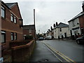
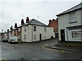
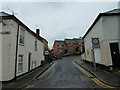
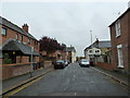
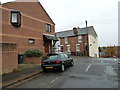
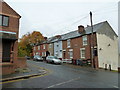
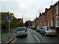
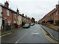
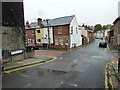
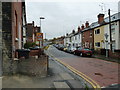
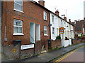
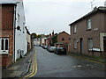
100 photos from this area
Area Information
Key information about the RG1 2RE including its size, population, and administrative classification.
- Area Type
- Postcode
- Area Size
- 7320 m²
- Population
- 2151
- Population Density
- 17617 people/km²
House Prices in RG1 2RE
67
Properties
£202,372
Average Sold Price
£46,950
Lowest Price
£343,500
Highest Price
Showing 67 properties
| Address | Type | Beds | Baths | Last Sale Price | Last Sale Date | |
|---|---|---|---|---|---|---|
| 50 Waldeck Street, Reading, RG1 2RE | Terraced | 2 | 1 | £270,000 | Nov 2025 | |
| 58 Waldeck Street, Reading, RG1 2RE | Terraced | 3 | 1 | £343,500 | Sep 2025 | |
| 10 Waldeck Street, Reading, RG1 2RE | Terraced | 3 | 1 | £310,000 | Aug 2025 | |
| 72 Waldeck Street, Reading, RG1 2RE | house | - | - | £225,000 | Oct 2024 | |
| 64 Waldeck Street, Reading, RG1 2RE | Terraced | 3 | 1 | £320,000 | Mar 2024 | |
| 108 Waldeck Street, Reading, RG1 2RE | Terraced | 2 | 1 | £300,000 | Mar 2024 | |
| 104 Waldeck Street, Reading, RG1 2RE | Terraced | 2 | - | £300,000 | Aug 2023 | |
| 88 Waldeck Street, Reading, RG1 2RE | Terraced | 2 | 1 | £260,000 | Aug 2023 | |
| 26 Waldeck Street, Reading, RG1 2RE | Terraced | 3 | 1 | £306,500 | Apr 2023 | |
| 30 Waldeck Street, Reading, RG1 2RE | Terraced | 3 | 1 | £290,000 | Apr 2022 |
Page 1 of 7
Energy Efficiency in RG1 2RE
Amenities
Schools
| Rank | School | Type | Entry gender | Ages |
|---|
Explore more schools in this area
Go to Schools tabDemographics
Household Size
Family (3-5 people)
most common
Accommodation Type
Houses
most common
Tenure
32
majority
Ethnic Group
White
most common
Religion
N/A
most common
Household Composition
N/A
most common
Age
47
median
Adults (30-64 years)
most common
Household Deprivation
N/A
with no deprivation
NS-SEC
36
in Lower managerial occupations
Explore more demographic insights in this area
Go to Demographics tabPlanning
Planning Constraints
- Flood RiskPremium
- Ramsar Wetland SitesPremium
- Area of Outstanding Natural BeautyPremium
- Protected Nature ReservePremium
- Protected WoodlandPremium