Area Overview for RG2 0AB
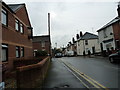
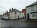
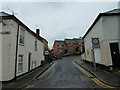
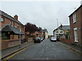
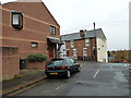
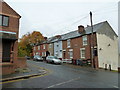
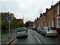
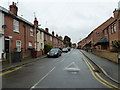
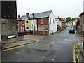
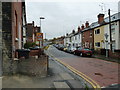
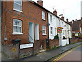
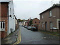
Photos of RG2 0AB
Area Information
RG2 0AB is a small, densely populated residential cluster in England, covering just 1,717 square metres and home to 1,283 residents. Its compact size means the area is tightly knit, with a high population density of 747,249 people per square kilometre. This is a place where daily life is shaped by proximity to amenities and a mature demographic. The median age of 47 suggests a community of established professionals and families, with the majority of residents falling between 30 and 64 years old. The area’s safety is a key draw, with a crime risk score of 77 (low) and no significant environmental hazards such as flood zones or protected natural sites. Living here offers a balance of convenience and tranquillity, with easy access to retail, rail, and educational facilities. The presence of multiple primary schools and nearby railway stations underscores its appeal for families and commuters alike. While the area is small, its strategic location and well-maintained infrastructure make it a practical choice for those seeking a stable, low-risk neighbourhood.
- Area Type
- Postcode
- Area Size
- 1717 m²
- Population
- 1283
- Population Density
- 13559 people/km²
The property market in RG2 0AB is characterised by a low home ownership rate of 33%, which suggests a significant portion of the housing stock is rented out. Despite this, the area is primarily composed of houses rather than flats or apartments, which is atypical for a small postcode area. This mix may indicate a blend of long-term residents and temporary occupants, though the exact balance is unclear. The limited size of the area means the housing stock is finite, and buyers should consider proximity to nearby amenities such as retail and rail links. The presence of multiple railway stations within practical reach may make the area attractive to commuters, though the small footprint of RG2 0AB means properties are likely to be in close proximity to each other. Buyers should also note the lack of significant planning constraints, which may offer flexibility for future development.
House Prices in RG2 0AB
Showing 5 properties
| Address | Type | Beds | Baths | Last Sale Price | Last Sale Date | |
|---|---|---|---|---|---|---|
| 1 Mount Street, Reading, RG2 0AB | Terraced | 3 | 1 | £317,000 | Aug 2025 | |
| 2 Mount Street, Reading, RG2 0AB | Semi-detached | 3 | - | £190,000 | Mar 2013 | |
| 5 Mount Street, Reading, RG2 0AB | Terraced | 3 | - | £115,000 | Feb 2002 | |
| 4 Mount Street, Reading, RG2 0AB | house | - | - | - | - | |
| 3 Mount Street, Reading, RG2 0AB | Terraced | - | - | - | - |
Energy Efficiency in RG2 0AB
Living in RG2 0AB offers access to a range of amenities within practical reach. Retail options include major stores such as Tesco Reading, Tesco Crown, and Makro Reading, providing convenience for shopping and daily essentials. The area’s proximity to multiple railway stations, including Reading and Earley, enhances connectivity for travel and commuting. While the data does not specify parks or leisure facilities, the absence of planning constraints such as protected woodlands or nature reserves suggests open spaces may be limited. However, the high population density implies a focus on urban living, with amenities prioritised for daily needs. The presence of multiple schools and retail hubs indicates a community-oriented environment, though residents may need to travel further for specialist services or recreational activities.
Amenities
Schools
Residents of RG2 0AB have access to three primary schools: Christ Church Church of England Primary School, New Christ Church Church of England (VA) Primary School, and New Christ Church Church of England Primary School, which holds an Ofsted rating of ‘good’. These schools cater to the needs of local families, though the absence of secondary schools in the area means students may need to travel to nearby postcodes for further education. The presence of multiple primary schools suggests a focus on early education, with options for parents to choose between different institutions. The ‘good’ rating at one school indicates a standard of teaching that meets or exceeds national expectations, which is a positive factor for families prioritising education. However, the lack of data on school capacity or pupil numbers means prospective buyers should investigate further to assess suitability for their children’s needs.
| Rank | School | Type | Entry gender | Ages |
|---|
Explore more schools in this area
Go to Schools tabDemographics
The community in RG2 0AB is predominantly composed of adults aged 30 to 64, with a median age of 47. This suggests a population of settled professionals and families, rather than a transient or student demographic. Home ownership is relatively low at 33%, indicating a mix of owner-occupied and rented properties. The area is primarily composed of houses, which is unusual for a small postcode area, suggesting a focus on family homes rather than apartments or flats. The predominant ethnic group is White, though specific data on diversity or deprivation is not provided. The low crime risk score of 77 (low) implies a generally safe environment, which may contribute to the area’s appeal. However, the high population density and limited space mean that living here requires adaptability to a compact, closely connected community.
Household Size
Accommodation Type
Tenure
Ethnic Group
Religion
Household Composition
Age
Household Deprivation
NS-SEC
Explore more demographic insights in this area
Go to Demographics tabPlanning
Planning Constraints
- Flood RiskPremium
- Ramsar Wetland SitesPremium
- Area of Outstanding Natural BeautyPremium
- Protected Nature ReservePremium
- Protected WoodlandPremium