Area Overview for RG17 9DZ
Photos of RG17 9DZ
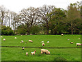
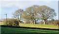
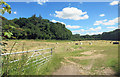

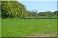
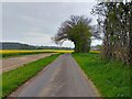
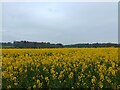
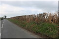
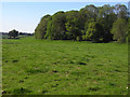

10 photos from this area
Area Information
Key information about the RG17 9DZ including its size, population, and administrative classification.
- Area Type
- Postcode
- Area Size
- 53.7 hectares
- Population
- 2042
- Population Density
- 26 people/km²
House Prices in RG17 9DZ
24
Properties
£630,020
Average Sold Price
£40,040
Lowest Price
£1,670,000
Highest Price
Showing 24 properties
| Address | Type | Beds | Baths | Last Sale Price | Last Sale Date | |
|---|---|---|---|---|---|---|
| Orchard Cottage, Craven Road, Inkpen, Hungerford, RG17 9DZ | Detached | 3 | 2 | £765,000 | Mar 2025 | |
| Westwood, Craven Road, Inkpen, Hungerford, RG17 9DZ | Bungalow | 4 | 2 | £775,000 | Mar 2025 | |
| Chase End, Craven Road, Inkpen, Hungerford, RG17 9DZ | house | - | - | £1,670,000 | Jun 2023 | |
| Combe View, Craven Road, Inkpen, Hungerford, RG17 9DZ | Semi-detached | 2 | 1 | £360,000 | Jan 2022 | |
| Woodmans, Craven Road, Inkpen, Hungerford, RG17 9DZ | house | 5 | - | £1,475,000 | Jun 2017 | |
| 3 Craven Road, Inkpen, Hungerford, RG17 9DZ | Semi-detached | 3 | 1 | £299,950 | Nov 2014 | |
| The Ferns, Craven Road, Inkpen, Hungerford, RG17 9DZ | Detached | - | - | £467,500 | Jun 2006 | |
| Amsterdam Cottage, Craven Road, Inkpen, Hungerford, RG17 9DZ | Detached | 4 | 3 | £580,000 | Jun 2004 | |
| The Glade, Craven Road, Inkpen, Hungerford, RG17 9DZ | Detached | 3 | 1 | £305,000 | May 2002 | |
| Woodside, Craven Road, Inkpen, Hungerford, RG17 9DZ | house | - | - | £411,000 | Oct 2001 |
Page 1 of 3
Energy Efficiency in RG17 9DZ
Amenities
Schools
| Rank | School | Type | Entry gender | Ages |
|---|
Explore more schools in this area
Go to Schools tabDemographics
Household Size
Two person
most common
Accommodation Type
Houses
most common
Tenure
67
majority
Ethnic Group
White
most common
Religion
N/A
most common
Household Composition
N/A
most common
Age
47
median
Adults (30-64 years)
most common
Household Deprivation
N/A
with no deprivation
NS-SEC
46
in Lower managerial occupations
Explore more demographic insights in this area
Go to Demographics tabPlanning
Planning Constraints
- Flood RiskPremium
- Ramsar Wetland SitesPremium
- Area of Outstanding Natural BeautyPremium
- Protected Nature ReservePremium
- Protected WoodlandPremium