Area Overview for RG17 9DY
Photos of RG17 9DY
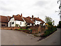
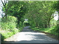
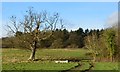
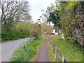
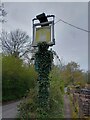
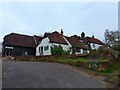
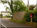
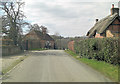
15 photos from this area
Area Information
Key information about the RG17 9DY including its size, population, and administrative classification.
- Area Type
- Postcode
- Area Size
- 21.8 hectares
- Population
- 2042
- Population Density
- 26 people/km²
House Prices in RG17 9DY
11
Properties
£696,844
Average Sold Price
£390,000
Lowest Price
£1,025,000
Highest Price
Showing 11 properties
| Address | Type | Beds | Baths | Last Sale Price | Last Sale Date | |
|---|---|---|---|---|---|---|
| Barton End, Craven Road, Inkpen, Hungerford, RG17 9DY | Detached | 4 | 3 | £1,025,000 | Mar 2023 | |
| Kates Cottage, Craven Road, Inkpen, Hungerford, RG17 9DY | house | - | - | £641,250 | Jun 2021 | |
| Honeysuckle Cottage, Craven Road, Inkpen, Hungerford, RG17 9DY | house | 4 | - | £710,000 | Mar 2019 | |
| Moss Farm, Craven Road, Inkpen, Hungerford, RG17 9DY | house | - | - | £880,000 | Feb 2019 | |
| Hunters Way, Craven Road, Inkpen, Hungerford, RG17 9DY | Detached | 3 | 1 | £661,661 | Sep 2009 | |
| Crows Nest, Craven Road, Inkpen, Hungerford, RG17 9DY | Detached | - | - | £390,000 | Jun 2008 | |
| Moss Cottage, Craven Road, Inkpen, Hungerford, RG17 9DY | Detached | - | - | £570,000 | Feb 2005 | |
| The Old Craven Arms, Craven Road, Inkpen, Hungerford, RG17 9DY | Detached | 6 | 2 | - | - | |
| Hatts Cottage, Craven Road, Inkpen, Hungerford, RG17 9DY | Detached | - | - | - | - | |
| Ford Lynn, Craven Road, Inkpen, Hungerford, RG17 9DY | Bungalow | - | - | - | - |
Page 1 of 2
Energy Efficiency in RG17 9DY
Amenities
Schools
| Rank | School | Type | Entry gender | Ages |
|---|
Explore more schools in this area
Go to Schools tabDemographics
Household Size
Two person
most common
Accommodation Type
Houses
most common
Tenure
67
majority
Ethnic Group
White
most common
Religion
N/A
most common
Household Composition
N/A
most common
Age
47
median
Adults (30-64 years)
most common
Household Deprivation
N/A
with no deprivation
NS-SEC
46
in Lower managerial occupations
Explore more demographic insights in this area
Go to Demographics tabPlanning
Planning Constraints
- Flood RiskPremium
- Ramsar Wetland SitesPremium
- Area of Outstanding Natural BeautyPremium
- Protected Nature ReservePremium
- Protected WoodlandPremium