Area Overview for RG17 0UP
Photos of RG17 0UP


Area Information
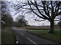
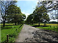
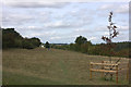
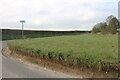
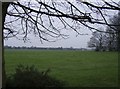
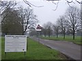
Living in RG17 0UP offers a quiet residential experience characterised by low density and a strong sense of locality. This specific postcode cluster spans 62.2 hectares and contains a small population of 1,637 residents. The concentration of people stands at 493 per square kilometre, which means streets remain relatively uncrowded compared to larger towns. Daily life here feels calm and unhurried, driven by the fact that this area functions as a contained residential pocket rather than a commercial hub. You will find that the environment is defined by its modest scale. There are no major city centres within the immediate boundaries, so your focus remains on the home and the immediate neighbourhood. The area does not experience the sprawl often associated with larger developments because of its limited size. Instead, it provides a stable setting where residents know their surroundings intimately. The physical boundaries create a contained community feel where neighbours are likely to be familiar faces. This layout suits those seeking peace without isolation. The ground plan allows for easy access to local points of interest while maintaining a buffer from heavy traffic flows. You can expect a consistent environment where the character of the place remains steady over time. The proximity to wider transport links ensures you do not sacrifice convenience for the quiet lifestyle. RG17 0UP represents a practical choice for small families or individuals who prioritise space and stability above urban excitement.
- Area Type
- Postcode
- Area Size
- 62.2 hectares
- Population
- 1637
- Population Density
- 493 people/km²
The property market in RG17 0UP is defined by a significant ownership rate of 55%, which signals a neighbourhood built for long-term residents. Houses form the predominant accommodation type, meaning you will primarily see standalone homes or semi-detached properties rather than apartment blocks. This stock type aligns with the area's low density and creates a spatial environment where each dwelling has distinct boundaries. Given the high percentage of owner-occupiers, the rental market is likely opportunistic rather than competitive. Breakups in local households may occasionally generate vacancies, but the core demand comes from people seeking to purchase a permanent home. Buyers looking at this small area should understand that the existing housing stock is geared towards family-sized or couple-owned traditional houses. The market dynamics differ from larger districts because of the limited land area of 62.2 hectares. There is scarcity of new builds, so the selection of homes rests almost entirely on the existing inventory. This constraint means you cannot expect a diverse range of architectural styles or property ages within the immediate postcode. You must adapt your search to fit the available houses rather than searching for a specific new development. High home ownership levels usually correlate with good maintenance of the housing stock. Owners tend to invest in upgrades that preserve property values, keeping the neighbourhood appearance consistent. This creates a market where structural integrity often outweighs cosmetic trends. When viewing homes in RG17 0UP, focus on the condition of the gardens and the structural age of the buildings. The mix of private ownership ensures that the area remains stable regardless of short-term shifts in national rental trends.
House Prices in RG17 0UP
Showing 5 properties
| Address | Type | Beds | Baths | Last Sale Price | Last Sale Date | |
|---|---|---|---|---|---|---|
| West Lodge, Hungerford Park, Hungerford, RG17 0UP | Detached | 5 | 3 | £1,075,000 | Jan 2017 | |
| South Block, The Stables, Hungerford Park, Hungerford, RG17 0UP | Equestrian | - | - | - | - | |
| Train Carriage, Hungerford Park, Hungerford, RG17 0UP | Office | - | - | - | - | |
| Unit 2, Cider Barn A, Hungerford Park, Hungerford, RG17 0UP | Industrial | - | - | - | - | |
| Manoir Antiques & Decorative Interiors, Unit 1, Cider Barn A, Hungerford Park, Hungerford, RG17 0UP | shop | - | - | - | - |
Energy Efficiency in RG17 0UP
Daily lifestyle in RG17 0UP benefits from easy access to three railway stations: Hungerford, Kintbury, and Bedwyn. These transport hubs are within practical reach and form the backbone of your excursion options. You do not need to drive far to reach railway platforms that connect you to broader travel networks. The presence of three stations provides resilience against scheduling changes or service interruptions at any single site. Shopping conveniences are located nearby at five key retail points. These include Tesco Hungerford, Morrisons Daily, and Asda Hungerford. These supermarkets offer a wide range of groceries and household essentials without requiring a long journey. You can stock your pantry with staples from the nearest Tesco or pick up fresh produce at the Morrisons location. The concentration of these three major retailers ensures that routine shopping remains a simple task. The blend of rail access and retail options creates a balanced routine for residents. You might start your morning with a train from the local station and finish it with a trip to Asda or Tesco later in the afternoon. The proximity of these amenities reduces the friction of daily errands. There is no need to plan elaborate outings for basic needs like food or transit schedules. This accessibility supports a lifestyle where the home remains the central focus while errands take minimal effort. The specific locations of Hungerford and Kintbury stations allow you to tailor your travel times to your schedule. The supermarkets mentioned ensure that no major chain is missing from your immediate shopping reach. Living here means balancing a quiet home environment with convenient access to the commercial services you need.
Amenities
Schools
Families in RG17 0UP rely on John O'Gaunt School for their children's education. This institution serves a dual role as both a primary school and an academy sector within the local system. The academy designation indicates it operates with greater autonomy over its curriculum and management standards than traditional maintained schools. The school holds a "good" Ofsted rating, which provides reassurance regarding educational standards and child welfare. This rating signifies that the institution meets defined benchmarks for teaching quality and outcomes. For residents located at this postcode, John O'Gaunt School represents a consistent educational option without the need to travel further for basic primary education. The presence of a single named school in the immediate vicinity suggests a close knitted relationship between the residential cluster and the learning facility. Parents will know the standard of education their children receive without complex routing requirements. The academy status may also influence the school's ability to attract staff and resources compared to other local institutions. This school configuration means families do not need to navigate a fragmented network of nurseries for primary-level learning. The distance to John O'Gaunt School remains practical for parents working nearby at Hungerford or Kintbury. While specific catchment boundary data is not detailed here, the geographical listing confirms the school is within reach. You should verify exact catchment zones before purchase, but the existence of a rated academy nearby is a confirmed fact for parents in this location.
| Rank | School | Type | Entry gender | Ages |
|---|
Explore more schools in this area
Go to Schools tabDemographics
The community in RG17 0UP reflects a settled population with a clear age profile. The median age is 47 years, indicating that households are likely established rather than newly formed. The most common age range consists of adults aged 30 to 64 years, which defines the primary demographic driving local demand. This age group typically seeks stability and tends to value the quality of the surrounding environment highly. Home ownership is a dominant feature of the area, with 55% of residents owning their properties outright or through a mortgage. This figure suggests a mature market where families have put down long-term roots in the neighbourhood. The dominance of individual houses as the main accommodation type reinforces this pattern of ownership and permanence. There is little evidence of transient housing markets within this specific cluster. The demographic makeup is predominantly White, aligning with the broader patterns of the England region. This homogeneity often leads to a cohesive community dynamic where shared values are common. The age distribution creates a neighbourly atmosphere where children and young adults coexist comfortably with older residents. The lack of younger children in the median suggests a quiet environment rather than one filled with the noise of a rapidly growing school population. This age structure implies a preference for established infrastructure and reliable services. You will encounter residents who value the area for its proven amenities rather than speculative future developments. The statistical profile points to a community built on long-term residence rather than seasonal occupancy. Understanding these figures helps explain the steady, low-fluctuation nature of local life in RG17 0UP.
Household Size
Accommodation Type
Tenure
Ethnic Group
Religion
Household Composition
Age
Household Deprivation
NS-SEC
Explore more demographic insights in this area
Go to Demographics tabPlanning
Planning Constraints
- Flood RiskPremium
- Ramsar Wetland SitesPremium
- Area of Outstanding Natural BeautyPremium
- Protected Nature ReservePremium
- Protected WoodlandPremium