Area Overview for RG17 0RT
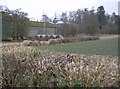
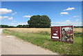
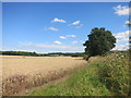
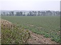
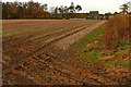
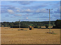
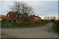
Photos of RG17 0RT


Area Information
Living in RG17 0RT means residing within a specific residential cluster in Wiltshire that covers 40.5 hectares. This postcode houses 1,637 people, creating a community with a generation count that keeps the atmosphere settled and purposeful. The population density stands at 493 people per square kilometre. This figure indicates a moderate spread of homes across the land. You will find that daily life here is shaped by a small but established footprint. The area functions as a practical residential extension to the wider Hungerford region. It offers a setting for those who prefer a low-density environment without complete isolation from local services. The distinct nature of this postcode ensures that residents enjoy a space defined by its housing concentration rather than high-rise density. The character of RG17 0RT is rooted in its designation as a cluster of homes rather than a sprawling town centre. This focused layout allows for quicker neighbourly interaction within walking or driving distance. The area serves as a stable home base for the region's growing population. You can expect a quiet haven where the scale of development remains manageable. The 40.5 hectare span provides enough room for green buffers between properties while maintaining access to nearby amenities. This balance makes the area a viable option for families or retirees seeking space. The specific geography of RG17 0RT ensures that you stay close to the community while enjoying a residential setting that avoids the clutter of larger urban zones.
- Area Type
- Postcode
- Area Size
- 40.5 hectares
- Population
- 1637
- Population Density
- 493 people/km²
The property market in RG17 0RT is defined by a clear preference for ownership. With 55 per cent of homes owned by their occupants, the area prioritises long-term residents over landlords or short-term tenants. This high ownership rate creates a stable local economy and fosters strong community bonds. You will find that the majority of transactions involve families or individuals buying to live in, rather than investors seeking rental yields. The accommodation type is almost exclusively houses. This characteristic restricts the housing stock to properties with gardens and traditional layouts. You cannot find flats or purpose-built rentals within this specific cluster. For buyers looking at RG17 0RT, this market structure means competition often revolves around finding the right house rather than bidding against multiple investors. The 55 per cent ownership figure indicates that the market is balanced but leans towards proprietorship. Houses predominate in this postcode, which aligns with the median age of 47. Older residents and families with space requirements drive demand. There are few listed shared ownership schemes or social housing data points for this specific cluster. The focus remains on conventional freehold or leasehold properties. This housing profile suits those seeking larger square footage and specific garden configurations. You will not encounter the rental volatility found in student towns or city centres. The market here rewards those willing to wait for a house to become available.
House Prices in RG17 0RT
Showing 2 properties
| Address | Type | Beds | Baths | Last Sale Price | Last Sale Date | |
|---|---|---|---|---|---|---|
| 1, Old Cold Harbour Cottages, Inkpen Road, Cold Harbour, Hungerford, RG17 0RT | house | 3 | - | £372,000 | Jul 2011 | |
| 2, Old Cold Harbour Cottages, Inkpen Road, Cold Harbour, Hungerford, RG17 0RT | Semi-detached | 2 | 1 | £410,000 | Aug 2010 |
Energy Efficiency in RG17 0RT
Daily life in RG17 0RT is convenient due to the proximity of key amenities. Three railway stations are within practical reach: Hungerford Railway Station, Kintbury Railway Station, and Bedwyn Railway Station. This rail connectivity links you to broader transport networks beyond the immediate vicinity. For shopping, five major retailers are nearby. Notable venues include Tesco Hungerford, Morrisons Daily, and Asda Hungerford. These large supermarkets provide a wide range of groceries and household essentials. You can stock your kitchen without driving long distances. The presence of these chains indicates good retail infrastructure for the local population. The combination of rail links and supermarkets creates a self-sufficient lifestyle. You do not rely solely on online delivery for essential goods. The three train stations offer flexibility for occasional trips into town or greater London. They also support commuting needs for those who choose to work elsewhere. The five retail outlets ensure that everyday errands take little time. You can pick up fresh produce at Tesco Hungerford or general goods at Asda Hungerford. This variety of nearby options supports the 1,637 residents of the postcode. The lifestyle is one of reasonable convenience. You do not have to compromise on shopping quality for rural living. The train stations and supermarkets form the backbone of daily logistics. Your morning walk or short drive covers your most important needs.
Amenities
Schools
Families considering RG17 0RT have access to the John O'Gaunt School. This institution appears in the local list as a primary school. It also operates as an academy with a rated good Ofsted rating. This dual listing confirms the school's status under the Academy Trust system while maintaining a robust standard of education. The presence of a good-rated academy is a significant positive for local parents. You do not need to look beyond RG17 0RT for a regulated primary education option. The John O'Gaunt School serves the immediate needs of children born or moving into the area. The good rating reflects consistent performance in academic and behavioural metrics. The mix of school types is straightforward here. The data shows only one main facility on the immediate list. This single entry simplifies the educational landscape for residents. You are not facing a complex choice between multiple primary options within the postcodes immediately surrounding you. The John O'Gaunt School accommodates primary aged students. Its academy status allows for flexible curriculum management. This arrangement benefits the families living in the 30 to 64 year age bracket who are the most common residents. The school's good rating provides assurance of quality education. Children in this postcode attend the school located nearby. The lack of secondary school listings in the immediate data suggests you would look to鎮级 schools for older children. However, the primary education base is solidly established for those moving into RG17 0RT.
| Rank | School | Type | Entry gender | Ages |
|---|
Explore more schools in this area
Go to Schools tabDemographics
The community in RG17 0RT reflects a mature demographic profile with a median age of 47 years. Most residents fall into the adult age range of 30 to 64 years. This concentration indicates a neighbourhood composed of established households rather than recent young professionals. You will find a high rate of stability among the neighbours. Home ownership stands at 55 per cent of all homes. This majority suggests that most people have settled down with long-term ties to their address. The accommodation type is dominated by houses. This fact confirms the area is built around detached or semi-detached family living rather than flats or high-density blocks. Diversity in RG17 0RT is represented primarily by a White ethnic group. This demographic is consistent with the broader rural demographics of Wiltshire. The adult-heavy population implies that the local scene revolves around families with children and active older residents. You are less likely to find transient populations or shared housing arrangements common in student or commercial hubs. The 55 per cent ownership rate further reinforces the idea of a permanent community. Children in the 30 to 64 bracket are likely to be raising young families or supporting adult children. This age structure means local services cater to established needs. The lack of young adult skew suggests a slower pace of life. You can expect neighbours who have lived in the area for years. The housing stock supports this settled lifestyle with a focus on traditional house structures.
Household Size
Accommodation Type
Tenure
Ethnic Group
Religion
Household Composition
Age
Household Deprivation
NS-SEC
Explore more demographic insights in this area
Go to Demographics tabPlanning
Planning Constraints
- Flood RiskPremium
- Ramsar Wetland SitesPremium
- Area of Outstanding Natural BeautyPremium
- Protected Nature ReservePremium
- Protected WoodlandPremium