Area Overview for RG17 0AS
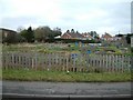
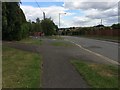
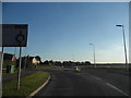
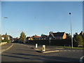
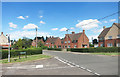
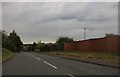
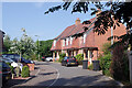
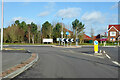
Photos of RG17 0AS


Area Information
RG17 0AS represents a specific postcode area covering a small residential cluster of 1.8 hectares. You will find exactly 1,637 residents living within this compact footprint, resulting in a population density of 493 people per square kilometre. This figure indicates a well-distributed community rather than a high-density urban block. The area is defined by its modest size and tight-knit nature, suitable for those seeking a quieter existence away from major city centers. Living in RG17 0AS means navigating a neighbourhood where space is shared among nearly 1,700 households. The character here is shaped by the concentration of homes in a relatively small geographical area. You do not find sprawling estates or dense high-rise blocks in this section of the Greater London postcodes. Instead, the layout offers a contained environment where the community interacts closely with its immediate surroundings. This post code functions as a specific residential gateway, blending accessibility with the privacy of a smaller settlement. The area sits within the RG17 postcode district, providing a distinct identity separate from larger neighbouring towns.
- Area Type
- Postcode
- Area Size
- 1.8 hectares
- Population
- 1637
- Population Density
- 493 people/km²
Homes in RG17 0AS consist almost exclusively of houses rather than apartments or other accommodation types. The market is heavily skewed toward owner-occupation, with a 55 per cent home ownership rate. This statistic suggests a stable environment where residents are less likely to move frequently compared to rental-dominated areas. Buyers looking at this small postcode area should expect a mix of family homes and potential investment opportunities for local landlords. The dominance of houses means you will find gardens and private outdoor space as standard features. Given the population of 1,637 spread across only 1.8 hectares, the housing stock is limited in total volume. This scarcity often drives up the value of individual properties. The area serves as a residential cluster where privacy is a key selling point. You can anticipate a market where sellers prioritize long-term living arrangements. The high proportion of owner-occupiers indicates that the area appeals to those seeking stability.
House Prices in RG17 0AS
Showing 40 properties
| Address | Type | Beds | Baths | Last Sale Price | Last Sale Date | |
|---|---|---|---|---|---|---|
| 40 Priory Avenue, Hungerford, RG17 0AS | house | - | - | £355,000 | Aug 2022 | |
| 69 Priory Avenue, Hungerford, RG17 0AS | Semi-detached | 3 | - | £365,000 | Nov 2021 | |
| 75 Priory Avenue, Hungerford, RG17 0AS | house | - | - | £408,000 | Feb 2021 | |
| 53 Priory Avenue, Hungerford, RG17 0AS | Semi-detached | 5 | 3 | £465,000 | Feb 2021 | |
| 62 Priory Avenue, Hungerford, RG17 0AS | house | 3 | - | £283,000 | Jan 2021 | |
| 59 Priory Avenue, Hungerford, RG17 0AS | Semi-detached | 4 | 2 | £425,000 | Apr 2019 | |
| 58 Priory Avenue, Hungerford, RG17 0AS | Semi-detached | 2 | 1 | £280,000 | Aug 2018 | |
| 78 Priory Avenue, Hungerford, RG17 0AS | house | - | - | £200,000 | Oct 2016 | |
| 71 Priory Avenue, Hungerford, RG17 0AS | Semi-detached | 4 | - | £390,000 | Oct 2015 | |
| 42 Priory Avenue, Hungerford, RG17 0AS | Semi-detached | 2 | 1 | £218,000 | Nov 2014 |
Energy Efficiency in RG17 0AS
Retail convenience lies a short practical distance from your home in RG17 0AS. Three major supermarkets operate within easy reach, providing local healthcare and staple goods. You will find Tesco Hungerford, Morrisons Daily, and Asda Hungerford available to residents. These five notable retail outlets cover your weekly grocery shopping needs and essential daily purchases. Rail transport links include Hungerford Railway Station, Kintbury Railway Station, and Bedwyn Railway Station. These three stations facilitate travel beyond the immediate residential cluster for work or leisure. Access to these amenities reduces the necessity for a private car for routine errands. The area sits close to established commercial hubs rather than isolated countryside. You can reach diverse shopping options without traveling deep into the county. The proximity to these three named stations and five retail centers defines the daily convenience factor. Living in RG17 0AS offers a balance of quiet residential life and immediate access to major services.
Amenities
Schools
Families in RG17 0AS have access to John O'Gaunt School, which operates as a primary institution serving younger children. For secondary education needs, the same institution functions as an academy with an Ofsted rating of good. This dual role provides a consistent educational framework for residents from early years through to secondary school. A good Ofsted rating signals that the academy meets specific standards for teaching and student welfare. You do not have multiple competing schools to choose from within immediate proximity, which simplifies the schooling process for parents living here. The presence of an academy rather than a traditional maintained school may offer different curriculum options or autonomy. Both the primary and academy phases of John O'Gaunt School cater to the local population of 1,637 people. The combination of good ratings and accessible types means schools near RG17 0AS provide reliable education. Parents can expect a straightforward route for their children through the school system without complex transfers.
| Rank | School | Type | Entry gender | Ages |
|---|
Explore more schools in this area
Go to Schools tabDemographics
The community within RG17 0AS reflects a mature demographic profile with a median age of 47 years. Adults aged between 30 and 64 years constitute the most common age range in this neighbourhood. This age distribution suggests a stable population of families and established professionals rather than a transient workforce. Home ownership stands at 55 per cent, indicating that over half of the residents own their properties outright or have a mortgage. The remaining households likely consist of renters or those living with family members. Houses make up the primary accommodation type in this area, aligning with the preference for standalone or semi-detached living over flats. The predominant ethnic group is White, which shapes the cultural makeup of the local community. With a median age above the national average, the area attracts older couples or parents raising school-aged children. Low deprivation metrics associated with this age and ownership profile contribute to a high quality of life. You will find a neighbourhood where residents have remained for significant periods.
Household Size
Accommodation Type
Tenure
Ethnic Group
Religion
Household Composition
Age
Household Deprivation
NS-SEC
Explore more demographic insights in this area
Go to Demographics tabPlanning
Planning Constraints
- Flood RiskPremium
- Ramsar Wetland SitesPremium
- Area of Outstanding Natural BeautyPremium
- Protected Nature ReservePremium
- Protected WoodlandPremium