Area Overview for RG14 2LY
Photos of RG14 2LY
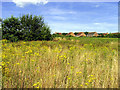
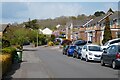
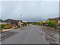
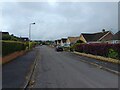
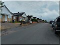
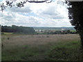
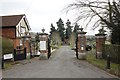


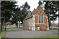
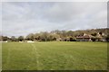
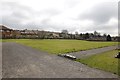
34 photos from this area
Area Information
Key information about the RG14 2LY including its size, population, and administrative classification.
- Area Type
- Postcode
- Area Size
- 11.9 hectares
- Population
- 3265
- Population Density
- 333 people/km²
House Prices in RG14 2LY
12
Properties
£327,714
Average Sold Price
£107,500
Lowest Price
£800,000
Highest Price
Showing 12 properties
| Address | Type | Beds | Baths | Last Sale Price | Last Sale Date | |
|---|---|---|---|---|---|---|
| 68 Pear Tree Lane, Newbury, RG14 2LY | Semi-detached | 2 | 1 | £348,500 | Feb 2022 | |
| The Bungalow, Pear Tree Lane, Newbury, RG14 2LY | Bungalow | 2 | - | £800,000 | Jul 2018 | |
| 76 Pear Tree Lane, Newbury, RG14 2LY | house | 4 | - | £411,000 | Mar 2016 | |
| 74 Pear Tree Lane, Newbury, RG14 2LY | Semi-detached | - | - | £183,995 | Feb 2004 | |
| 60 Pear Tree Lane, Newbury, RG14 2LY | house | - | - | £250,000 | May 2003 | |
| 70 Pear Tree Lane, Newbury, RG14 2LY | Semi-detached | - | - | £107,500 | Jan 2000 | |
| 72 Pear Tree Lane, Newbury, RG14 2LY | Detached | - | - | £193,000 | Dec 1998 | |
| Grovelands, Pear Tree Lane, Newbury, RG14 2LY | Detached | - | - | - | - | |
| Messenger House, Pear Tree Lane, Newbury, RG14 2LY | Detached | - | - | - | - | |
| 62 Pear Tree Lane, Newbury, RG14 2LY | Semi-detached | - | - | - | - |
Page 1 of 2
Energy Efficiency in RG14 2LY
Amenities
Schools
| Rank | School | Type | Entry gender | Ages |
|---|
Explore more schools in this area
Go to Schools tabDemographics
Household Size
Family (3-5 people)
most common
Accommodation Type
Houses
most common
Tenure
78
majority
Ethnic Group
White
most common
Religion
N/A
most common
Household Composition
N/A
most common
Age
47
median
Adults (30-64 years)
most common
Household Deprivation
N/A
with no deprivation
NS-SEC
49
in Lower managerial occupations
Explore more demographic insights in this area
Go to Demographics tabPlanning
Planning Constraints
- Flood RiskPremium
- Ramsar Wetland SitesPremium
- Area of Outstanding Natural BeautyPremium
- Protected Nature ReservePremium
- Protected WoodlandPremium