Area Overview for RG12 7WT
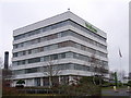
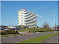
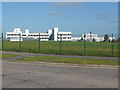
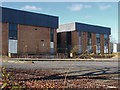
Photos of RG12 7WT
Area Information
RG12 7WT represents a compact residential cluster within Berkshire, covering exactly 15.2 hectares. This small footprint contains 1,782 residents, creating a tightly knit neighbourhood rather than a sprawling suburb. The postcode serves as a specific address for a dense settlement where inhabitants share immediate proximity. You move through an environment where the 1782 population means neighbours are rarely far away. The area functions as a distinct pocket of housing within the larger RG12 unitary authority. Living here means prioritising space economy and community recognition. The high density of 11,687 people per square kilometre sets this cluster apart from the surrounding valleys and countryside. You access a focused range of services without traversing long distances for daily chores. This area appeals to those who want a defined residential zone rather than a generic postcode district. The character is defined by the sheer concentration of homes within these 15.2 hectares. This residential cluster offers a straightforward living arrangement for those seeking a specific postcode for work or family reasons. The scale ensures that local decisions affect everyone in the immediate vicinity. You experience a community where individual households are part of a larger, singular residential entity. The compact nature of RG12 7WT means that every street plays a critical role in the area's total function.
- Area Type
- Postcode
- Area Size
- 15.2 hectares
- Population
- 1782
- Population Density
- 3347 people/km²
The housing market in RG12 7WT reflects a distinct owner-occupied character. With 65% of residents owning their homes, the area relies heavily on private investment rather than rental yields. You will predominantly encounter houses when scouting for properties in this 15.2-hectare cluster. This high ownership rate creates a community where residents often have ties to the property for decades. The accommodation type data confirms that houses constitute the primary stock in RG12 7WT. You do not expect flats or purpose-built estates; instead, the landscape consists of residential clusters of homes. This distribution influences the local market, as buyers seek freehold properties suited to family or retirement needs. The presence of 1,782 residents in such a small area supports a niche market for specific house types. Living in RG12 7WT means purchasing a share of a limited housing stock. The 65% ownership figure signals strong roots in the community. You compete against cautious sellers who are emotionally attached to their homes. The market operates with the rhythm of a maturing neighbourhood where change happens slowly. This makes the area attractive for stability but potentially difficult for rapid flipping.
House Prices in RG12 7WT
Showing 1 properties
| Address | Type | Beds | Baths | Last Sale Price | Last Sale Date | |
|---|---|---|---|---|---|---|
| Mcdonalds Restaurants Ltd, Mcdonalds, Wildridings Road, Bracknell, RG12 7WT | Flat | - | - | - | - |
Energy Efficiency in RG12 7WT
Residents of RG12 7WT access retail and transport hubs located within practical reach. For shopping, Co-op Easthampstead, Morrisons Bracknell, and Co-op Jennetts provide your nearest convenient options. These five retail outlets offer groceries and essentials directly on your drive to work or school runs. You do not need to travel far for weekly provisions. Rail connectivity connects the area effectively through five nearby stations, including Bracknell, Martins Heron, and Wokingham Railway Stations. These rail links form the backbone of your commuting routine into central London or other business districts. You can rely on these five stations for timely departures during rush hour. The variety of stations ensures you have backup options if one line is delayed. This mix of retail and rail access defines the lifestyle in RG12 7WT. You balance the quiet of a residential cluster with the convenience of major superstores and train platforms. Your daily life involves short drives to Morrisons Bracknell and short walks to the nearest station.
Amenities
Schools
Families in RG12 7WT rely on one main educational facility nearby: Adastron House Pupil Referral Unit. This institution operates as an 'other' type of school, distinct from standard primary or secondary academies. You must investigate this unit carefully, as it serves a specific role within the local education landscape. The type classification indicates a specialised function rather than a mainstream classroom environment. The proximity of this unit means it is the only named educational provision within the immediate vicinity of the postcode. There is no data provided for other mainstream schools in this zone, limiting your local options for standard education. You must explore schools slightly further afield if you seek a typical primary or secondary setting. The presence of Adastron House Pupil Referral Unit highlights the educational infrastructure available to the 1,782 residents. Schools near RG12 7WT are currently limited to this singular entry in the local register. You should verify Ofsted ratings independently for this centre, as the provided data lists only the name and type. This unique school setup means the local area caters to a specific subset of educational needs.
| Rank | School | Type | Entry gender | Ages |
|---|
Explore more schools in this area
Go to Schools tabDemographics
The community in RG12 7WT skews significantly older than the national average, with a median age of 47 years. The most common residents fall into the adult bracket between 30 and 64 years old. This age profile suggests a population that has either raised families and stayed or attracted mature professionals. You are likely to meet many people in this demographic range during your daily routines. Home ownership stands at a respectable 65%, indicating that the majority of residents have purchased properties in this postcode. This purchase rate points to a settled population rather than a large transient rental market. The accommodation type list confirms that houses dominate the housing stock in this specific 15.2-hectare area. You will find detached or semi-detached homes rather than terraced row housing. The predominant ethnic group in RG12 7WT is White, reflecting the broader demographic trends of Berkshire. The area lacks significant ethnic diversity compared to larger urban centres. These facts define the social fabric of the 1,782 residents living in this postcode. You interact with a community established by long-term owners who value stability.
Household Size
Accommodation Type
Tenure
Ethnic Group
Religion
Household Composition
Age
Household Deprivation
NS-SEC
Explore more demographic insights in this area
Go to Demographics tabPlanning
Planning Constraints
- Flood RiskPremium
- Ramsar Wetland SitesPremium
- Area of Outstanding Natural BeautyPremium
- Protected Nature ReservePremium
- Protected WoodlandPremium