Area Overview for RG12 7GF
Photos of RG12 7GF

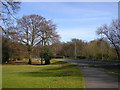
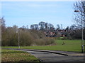
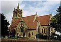
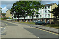
31 photos from this area
Area Information
Key information about the RG12 7GF including its size, population, and administrative classification.
- Area Type
- Postcode
- Area Size
- 5.2 hectares
- Population
- 1534
- Population Density
- 4739 people/km²
House Prices in RG12 7GF
62
Properties
£211,730
Average Sold Price
£148,495
Lowest Price
£355,000
Highest Price
Showing 62 properties
| Address | Type | Beds | Baths | Last Sale Price | Last Sale Date | |
|---|---|---|---|---|---|---|
| 55 Turing Drive, Bracknell, RG12 7GF | Flat | 2 | 2 | £223,000 | Sep 2025 | |
| 54 Turing Drive, Bracknell, RG12 7GF | Flat | - | - | £216,000 | Jun 2024 | |
| 62 Turing Drive, Bracknell, RG12 7GF | Flat | - | - | £197,500 | Jun 2024 | |
| 58 Turing Drive, Bracknell, RG12 7GF | Flat | 2 | 2 | £238,000 | Dec 2023 | |
| 59 Turing Drive, Bracknell, RG12 7GF | Flat | - | - | £218,000 | Oct 2023 | |
| 8 Turing Drive, Bracknell, RG12 7GF | Flat | 2 | - | £233,000 | Sep 2022 | |
| 16 Turing Drive, Bracknell, RG12 7GF | Flat | 2 | 2 | £212,000 | Jul 2022 | |
| 20A Turing Drive, Bracknell, RG12 7GF | Semi-detached | 2 | 2 | £355,000 | Aug 2020 | |
| 12 Turing Drive, Bracknell, RG12 7GF | Flat | - | - | £202,000 | Mar 2020 | |
| 7 Turing Drive, Bracknell, RG12 7GF | Flat | 2 | 2 | £190,000 | May 2019 |
Page 1 of 7
Energy Efficiency in RG12 7GF
Amenities
Schools
| Rank | School | Type | Entry gender | Ages |
|---|
Explore more schools in this area
Go to Schools tabDemographics
Household Size
Family (3-5 people)
most common
Accommodation Type
Houses
most common
Tenure
60
majority
Ethnic Group
White
most common
Religion
N/A
most common
Household Composition
N/A
most common
Age
47
median
Adults (30-64 years)
most common
Household Deprivation
N/A
with no deprivation
NS-SEC
30
in Lower managerial occupations
Explore more demographic insights in this area
Go to Demographics tabPlanning
Planning Constraints
- Flood RiskPremium
- Ramsar Wetland SitesPremium
- Area of Outstanding Natural BeautyPremium
- Protected Nature ReservePremium
- Protected WoodlandPremium