Area Overview for RG12 0GA
Photos of RG12 0GA
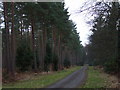
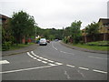
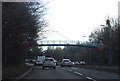
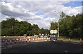

26 photos from this area
Area Information
Key information about the RG12 0GA including its size, population, and administrative classification.
- Area Type
- Postcode
- Area Size
- 1.3 hectares
- Population
- 1285
- Population Density
- 5930 people/km²
House Prices in RG12 0GA
51
Properties
£213,386
Average Sold Price
£65,000
Lowest Price
£425,000
Highest Price
Showing 51 properties
| Address | Type | Beds | Baths | Last Sale Price | Last Sale Date | |
|---|---|---|---|---|---|---|
| 12 Burn Moor Chase, Bracknell, RG12 0GA | Terraced | 2 | 1 | £320,000 | Nov 2024 | |
| 20 Burn Moor Chase, Bracknell, RG12 0GA | Terraced | 2 | 1 | £315,000 | Oct 2024 | |
| 16 Burn Moor Chase, Bracknell, RG12 0GA | Terraced | 2 | 1 | £340,000 | Jul 2024 | |
| 25 Burn Moor Chase, Bracknell, RG12 0GA | Terraced | 2 | 1 | £320,000 | Jun 2024 | |
| 47 Burn Moor Chase, Bracknell, RG12 0GA | Terraced | 3 | 1 | £425,000 | Jun 2023 | |
| 5 Burn Moor Chase, Bracknell, RG12 0GA | Terraced | 2 | 1 | £310,000 | Mar 2023 | |
| 1 Burn Moor Chase, Bracknell, RG12 0GA | Terraced | 3 | 1 | £425,000 | Feb 2023 | |
| 35 Burn Moor Chase, Bracknell, RG12 0GA | house | - | - | £340,000 | Jan 2023 | |
| 40 Burn Moor Chase, Bracknell, RG12 0GA | house | 2 | - | £337,000 | Oct 2022 | |
| 37 Burn Moor Chase, Bracknell, RG12 0GA | Terraced | 2 | 1 | £257,000 | Nov 2019 |
Page 1 of 6
Energy Efficiency in RG12 0GA
Amenities
Schools
| Rank | School | Type | Entry gender | Ages |
|---|
Explore more schools in this area
Go to Schools tabDemographics
Household Size
Two person
most common
Accommodation Type
Houses
most common
Tenure
67
majority
Ethnic Group
White
most common
Religion
N/A
most common
Household Composition
N/A
most common
Age
47
median
Adults (30-64 years)
most common
Household Deprivation
N/A
with no deprivation
NS-SEC
44
in Lower managerial occupations
Explore more demographic insights in this area
Go to Demographics tabPlanning
Planning Constraints
- Flood RiskPremium
- Ramsar Wetland SitesPremium
- Area of Outstanding Natural BeautyPremium
- Protected Nature ReservePremium
- Protected WoodlandPremium