Area Overview for RG10 9XU
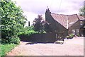
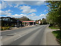
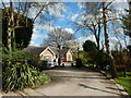
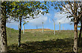
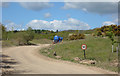
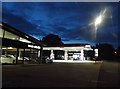
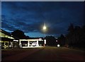
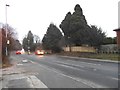
Photos of RG10 9XU
Area Information
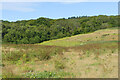
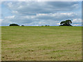
Living in RG10 9XU offers a quiet residential experience within a small, defined cluster of homes. This specific postcode covers an area of 9,951 square metres, creating a low-density neighbourhood where privacy is the norm. With a population of 2,508, you will find a tightly knit community that avoids the congestion of larger towns. The layout is expansive, supporting a population density of just 126 people per square kilometre. You are not in the city centre, but you are well situated in a residential zone designed for calm living. Daily life here revolves around the immediate surroundings and the nearby villages that serve as commercial hubs. The environment is spacious, allowing for gardens and open spaces that are rare in more built-up parts of Berkshire. You get a slice of country life while retaining access to essential services nearby. The character of RG10 9XU is defined by its size and its peaceful, suburban atmosphere. It is a place where you can step outside your door without immediately encountering busy streets.
- Area Type
- Postcode
- Area Size
- 9951 m²
- Population
- 2508
- Population Density
- 126 people/km²
You will find that the property market in RG10 9XU is dominated by owner-occupied homes. With 72% of residents owning their homes, this area is not a bustling lettings market but a stable environment for buyers seeking to end their rent-to-own journey. The predominant accommodation type in the neighbourhood is houses, meaning you will primarily encounter detached or semi-detached properties rather than flats or maisonettes. This is a small residential cluster, yet the high ownership rate suggests a strong desire for asset accumulation and security. For a prospective buyer, this indicates that competition comes from other owners looking to upgrade or stay rather than renters. The housing stock is designed for families and older adults, offering space and privacy. If you are looking to move into RG10 9XU, you are joining a group of people who have already made a financial commitment to the property. The market reflects a preference for tangible assets and a reluctance to move frequently, making it a solid choice for long-term investment.
House Prices in RG10 9XU
Showing 5 properties
| Address | Type | Beds | Baths | Last Sale Price | Last Sale Date | |
|---|---|---|---|---|---|---|
| Thornwood, Canhurst Lane, Knowl Hill, RG10 9XU | Detached | 5 | 3 | £2,400,000 | May 2022 | |
| Greytiles, Canhurst Lane, Knowl Hill, RG10 9XU | Detached | 4 | 2 | - | - | |
| The Old Bakery, Canhurst Lane, Knowl Hill, RG10 9XU | house | - | - | - | - | |
| Bonds Cottage, Canhurst Lane, Knowl Hill, RG10 9XU | house | - | - | - | - | |
| Bakers Cottage, Canhurst Lane, Knowl Hill, RG10 9XU | house | - | - | - | - |
Energy Efficiency in RG10 9XU
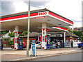
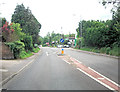
Your lifestyle in RG10 9XU is shaped by practical retail and rail connections nearby. There are five retail venues within practical reach, including Tesco Twyford, Morrisons Daily, and M&S Twyford BP. These specific stores mean you have full supermarket and convenience access without travelling far. You can do your weekly shopping on a Sunday morning at Morrisons or grab essentials from the TESCO and M&S locations. Your rail connectivity is equally robust, with five nearby stations offering regular travel options. Wargrave Railway Station, Shiplake Railway Station, and Twyford Railway Station are all close enough to fit into your commute or leisure plans. These stations connect you to Windsor, Reading, and London without the need for a car for every journey. The combination of major supermarkets and multiple railway stations means that daily life is convenient and varied. You have the quiet of a small residential cluster but the utility of a major transport hub nearby.
Amenities
Schools
Families considering RG10 9XU have access to two local primary options. The area is served by Crazies Hill CofE Primary School and Crazies Hill Church of England Primary School. Both institutions offer primary education, ensuring consistency in the learning environment for local children. Crazies Hill Church of England Primary School holds a 'good' Ofsted rating, confirming its standard of education and performance. While there is no data on secondary schools within the immediate vicinity, the presence of two well-rated primary options suggests a strong focus on early education. The mix of Church of England schools indicates a community with traditional values and specific religious ties. When you look at schools near RG10 9XU, you see a direct link between residence and local education. Parents can keep their children close to home while ensuring they attend an institution with proven quality standards.
| Rank | School | Type | Entry gender | Ages |
|---|
Explore more schools in this area
Go to Schools tabDemographics
The community of RG10 9XU is defined by maturity and stability. The demographic profile shows a median age of 47, indicating that adults between the ages of 30 and 64 make up the most common age range. This demographic skew suggests an area settled by families with children and empty nesters who value long-term local knowledge. Home ownership stands at 72%, which is significantly higher than the national average. This high rate of ownership points to residents who have put down roots and intend to stay for the foreseeable future. The predominant accommodation type consists of houses rather than flats, providing detached or semi-detached living situations for those who prefer single-level or multi-level homes. The ethnic composition is predominantly White, reflecting the traditional demographic makeup of rural and semi-rural Berkshire. There is very low population density, further reinforcing the quiet, established nature of daily life here. When you look at the data, this is clearly a neighbourhood for people who have secured their housing and do not frequently move.
Household Size
Accommodation Type
Tenure
Ethnic Group
Religion
Household Composition
Age
Household Deprivation
NS-SEC
Explore more demographic insights in this area
Go to Demographics tabPlanning
Planning Constraints
- Flood RiskPremium
- Ramsar Wetland SitesPremium
- Area of Outstanding Natural BeautyPremium
- Protected Nature ReservePremium
- Protected WoodlandPremium