Area Overview for RG10 9XY
Photos of RG10 9XY
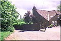
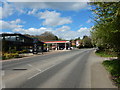
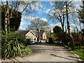
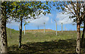
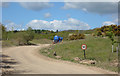
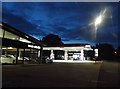
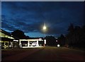
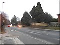

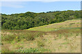
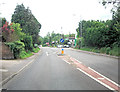
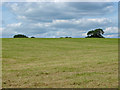
29 photos from this area
Area Information
Key information about the RG10 9XY including its size, population, and administrative classification.
- Area Type
- Postcode
- Area Size
- 43.2 hectares
- Population
- 2508
- Population Density
- 126 people/km²
House Prices in RG10 9XY
27
Properties
£454,401
Average Sold Price
£190,000
Lowest Price
£650,000
Highest Price
Showing 27 properties
| Address | Type | Beds | Baths | Last Sale Price | Last Sale Date | |
|---|---|---|---|---|---|---|
| Stone Cottage, Star Lane, Knowl Hill, Reading, RG10 9XY | Semi-detached | 3 | 2 | £625,000 | Apr 2023 | |
| Orchard Springs, Star Lane, Knowl Hill, Reading, RG10 9XY | Land | 3 | 1 | £526,250 | Mar 2021 | |
| Fairway, 3 Star Lane, Knowl Hill, Reading, RG10 9XY | house | 3 | - | £475,000 | Jun 2016 | |
| Ashley View, Star Lane, Knowl Hill, RG10 9XY | Detached | 4 | 3 | £650,000 | Sep 2015 | |
| Oakfield, Star Lane, Knowl Hill, Reading, RG10 9XY | Detached | 4 | - | £595,000 | Jul 2013 | |
| Meadow View, Star Lane, Knowl Hill, Reading, RG10 9XY | house | 4 | - | £355,000 | Mar 2012 | |
| Conifers, Star Lane, Knowl Hill, Reading, RG10 9XY | house | - | - | £190,000 | Dec 2006 | |
| White House, Star Lane, Knowl Hill, Reading, RG10 9XY | Detached | - | - | £532,756 | Aug 2006 | |
| The Jays, Star Lane, Knowl Hill, Reading, RG10 9XY | Detached | - | - | £400,000 | Jan 2001 | |
| Hill View, Star Lane, Knowl Hill, Reading, RG10 9XY | Detached | - | - | £195,000 | Nov 1997 |
Page 1 of 3
Energy Efficiency in RG10 9XY
Amenities
Schools
| Rank | School | Type | Entry gender | Ages |
|---|
Explore more schools in this area
Go to Schools tabDemographics
Household Size
Two person
most common
Accommodation Type
Houses
most common
Tenure
72
majority
Ethnic Group
White
most common
Religion
N/A
most common
Household Composition
N/A
most common
Age
47
median
Adults (30-64 years)
most common
Household Deprivation
N/A
with no deprivation
NS-SEC
51
in Lower managerial occupations
Explore more demographic insights in this area
Go to Demographics tabPlanning
Planning Constraints
- Flood RiskPremium
- Ramsar Wetland SitesPremium
- Area of Outstanding Natural BeautyPremium
- Protected Nature ReservePremium
- Protected WoodlandPremium