Area Overview for RG10 9DJ
Photos of RG10 9DJ
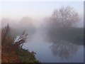
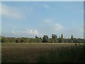
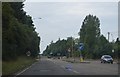
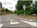
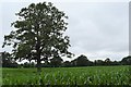
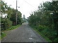
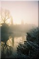
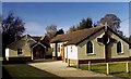
24 photos from this area
Area Information
Key information about the RG10 9DJ including its size, population, and administrative classification.
- Area Type
- Postcode
- Area Size
- 3.7 hectares
- Population
- 1526
- Population Density
- 2196 people/km²
House Prices in RG10 9DJ
49
Properties
£577,073
Average Sold Price
£180,000
Lowest Price
£910,000
Highest Price
Showing 49 properties
| Address | Type | Beds | Baths | Last Sale Price | Last Sale Date | |
|---|---|---|---|---|---|---|
| 36 Gingells Farm Road, Charvil, RG10 9DJ | Detached | 4 | 2 | £750,000 | Sep 2024 | |
| 43 Gingells Farm Road, Charvil, RG10 9DJ | Detached | 4 | 1 | £710,000 | Jul 2024 | |
| 24 Gingells Farm Road, Charvil, RG10 9DJ | Detached | 5 | 3 | £831,250 | Jul 2024 | |
| 39 Gingells Farm Road, Charvil, RG10 9DJ | house | - | - | £695,000 | Jun 2024 | |
| 25 Gingells Farm Road, Charvil, RG10 9DJ | Detached | - | - | £910,000 | Jul 2023 | |
| 33 Gingells Farm Road, Charvil, RG10 9DJ | Detached | 4 | 2 | £795,000 | Dec 2022 | |
| 28 Gingells Farm Road, Charvil, RG10 9DJ | house | - | - | £675,000 | Aug 2022 | |
| 40 Gingells Farm Road, Charvil, RG10 9DJ | Detached | 4 | 2 | £650,000 | Oct 2021 | |
| 27 Gingells Farm Road, Charvil, RG10 9DJ | Detached | 4 | - | £740,000 | Oct 2021 | |
| 9 Gingells Farm Road, Charvil, RG10 9DJ | house | - | - | £685,000 | Jun 2021 |
Page 1 of 5
Energy Efficiency in RG10 9DJ
Amenities
Schools
| Rank | School | Type | Entry gender | Ages |
|---|
Explore more schools in this area
Go to Schools tabDemographics
Household Size
Family (3-5 people)
most common
Accommodation Type
Houses
most common
Tenure
79
majority
Ethnic Group
White
most common
Religion
N/A
most common
Household Composition
N/A
most common
Age
47
median
Adults (30-64 years)
most common
Household Deprivation
N/A
with no deprivation
NS-SEC
50
in Lower managerial occupations
Explore more demographic insights in this area
Go to Demographics tabPlanning
Planning Constraints
- Flood RiskPremium
- Ramsar Wetland SitesPremium
- Area of Outstanding Natural BeautyPremium
- Protected Nature ReservePremium
- Protected WoodlandPremium