Area Overview for RG10 0AA
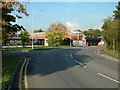
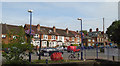
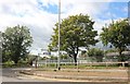
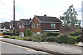
Photos of RG10 0AA


Area Information
RG10 0AA defines a small, tightly knit residential cluster within England, covering an area of 4,905 square metres. This compact footprint hosts a total population of 1,561 residents, creating an exceptionally dense living environment with a population density of 318,253 people per square kilometre. Such high density characterises this specific postcode, distinguishing it from broader neighbourhoods in the broader RG10 region. Living in RG10 0AA means residing in a focus where every square metre serves multiple households, resulting in a close-knit community atmosphere. The area functions as a concentrated village, where proximity to neighbours is immediate and shared spaces are likely controlled environments. This unique scale makes daily routines efficient, as local needs are concentrated in a limited geographic zone. For those considering homes in this postcode, you are looking at a micro-community rather than a sprawling suburb. The sheer concentration of people within this 4,905 square metre boundary creates a specific rhythm to life here, distinct from the more dispersed housing patterns found further away. You will find a residential setting defined strictly by this high-density classification. ### The community within RG10 0AA is defined by a mature age profile, with a median age of 47 years. Adults between the ages of 30 and 64 constitute the most common age range within this population, suggesting a steady demographic where families and established households form the backbone of the neighbourhood. Home ownership stands at a decisive 73%, indicating that the vast majority of residents purchase their properties rather than rent. This high rate of ownership creates a stable, long-term resident base within the homes found in RG10 0AA. The prevailing accommodation type consists of houses, reinforcing the traditional character of the built environment. The predominant ethnic group is White, reflecting the demographic composition of this specific housing cluster. These statistics collectively paint a picture of a settled, owner-occupied community centred around family life and stability. A significant portion of the population falls into the 30-64 bracket, meaning you are likely to encounter a neighbours who have lived in the area for decades. The demographic make-up supports a quiet, established lifestyle typical of owner-occupier districts. ### Homes in RG10 0AA are overwhelmingly characterised by private ownership, with 73% of residents owning their properties outright. This statistic highlights that the property market here is dominated by owner-occupiers rather than the rental sector. The accommodation type data confirms that houses form the primary housing stock within this postcode boundary. Seventy-three percent ownership suggests a market where families and long-term residents build roots rather than transient lifestyles. When you look for properties in this area, you will predominantly encounter houses suitable for established households. The concentration of owner-occupied homes creates a neighbourhood where residents often stay for many years, fostering predictable community dynamics. This 73% figure indicates a robust local property base where buyers compete for permanent addresses rather than viewing the area as a short-term rental option. For prospective buyers, this high ownership rate signals a stable investment environment where local knowledge and neighbourly ties are strong pillars. You can expect a housing market driven by people who have chosen this specific cluster for its permanent living conditions. ### Digital connectivity in RG10 0AA is a major strength for modern living, with a fixed broadband quality score of 97. On a scale where 100 represents the highest quality, this rating confirms excellent internet performance suitable for heavy streaming, large file transfers, and video conferencing. Mobile network coverage receives a score of 82, which translates to a high level of reliability for keeping connected on the go. You can work from home in RG10 0AA with confidence that your digital infrastructure supports professional demands. This level of broadband quality removes common frustrations associated with slow or unstable connections. Residents benefit from an area classified for digital excellence, ensuring that remote work or school supervision faces no technical barriers. The 97 broadband score places this postcode among the very best available, making it an ideal choice for tech-dependent households. Mobile connectivity at 82 ensures you remain reachable even when leaving the immediate property boundaries. ### Living in RG10 0AA places you within practical reach of essential amenities named Twyford Railway Station, Wargrave Railway Station, and Shiplake Railway Station. With five railway options in the vicinity, you can easily access regional transport networks from your doorstep. For daily shopping needs, you have five retail facilities nearby, including Tesco Twyford, M&S Twyford BP, and Co-op Petrol. These specific venues offer immediate access to groceries, clothing, and essential services without long commutes. The presence of these named retailers ensures that your weekly shop requires no significant travel time. Furthermore, the area's compact nature means these amenities are integrated into your daily routine. You will find that your local convenience store is quite close, and weekly grocery trips are straightforward. The variety of five retail outlets ensures you can find what you need locally. Whether you are stocking up at Tesco Twyford or filling cars at Co-op Petrol, your lifestyle is supported by a robust local infrastructure. ### Safety assessments for RG10 0AA indicate a secure environment with a crime risk level described as low. The area holds a safety score of 83 out of 100, which signifies that crime rates fall below the regional average. You can feel confident that this neighbourhood prioritises resident security. Environmental considerations also present no significant risks. The area passes assessments for flood risk, Ramsar wetland sites, Areas of Outstanding Natural Beauty, protected nature reserves, and protected woodland. Each of these categories registers a score indicating zero risk or lack of coverage for these specific constraints. Consequently, you will not face planning restrictions related to protected natural landscapes or flooding concerns. The low flood risk score ensures that weather events do not threaten your property. The absence of Ramsar or AONB status simplifies future planning within the area. Overall, the safety and environmental profile of RG10 0AA is robust, offering peace of mind regarding both crime and natural hazards. ### What is the community feel like in RG10 0AA?The community is highly stable with a 73% home ownership rate and a median age of 47. The population is dominated by adults aged 30 to 64 years, creating a settled atmosphere where owners rather than renters form the core demographic. How good is the connectivity for working from home?Digital infrastructure is excellent, featuring a fixed broadband quality score of 97 out of 100. Mobile coverage is also strong at 82 out of 100, ensuring reliable high-speed internet for remote work or streaming without interruption. Are there easy transport links nearby?Yes, residents have access to five railway stations including Twyford, Wargrave, and Shiplake. Additionally, there are five retail locations within practical reach, such as Tesco Twyford and M&S Twyford BP, for daily necessities. Is the area safe and free from environmental risks?Crim rates are low with a safety score of 83/100. Environmental constraints are minimal, showing zero risk for flood, Ramsar sites, AONB, and protected reserves, meaning no planning limitations regarding these hazards.
- Area Type
- Postcode
- Area Size
- 4905 m²
- Population
- 1561
- Population Density
- 3014 people/km²
Homes in RG10 0AA are overwhelmingly characterised by private ownership, with 73% of residents owning their properties outright. This statistic highlights that the property market here is dominated by owner-occupiers rather than the rental sector. The accommodation type data confirms that houses form the primary housing stock within this postcode boundary. Seventy-three percent ownership suggests a market where families and long-term residents build roots rather than transient lifestyles. When you look for properties in this area, you will predominantly encounter houses suitable for established households. The concentration of owner-occupied homes creates a neighbourhood where residents often stay for many years, fostering predictable community dynamics. This 73% figure indicates a robust local property base where buyers compete for permanent addresses rather than viewing the area as a short-term rental option. For prospective buyers, this high ownership rate signals a stable investment environment where local knowledge and neighbourly ties are strong pillars. You can expect a housing market driven by people who have chosen this specific cluster for its permanent living conditions. ### Digital connectivity in RG10 0AA is a major strength for modern living, with a fixed broadband quality score of 97. On a scale where 100 represents the highest quality, this rating confirms excellent internet performance suitable for heavy streaming, large file transfers, and video conferencing. Mobile network coverage receives a score of 82, which translates to a high level of reliability for keeping connected on the go. You can work from home in RG10 0AA with confidence that your digital infrastructure supports professional demands. This level of broadband quality removes common frustrations associated with slow or unstable connections. Residents benefit from an area classified for digital excellence, ensuring that remote work or school supervision faces no technical barriers. The 97 broadband score places this postcode among the very best available, making it an ideal choice for tech-dependent households. Mobile connectivity at 82 ensures you remain reachable even when leaving the immediate property boundaries. ### Living in RG10 0AA places you within practical reach of essential amenities named Twyford Railway Station, Wargrave Railway Station, and Shiplake Railway Station. With five railway options in the vicinity, you can easily access regional transport networks from your doorstep. For daily shopping needs, you have five retail facilities nearby, including Tesco Twyford, M&S Twyford BP, and Co-op Petrol. These specific venues offer immediate access to groceries, clothing, and essential services without long commutes. The presence of these named retailers ensures that your weekly shop requires no significant travel time. Furthermore, the area's compact nature means these amenities are integrated into your daily routine. You will find that your local convenience store is quite close, and weekly grocery trips are straightforward. The variety of five retail outlets ensures you can find what you need locally. Whether you are stocking up at Tesco Twyford or filling cars at Co-op Petrol, your lifestyle is supported by a robust local infrastructure. ### Safety assessments for RG10 0AA indicate a secure environment with a crime risk level described as low. The area holds a safety score of 83 out of 100, which signifies that crime rates fall below the regional average. You can feel confident that this neighbourhood prioritises resident security. Environmental considerations also present no significant risks. The area passes assessments for flood risk, Ramsar wetland sites, Areas of Outstanding Natural Beauty, protected nature reserves, and protected woodland. Each of these categories registers a score indicating zero risk or lack of coverage for these specific constraints. Consequently, you will not face planning restrictions related to protected natural landscapes or flooding concerns. The low flood risk score ensures that weather events do not threaten your property. The absence of Ramsar or AONB status simplifies future planning within the area. Overall, the safety and environmental profile of RG10 0AA is robust, offering peace of mind regarding both crime and natural hazards. ### What is the community feel like in RG10 0AA?The community is highly stable with a 73% home ownership rate and a median age of 47. The population is dominated by adults aged 30 to 64 years, creating a settled atmosphere where owners rather than renters form the core demographic. How good is the connectivity for working from home?Digital infrastructure is excellent, featuring a fixed broadband quality score of 97 out of 100. Mobile coverage is also strong at 82 out of 100, ensuring reliable high-speed internet for remote work or streaming without interruption. Are there easy transport links nearby?Yes, residents have access to five railway stations including Twyford, Wargrave, and Shiplake. Additionally, there are five retail locations within practical reach, such as Tesco Twyford and M&S Twyford BP, for daily necessities. Is the area safe and free from environmental risks?Crim rates are low with a safety score of 83/100. Environmental constraints are minimal, showing zero risk for flood, Ramsar sites, AONB, and protected reserves, meaning no planning limitations regarding these hazards.
House Prices in RG10 0AA
Showing 21 properties
| Address | Type | Beds | Baths | Last Sale Price | Last Sale Date | |
|---|---|---|---|---|---|---|
| 25, Highfield Court, Waltham Road, Twyford, RG10 0AA | Flat | - | - | £260,000 | Oct 2024 | |
| 5, Highfield Court, Waltham Road, Twyford, RG10 0AA | Flat | - | - | £322,500 | Jul 2024 | |
| 9, Highfield Court, Waltham Road, Twyford, RG10 0AA | Flat | - | - | £275,000 | Mar 2024 | |
| 26, Highfield Court, Waltham Road, Twyford, RG10 0AA | Flat | 2 | 1 | £275,000 | May 2023 | |
| 19, Highfield Court, Waltham Road, Twyford, RG10 0AA | Flat | - | - | £260,000 | Mar 2023 | |
| 10, Highfield Court, Waltham Road, Twyford, RG10 0AA | Flat | - | - | £265,000 | Nov 2019 | |
| 21, Highfield Court, Waltham Road, Twyford, RG10 0AA | Flat | 2 | 1 | £282,500 | May 2019 | |
| 20, Highfield Court, Waltham Road, Twyford, RG10 0AA | Flat | - | - | £279,000 | Apr 2018 | |
| 24, Highfield Court, Waltham Road, Twyford, RG10 0AA | Flat | - | - | £282,500 | Jun 2015 | |
| 14, Highfield Court, Waltham Road, Twyford, RG10 0AA | Flat | - | - | £190,000 | Apr 2013 |
Energy Efficiency in RG10 0AA
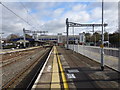
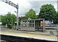
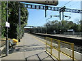
Living in RG10 0AA places you within practical reach of essential amenities named Twyford Railway Station, Wargrave Railway Station, and Shiplake Railway Station. With five railway options in the vicinity, you can easily access regional transport networks from your doorstep. For daily shopping needs, you have five retail facilities nearby, including Tesco Twyford, M&S Twyford BP, and Co-op Petrol. These specific venues offer immediate access to groceries, clothing, and essential services without long commutes. The presence of these named retailers ensures that your weekly shop requires no significant travel time. Furthermore, the area's compact nature means these amenities are integrated into your daily routine. You will find that your local convenience store is quite close, and weekly grocery trips are straightforward. The variety of five retail outlets ensures you can find what you need locally. Whether you are stocking up at Tesco Twyford or filling cars at Co-op Petrol, your lifestyle is supported by a robust local infrastructure. ### Safety assessments for RG10 0AA indicate a secure environment with a crime risk level described as low. The area holds a safety score of 83 out of 100, which signifies that crime rates fall below the regional average. You can feel confident that this neighbourhood prioritises resident security. Environmental considerations also present no significant risks. The area passes assessments for flood risk, Ramsar wetland sites, Areas of Outstanding Natural Beauty, protected nature reserves, and protected woodland. Each of these categories registers a score indicating zero risk or lack of coverage for these specific constraints. Consequently, you will not face planning restrictions related to protected natural landscapes or flooding concerns. The low flood risk score ensures that weather events do not threaten your property. The absence of Ramsar or AONB status simplifies future planning within the area. Overall, the safety and environmental profile of RG10 0AA is robust, offering peace of mind regarding both crime and natural hazards. ### What is the community feel like in RG10 0AA?The community is highly stable with a 73% home ownership rate and a median age of 47. The population is dominated by adults aged 30 to 64 years, creating a settled atmosphere where owners rather than renters form the core demographic. How good is the connectivity for working from home?Digital infrastructure is excellent, featuring a fixed broadband quality score of 97 out of 100. Mobile coverage is also strong at 82 out of 100, ensuring reliable high-speed internet for remote work or streaming without interruption. Are there easy transport links nearby?Yes, residents have access to five railway stations including Twyford, Wargrave, and Shiplake. Additionally, there are five retail locations within practical reach, such as Tesco Twyford and M&S Twyford BP, for daily necessities. Is the area safe and free from environmental risks?Crim rates are low with a safety score of 83/100. Environmental constraints are minimal, showing zero risk for flood, Ramsar sites, AONB, and protected reserves, meaning no planning limitations regarding these hazards.
Amenities
Schools
| Rank | School | Type | Entry gender | Ages |
|---|
Explore more schools in this area
Go to Schools tabDemographics
The community within RG10 0AA is defined by a mature age profile, with a median age of 47 years. Adults between the ages of 30 and 64 constitute the most common age range within this population, suggesting a steady demographic where families and established households form the backbone of the neighbourhood. Home ownership stands at a decisive 73%, indicating that the vast majority of residents purchase their properties rather than rent. This high rate of ownership creates a stable, long-term resident base within the homes found in RG10 0AA. The prevailing accommodation type consists of houses, reinforcing the traditional character of the built environment. The predominant ethnic group is White, reflecting the demographic composition of this specific housing cluster. These statistics collectively paint a picture of a settled, owner-occupied community centred around family life and stability. A significant portion of the population falls into the 30-64 bracket, meaning you are likely to encounter a neighbours who have lived in the area for decades. The demographic make-up supports a quiet, established lifestyle typical of owner-occupier districts. ### Homes in RG10 0AA are overwhelmingly characterised by private ownership, with 73% of residents owning their properties outright. This statistic highlights that the property market here is dominated by owner-occupiers rather than the rental sector. The accommodation type data confirms that houses form the primary housing stock within this postcode boundary. Seventy-three percent ownership suggests a market where families and long-term residents build roots rather than transient lifestyles. When you look for properties in this area, you will predominantly encounter houses suitable for established households. The concentration of owner-occupied homes creates a neighbourhood where residents often stay for many years, fostering predictable community dynamics. This 73% figure indicates a robust local property base where buyers compete for permanent addresses rather than viewing the area as a short-term rental option. For prospective buyers, this high ownership rate signals a stable investment environment where local knowledge and neighbourly ties are strong pillars. You can expect a housing market driven by people who have chosen this specific cluster for its permanent living conditions. ### Digital connectivity in RG10 0AA is a major strength for modern living, with a fixed broadband quality score of 97. On a scale where 100 represents the highest quality, this rating confirms excellent internet performance suitable for heavy streaming, large file transfers, and video conferencing. Mobile network coverage receives a score of 82, which translates to a high level of reliability for keeping connected on the go. You can work from home in RG10 0AA with confidence that your digital infrastructure supports professional demands. This level of broadband quality removes common frustrations associated with slow or unstable connections. Residents benefit from an area classified for digital excellence, ensuring that remote work or school supervision faces no technical barriers. The 97 broadband score places this postcode among the very best available, making it an ideal choice for tech-dependent households. Mobile connectivity at 82 ensures you remain reachable even when leaving the immediate property boundaries. ### Living in RG10 0AA places you within practical reach of essential amenities named Twyford Railway Station, Wargrave Railway Station, and Shiplake Railway Station. With five railway options in the vicinity, you can easily access regional transport networks from your doorstep. For daily shopping needs, you have five retail facilities nearby, including Tesco Twyford, M&S Twyford BP, and Co-op Petrol. These specific venues offer immediate access to groceries, clothing, and essential services without long commutes. The presence of these named retailers ensures that your weekly shop requires no significant travel time. Furthermore, the area's compact nature means these amenities are integrated into your daily routine. You will find that your local convenience store is quite close, and weekly grocery trips are straightforward. The variety of five retail outlets ensures you can find what you need locally. Whether you are stocking up at Tesco Twyford or filling cars at Co-op Petrol, your lifestyle is supported by a robust local infrastructure. ### Safety assessments for RG10 0AA indicate a secure environment with a crime risk level described as low. The area holds a safety score of 83 out of 100, which signifies that crime rates fall below the regional average. You can feel confident that this neighbourhood prioritises resident security. Environmental considerations also present no significant risks. The area passes assessments for flood risk, Ramsar wetland sites, Areas of Outstanding Natural Beauty, protected nature reserves, and protected woodland. Each of these categories registers a score indicating zero risk or lack of coverage for these specific constraints. Consequently, you will not face planning restrictions related to protected natural landscapes or flooding concerns. The low flood risk score ensures that weather events do not threaten your property. The absence of Ramsar or AONB status simplifies future planning within the area. Overall, the safety and environmental profile of RG10 0AA is robust, offering peace of mind regarding both crime and natural hazards. ### What is the community feel like in RG10 0AA?The community is highly stable with a 73% home ownership rate and a median age of 47. The population is dominated by adults aged 30 to 64 years, creating a settled atmosphere where owners rather than renters form the core demographic. How good is the connectivity for working from home?Digital infrastructure is excellent, featuring a fixed broadband quality score of 97 out of 100. Mobile coverage is also strong at 82 out of 100, ensuring reliable high-speed internet for remote work or streaming without interruption. Are there easy transport links nearby?Yes, residents have access to five railway stations including Twyford, Wargrave, and Shiplake. Additionally, there are five retail locations within practical reach, such as Tesco Twyford and M&S Twyford BP, for daily necessities. Is the area safe and free from environmental risks?Crim rates are low with a safety score of 83/100. Environmental constraints are minimal, showing zero risk for flood, Ramsar sites, AONB, and protected reserves, meaning no planning limitations regarding these hazards.
Household Size
Accommodation Type
Tenure
Ethnic Group
Religion
Household Composition
Age
Household Deprivation
NS-SEC
Explore more demographic insights in this area
Go to Demographics tabPlanning
Planning Constraints
- Flood RiskPremium
- Ramsar Wetland SitesPremium
- Area of Outstanding Natural BeautyPremium
- Protected Nature ReservePremium
- Protected WoodlandPremium