Area Overview for PO9 5DP
Photos of PO9 5DP
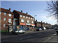

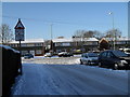
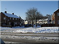
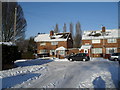
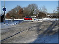
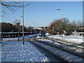
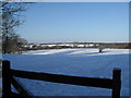
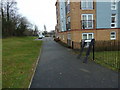
100 photos from this area
Area Information
Key information about the PO9 5DP including its size, population, and administrative classification.
- Area Type
- Postcode
- Area Size
- 7120 m²
- Population
- 1440
- Population Density
- 966 people/km²
House Prices in PO9 5DP
34
Properties
£137,643
Average Sold Price
£43,500
Lowest Price
£268,000
Highest Price
Showing 34 properties
| Address | Type | Beds | Baths | Last Sale Price | Last Sale Date | |
|---|---|---|---|---|---|---|
| 427 Middle Park Way, Havant, PO9 5DP | Semi-detached | 2 | 1 | £265,000 | Jul 2024 | |
| 403A Middle Park Way, Havant, PO9 5DP | Maisonette | - | - | £120,000 | Sep 2023 | |
| 397D Middle Park Way, Havant, PO9 5DP | Maisonette | - | - | £115,000 | Jul 2023 | |
| 443 Middle Park Way, Havant, PO9 5DP | house | 4 | 1 | £268,000 | Oct 2022 | |
| 411 Middle Park Way, Havant, PO9 5DP | Semi-detached | 2 | 1 | £185,000 | Mar 2021 | |
| 439 Middle Park Way, Havant, PO9 5DP | Semi-detached | 2 | 1 | £196,500 | Oct 2019 | |
| 417 Middle Park Way, Havant, PO9 5DP | house | 2 | - | £190,000 | Sep 2018 | |
| 431 Middle Park Way, Havant, PO9 5DP | Terraced | 3 | 1 | £120,000 | Feb 2012 | |
| 419 Middle Park Way, Havant, PO9 5DP | house | 3 | 1 | £135,000 | Jul 2007 | |
| 437 Middle Park Way, Havant, PO9 5DP | Detached | 2 | 1 | £129,000 | Dec 2006 |
Page 1 of 4
Energy Efficiency in PO9 5DP
Amenities
Schools
| Rank | School | Type | Entry gender | Ages |
|---|
Explore more schools in this area
Go to Schools tabDemographics
Household Size
Family (3-5 people)
most common
Accommodation Type
Houses
most common
Tenure
50
majority
Ethnic Group
White
most common
Religion
N/A
most common
Household Composition
N/A
most common
Age
47
median
Adults (30-64 years)
most common
Household Deprivation
N/A
with no deprivation
NS-SEC
21
in Lower managerial occupations
Explore more demographic insights in this area
Go to Demographics tabPlanning
Planning Constraints
- Flood RiskPremium
- Ramsar Wetland SitesPremium
- Area of Outstanding Natural BeautyPremium
- Protected Nature ReservePremium
- Protected WoodlandPremium