Area Overview for PO8 9WP
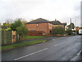
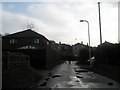
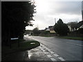
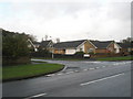
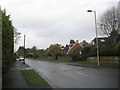
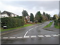
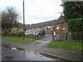
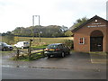
Photos of PO8 9WP
Area Information
Living in PO8 9WP offers a quiet residential experience within a tightly defined cluster measuring just 6947 square metres. This small postcode area, located in England, accommodates a population of 1718 people, creating an intimate community feel where neighbours are likely to know one another. The layout supports a predominantly house-based environment rather than high-density flats, contributing to a slower-paced daily life away from urban congestion. Residents benefit from a stable, established setting where the majority of occupants have long-standing ties to the locality. The area does not suffer from planning constraints related to protected nature reserves, AONBs, or Ramsar wetland sites, meaning development restrictions are minimal compared to more environmentally sensitive locations. Despite its small physical footprint, the cluster provides a self-contained feel with distinct boundaries. For those seeking a straightforward address without the complexities of major planning zones, PO8 9WP delivers a compact, predictable living arrangement. The high population density per square metre reflects the close proximity of homes within this specific postcode, fostering a neighbourhood where access to local streets is immediate and direct.
- Area Type
- Postcode
- Area Size
- 6947 m²
- Population
- 1718
- Population Density
- 4546 people/km²
The property market within PO8 9WP is almost exclusively dominated by owner-occupied households, with home ownership standing at 79% of the total population. This figure suggests a very high proportion of the local stock consists of single-family homes where residents have purchased their properties outright or have significant equity. The accommodation type is explicitly listed as houses, meaning you will not find towering apartment blocks or purpose-built rental estates in this specific postcode. Potential buyers looking for detached or semi-detached family homes will find this area aligns perfectly with their requirements, as the density and housing type cater to those seeking ground-level living. The very low density of 1718 people across only 6947 square metres indicates that properties are likely spaced reasonably apart within the cluster, avoiding the claustrophobia of urban high-rises. A rental market in this postcode is likely a minor component, overshadowed by the entrenched owner-occupier base. Consequently, the buying process here is geared towards established homeownership rather than the competitive bidding wars often seen in high-demand rental conversion areas. The stability of the 79% ownership rate provides confidence to purchasers that the local economy supports long-term residents who intend to stay for years rather than months.
House Prices in PO8 9WP
Showing 9 properties
| Address | Type | Beds | Baths | Last Sale Price | Last Sale Date | |
|---|---|---|---|---|---|---|
| 2 Baker Close, Waterlooville, PO8 9WP | Terraced | 4 | 2 | £350,000 | Oct 2024 | |
| 9 Baker Close, Waterlooville, PO8 9WP | house | - | - | £405,000 | Dec 2019 | |
| 1 Baker Close, Waterlooville, PO8 9WP | house | - | - | £435,000 | Nov 2019 | |
| 6 Baker Close, Waterlooville, PO8 9WP | Semi-detached | 4 | 2 | £336,000 | Nov 2019 | |
| 7 Baker Close, Waterlooville, PO8 9WP | house | - | - | £420,000 | Nov 2019 | |
| 3 Baker Close, Waterlooville, PO8 9WP | house | - | - | £335,000 | Nov 2019 | |
| 4 Baker Close, Waterlooville, PO8 9WP | house | - | - | £335,000 | Nov 2019 | |
| 8 Baker Close, Waterlooville, PO8 9WP | house | - | - | £405,000 | Nov 2019 | |
| 5 Baker Close, Waterlooville, PO8 9WP | Terraced | 4 | 2 | £332,500 | Nov 2019 |
Energy Efficiency in PO8 9WP
Daily life in PO8 9WP is supported by a cluster of amenities that are within easy reach of every home in the postcode. Residents can shop at Tesco Lovedean and Asda Westons, providing convenient access to groceries and everyday household essentials without the need for long journeys. The Southern Co-operative Co also adds to the local retail offerings for those preferring independent stores nearby. For those who prefer to travel slightly further, these venues are situated in the surrounding catchment area, making them practical choices for weekly shopping trips. Rail transport plays a key role in the lifestyle, with Rowlands Castle, Bedhampton, and Havant Railway Stations offering connections for outings or work commutes. While no specific parks or leisure centres are named in the immediate data, the presence of five retail outlets and five rail stations indicates a well-connected community neighbourhood. The layout encourages a balanced routine where residents can manage their daily errands locally while retaining the option to travel for extended activities. This mix of supermarkets and train links ensures that living in this small residential cluster does not mean sacrificing convenience or access to broader regional services.
Amenities
Schools
Families living in PO8 9WP have access to a select group of primary schools within practical reach, all of which are essential stops for children in the local catchment. Meadowlands Infant School serves the younger pupils, followed directly by Meadowlands Junior School to provide continuity of education through the primary years. Both are located close enough to the postcode to form a dedicated educational route for residents. Further along the education route stands Woodcroft Primary, which holds a 'good' Ofsted rating, offering a proven standard of teaching and school management. The mix of separate infant and junior phases alongside the rated good performance of Woodcroft Primary means parents have multiple reputable options nearby. There are no secondary schools listed in the immediate data for this specific cluster, suggesting that families may transport older children to larger institutions a short distance away. The presence of three named schools ensures that school run routes are well-defined and do not require crossing major highways or entering complex urban zones. The combination of local infant schools and a rated good primary institution supports a straightforward educational pathway for children growing up in this house-dominated area.
| Rank | School | Type | Entry gender | Ages |
|---|
Explore more schools in this area
Go to Schools tabDemographics
The community profile in PO8 9WP is defined by a mature demographic structure centred on adults aged between 30 and 64 years old. The median age for residents stands at 47, indicating a household composition typical of established families or older couples rather than young professionals moving into their first home. Home ownership in this postcode reaches an impressive 79%, which creates a stable society where residents are accustomed to long-term tenure rather than transient renting. This high rate of ownership aligns with the accommodation type, which consists primarily of houses rather than rental flats or student accommodation. The predominant ethnic group is White, reflecting a traditional demographic consistent with many suburban clusters in the region. Because the population density reaches 247,293 people per square kilometre, daily interactions on the street are frequent, yet the older age profile likely ensures a calm, orderly atmosphere. There is no indication of significant youth influx or rapid demographic turnover, meaning the social fabric remains consistent year after year. Families looking for a settled environment will find the 47-year median age relevant when considering the range of activities and services tailored to children and older adults alike.
Household Size
Accommodation Type
Tenure
Ethnic Group
Religion
Household Composition
Age
Household Deprivation
NS-SEC
Explore more demographic insights in this area
Go to Demographics tabPlanning
Planning Constraints
- Flood RiskPremium
- Ramsar Wetland SitesPremium
- Area of Outstanding Natural BeautyPremium
- Protected Nature ReservePremium
- Protected WoodlandPremium