Area Overview for PO7 6HQ
Photos of PO7 6HQ
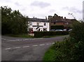
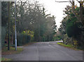
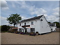

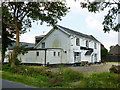
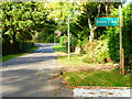
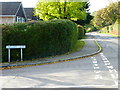
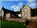
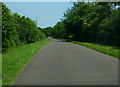
10 photos from this area
Area Information
Key information about the PO7 6HQ including its size, population, and administrative classification.
- Area Type
- Postcode
- Area Size
- 3.5 hectares
- Population
- 1850
- Population Density
- 233 people/km²
House Prices in PO7 6HQ
33
Properties
£441,625
Average Sold Price
£210,000
Lowest Price
£775,000
Highest Price
Showing 33 properties
| Address | Type | Beds | Baths | Last Sale Price | Last Sale Date | |
|---|---|---|---|---|---|---|
| Quillon, Upper Crabbick Lane, Denmead, PO7 6HQ | Detached | 4 | 2 | £570,000 | Jan 2025 | |
| Willow Tree House, Upper Crabbick Lane, Denmead, PO7 6HQ | Detached | - | - | £775,000 | Jun 2022 | |
| Beech House, Upper Crabbick Lane, Denmead, PO7 6HQ | Detached | 4 | 3 | £750,000 | Sep 2021 | |
| Woodlands, Upper Crabbick Lane, Denmead, PO7 6HQ | Detached | 3 | 2 | £475,000 | Oct 2019 | |
| Dragons Well, Upper Crabbick Lane, Denmead, PO7 6HQ | Bungalow | - | - | £440,000 | Jan 2019 | |
| Ridgeway, Upper Crabbick Lane, Denmead, PO7 6HQ | house | 4 | 1 | £558,000 | Feb 2017 | |
| Prestbury, Upper Crabbick Lane, Denmead, PO7 6HQ | house | - | - | £378,500 | Feb 2016 | |
| The Laurels, Upper Crabbick Lane, Denmead, PO7 6HQ | house | - | - | £600,000 | Apr 2015 | |
| Long Acre, Upper Crabbick Lane, Denmead, PO7 6HQ | Detached | 5 | 2 | £608,000 | Oct 2014 | |
| Sherril, Upper Crabbick Lane, Denmead, PO7 6HQ | Detached | 4 | - | £435,000 | Aug 2013 |
Page 1 of 4
Energy Efficiency in PO7 6HQ
Amenities
Schools
| Rank | School | Type | Entry gender | Ages |
|---|
Explore more schools in this area
Go to Schools tabDemographics
Household Size
Two person
most common
Accommodation Type
Houses
most common
Tenure
88
majority
Ethnic Group
White
most common
Religion
N/A
most common
Household Composition
N/A
most common
Age
47
median
Adults (30-64 years)
most common
Household Deprivation
N/A
with no deprivation
NS-SEC
48
in Lower managerial occupations
Explore more demographic insights in this area
Go to Demographics tabPlanning
Planning Constraints
- Flood RiskPremium
- Ramsar Wetland SitesPremium
- Area of Outstanding Natural BeautyPremium
- Protected Nature ReservePremium
- Protected WoodlandPremium