Area Overview for PO7 5TH
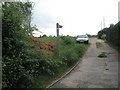
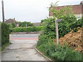
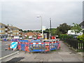
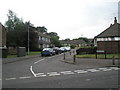
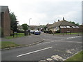
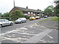
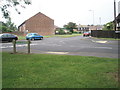
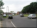
Photos of PO7 5TH


Area Information
Living in PO7 5TH means residing within a small residential cluster defined by a precise postcode. This particular area spans just 1949 square metres, indicating a compact footprint rather than sprawling suburbs. A total population of 2146 people calls this specific location home. The density suggests a close-knit environment where neighbours are likely within walking distance. This postcode represents a distinct pocket of settlement within the wider region, offering a concentrated living experience. You will find a setting that values proximity and established character. The area functions as a self-contained residential zone, separate from the larger towns that surround it. Daily life here revolves around the immediate vicinity, with residents having defined boundaries for their commute and leisure activities. The scale of the area creates a sense of exclusivity without the isolation of rural life. You move through a space designed for housing, where the built environment takes precedence over open countryside. The small size of the postcode means that local events or changes are felt immediately across the whole neighbourhood. For those seeking a defined, small-scale living arrangement, PO7 5TH delivers a clear geographical identity.
- Area Type
- Postcode
- Area Size
- 1949 m²
- Population
- 2146
- Population Density
- 3866 people/km²
The property market in PO7 5TH is characterised by a strong owner-occupier presence. With 80% of homes fully owned, the area functions as a established residential district rather than a transient rental hub. This high rate of ownership typically translates to stable neighbourhood relations and long-term investment in properties. Houses remain the dominant accommodation type, meaning you will find traditional British housing stock rather than high-rise developments or modern apartments. This preference for houses suggests that buyers in PO7 5TH value private gardens and separate living spaces. The small size of the postcode, covering only 1949 square metres, limits the number of available properties. Competition for homes may be intense due to the concentration of the population of 2146 people in such a small space. If you are looking for rental accommodation, your options are limited compared to owner-occupied equivalents. The market reflects a community that has put down roots and rarely moves elsewhere. Anyone purchasing a home here acquires an asset in a high-ownership zone. The nature of the houses means you are likely to encounter family-oriented settings or mature retirees. The consistency of the housing type provides predictability for investors or buyers visiting the area. Check the asking prices for these specific houses, as they represent the core of the local market.
House Prices in PO7 5TH
Showing 36 properties
Energy Efficiency in PO7 5TH
Daily life in PO7 5TH offers practical access to essential amenities within a short reach. Residents can visit The Southern Co-operative Co, Asda Waterlooville, and Iceland Waterlooville for their regular grocery shopping. These retail locations provide fresh produce, household staples, and everyday essentials. You have five retail options in your immediate vicinity, ensuring that you do not need to drive far for basic needs. Transport links are extensive, with five nearby railway stations including Bedhampton, Cosham, and Havant. This rail connectivity allows you to travel to Portsmouth, Southampton, or other coastal towns easily. Additionally, four ferry terminals such as Portsmouth International Cruise & Ferry Terminal, Eastney Ferry Landing, and Hayling Island Ferry Landing are accessible. These transport hubs mean you can reach the coast quickly for leisure or explore the South Coast. The proximity to these stations and terminals defines the lifestyle convenience of PO7 5TH. You can combine local shopping with regional travel in a single day. The mix of rail and ferry access makes this postcode a logical base for exploring Hampshire and the Isle of Wight. Your daily routines are supported by the concentration of these key services nearby.
Amenities
Schools
Families living in PO7 5TH benefit from two specific schools located nearby, both rated good by Ofsted. Purbrook Infant School serves younger children in the primary phase, while Purbrook Junior School caters to older primary-aged students. This arrangement indicates a local educational structure that splits key stages into separate buildings. You do not need to travel far to access school education, as both institutions hold a positive rating. The presence of two schools within reach reduces the need for long bus journeys to larger towns. As a parent, you can rely on the fact that these schools maintain a good standard of education. The names Purbrook suggest a connection to the broader local history of Waterlooville. If your children move into PO7 5TH, they will integrate into a familiar local school system quickly. The good ratings from Ofsted provide assurance regarding academic performance andBehaviour management standards. No other schools are listed for this specific postcode, ensuring that your choice remains focused on these two proven institutions. The proximity to these schools adds significant value to homes in the area. Parents appreciate the convenience of a neighbourhood where education requirements are met locally. The consistent good ratings mean that problem schools are not a concern for you.
| Rank | School | Type | Entry gender | Ages |
|---|
Explore more schools in this area
Go to Schools tabDemographics
The community within PO7 5TH reflects a mature demographic profile dominated by adults aged between 30 and 64 years. The median age stands at 47, confirming that families with grown children or those approaching retirement reside here. Home ownership is the primary lifestyle choice, with 80% of residents owning their properties outright or with a mortgage. This high level of ownership contrasts with areas where renting is more common. Houses form the standard accommodation type, suggesting families prefer detached or semi-detached dwellings over flats or terraced homes. The population is predominantly White, aligning with the broader demographic trends of Hampshire. You do not need to worry about significant deprivation affecting this specific cluster, as the area maintians stable living standards. The age range indicates a period of life where residents often have secured their finances and sought stability. Young professionals may find the median age slightly high, but families appreciate the quiet atmosphere provided by older residents. The 80% ownership figure implies strong attachment to the homes you might consider. People live here for the long term, not for short stays. This stability creates a neighbourhood where local knowledge is shared freely. The age profile ensures that the community remains active but not chaotic.
Household Size
Accommodation Type
Tenure
Ethnic Group
Religion
Household Composition
Age
Household Deprivation
NS-SEC
Explore more demographic insights in this area
Go to Demographics tabPlanning
Planning Constraints
- Flood RiskPremium
- Ramsar Wetland SitesPremium
- Area of Outstanding Natural BeautyPremium
- Protected Nature ReservePremium
- Protected WoodlandPremium