Area Overview for PO7 5TA
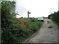
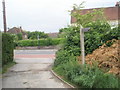
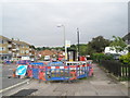
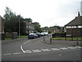
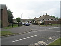
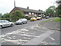
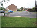
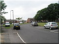
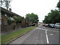
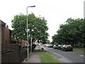
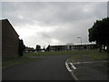
Photos of PO7 5TA

Area Information
Living in PO7 5TA offers a distinct experience within a compact 2.8-hectare residential cluster. This postcode covers a specific small area where 1,448 residents call home. The population density reaches 52,455 people per square kilometre, creating a tightly knit neighbourhood character. Residents here navigate daily life in a setting that balances close proximity with defined spatial boundaries. The area functions as a self-contained community where the scale of the land directly influences the pace of life. You will find a population that has settled into this specific footprint, creating a cohesive local identity. The size of the area means that amenities and neighbours are often just a short walk away. This configuration supports a routine where the built environment serves immediate needs without requiring extensive travel across the Waterlooville landscape. The cluster nature of PO7 5TA distinguishes it from sprawling suburban developments, fostering an environment where community interactions happen naturally within the shared neighbourhood space.
- Area Type
- Postcode
- Area Size
- 2.8 hectares
- Population
- 1448
- Population Density
- 5421 people/km²
The property market in PO7 5TA is heavily characterised by traditional housing stock. Houses represent the predominant accommodation type, distinguishing this postcode from areas dominated by high-rise flats or rental conversions. With a home ownership rate of 47%, the area sits between a purely private market and a rental-heavy zone, suggesting a diverse mix of owners and tenants. This balance means you may encounter listings for both self-built inheritances and purchased properties adapted for current needs. The small geographic size of the 2.8-hectare area limits total housing volume, which can influence local pricing dynamics compared to broader boroughs. Buyers looking at homes in PO7 5TA should expect a inventory focused on standard domestic dwellings rather than niche luxury developments. The neighbourhood status of PO7 5TA within the larger Waterlooville region often keeps property values aligned with local averages. Understanding this specific housing profile helps you evaluate whether the stock meets your requirements for space and tenure.
House Prices in PO7 5TA
Showing 66 properties
| Address | Type | Beds | Baths | Last Sale Price | Last Sale Date | |
|---|---|---|---|---|---|---|
| 32 Corbett Road, Waterlooville, PO7 5TA | Terraced | 4 | 2 | £350,000 | Nov 2025 | |
| 34 Corbett Road, Waterlooville, PO7 5TA | Terraced | 4 | 2 | £300,000 | Aug 2025 | |
| 44 Corbett Road, Waterlooville, PO7 5TA | Terraced | 3 | 1 | £285,000 | Mar 2025 | |
| 71 Corbett Road, Waterlooville, PO7 5TA | Semi-detached | 3 | 1 | £380,000 | Dec 2022 | |
| 10 Corbett Road, Waterlooville, PO7 5TA | house | - | - | £239,000 | Jul 2022 | |
| 53 Corbett Road, Waterlooville, PO7 5TA | house | - | - | £370,000 | Jan 2022 | |
| 24 Corbett Road, Waterlooville, PO7 5TA | house | - | - | £265,000 | May 2021 | |
| 51 Corbett Road, Waterlooville, PO7 5TA | Semi-detached | 3 | - | £285,000 | Jan 2021 | |
| 18 Corbett Road, Waterlooville, PO7 5TA | Terraced | 3 | 1 | £188,000 | Aug 2020 | |
| 42 Corbett Road, Waterlooville, PO7 5TA | Terraced | 3 | 2 | £310,000 | Oct 2018 |
Energy Efficiency in PO7 5TA
Residents of PO7 5TA benefit from immediate access to key amenities within practical reach. For shopping needs, five retail locations are nearby, including The Southern Co-operative Co, Asda Waterlooville, and Iceland Waterlooville. These outlets provide everything from groceries to household essentials, reducing the need for long car journeys for routine purchases. Transport links are equally accessible, with five railway stations at Bedhampton, Cosham, and Havant. These stations facilitate easy travel for commuters heading into Brighton or central London. Additionally, five ferry terminals serve the area, including Portsmouth International Cruise and Ferry Terminal, Eastney Ferry Landing, and Hayling Island Ferry Landing. This multimodal transport matrix offers diverse options for leisure and travel. You can enjoy a lifestyle where daily errands, work commutes, and weekend excursions are managed efficiently. The presence of these specific venues ensures that convenience and connectivity remain central to daily life in PO7 5TA.
Amenities
Schools
Families living in PO7 5TA have access to several primary education options within the local vicinity. You can choose from Waite End Junior School and Waite End Infant School, which operate together to provide a continuous primary education pathway for children. Mill Hill Primary School also serves the area and holds a good Ofsted rating, offering a verified standard of education. This combination of schools gives parents flexibility, as the infant and junior institutions likely feed into the same educational community, ensuring consistency from reception to Year 6. For residents concerned with educational quality, the presence of a school with a good rating is a tangible advantage. The proximity of these institutions supports daily commutes for children attending schools near PO7 5TA. You can plan your route through a network that includes these three named establishments, avoiding the need for long-distance travel to larger secondary hubs. The mix of schools indicates a focus on foundational education within the immediate neighbourhood.
| Rank | School | Type | Entry gender | Ages |
|---|
Explore more schools in this area
Go to Schools tabDemographics
The community in PO7 5TA reflects a mature demographic profile with a median age of 47 years. The most common age range consists of adults between 30 and 64 years old, indicating a population that has likely established careers and families. Home ownership stands at 47%, which suggests a significant portion of residents hold their properties outright or via mortgage rather than renting. Houses form the dominant accommodation type within this postcode, reinforcing the preference for single-family living over flats or apartments. The predominant ethnic group is White, shaping the cultural fabric of the neighbourhood. These figures paint a picture of a stable, long-term residential area. The age distribution implies a community focused on stability, where many residents have remained in the area for extended periods. This demographic consistency contributes to a predictable local environment where neighbours often know one another through years of co-habitation in the houses that define the streets of PO7 5TA.
Household Size
Accommodation Type
Tenure
Ethnic Group
Religion
Household Composition
Age
Household Deprivation
NS-SEC
Explore more demographic insights in this area
Go to Demographics tabPlanning
Planning Constraints
- Flood RiskPremium
- Ramsar Wetland SitesPremium
- Area of Outstanding Natural BeautyPremium
- Protected Nature ReservePremium
- Protected WoodlandPremium