Area Overview for PO6 1AP
Photos of PO6 1AP
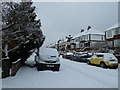
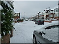
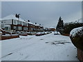

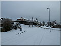
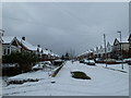
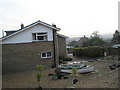
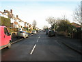
100 photos from this area
Area Information
Key information about the PO6 1AP including its size, population, and administrative classification.
- Area Type
- Postcode
- Area Size
- 1.4 hectares
- Population
- 1667
- Population Density
- 2388 people/km²
House Prices in PO6 1AP
31
Properties
£321,708
Average Sold Price
£127,000
Lowest Price
£610,000
Highest Price
Showing 31 properties
| Address | Type | Beds | Baths | Last Sale Price | Last Sale Date | |
|---|---|---|---|---|---|---|
| 52 Woodfield Avenue, Portsmouth, PO6 1AP | Semi-detached | 3 | 1 | £475,000 | May 2025 | |
| 4 Woodfield Avenue, Portsmouth, PO6 1AP | Semi-detached | 4 | 2 | £610,000 | Jun 2023 | |
| 54 Woodfield Avenue, Portsmouth, PO6 1AP | Semi-detached | 3 | 1 | £350,175 | Mar 2023 | |
| 30 Woodfield Avenue, Portsmouth, PO6 1AP | house | 4 | - | £505,000 | Feb 2021 | |
| 12 Woodfield Avenue, Portsmouth, PO6 1AP | Bungalow | - | - | £320,000 | Dec 2020 | |
| 40 Woodfield Avenue, Portsmouth, PO6 1AP | house | - | - | £335,000 | Aug 2020 | |
| 10 Woodfield Avenue, Portsmouth, PO6 1AP | Bungalow | 2 | 2 | £330,000 | Dec 2019 | |
| 48 Woodfield Avenue, Portsmouth, PO6 1AP | Semi-detached | 3 | 1 | £300,000 | Aug 2018 | |
| 6 Woodfield Avenue, Portsmouth, PO6 1AP | Semi-detached | 4 | 2 | £388,000 | Jun 2018 | |
| 46 Woodfield Avenue, Portsmouth, PO6 1AP | Semi-detached | 3 | 1 | £253,000 | Jan 2018 |
Page 1 of 4
Energy Efficiency in PO6 1AP
Amenities
Schools
| Rank | School | Type | Entry gender | Ages |
|---|
Explore more schools in this area
Go to Schools tabDemographics
Household Size
Family (3-5 people)
most common
Accommodation Type
Houses
most common
Tenure
71
majority
Ethnic Group
White
most common
Religion
N/A
most common
Household Composition
N/A
most common
Age
47
median
Adults (30-64 years)
most common
Household Deprivation
N/A
with no deprivation
NS-SEC
49
in Lower managerial occupations
Explore more demographic insights in this area
Go to Demographics tabPlanning
Planning Constraints
- Flood RiskPremium
- Ramsar Wetland SitesPremium
- Area of Outstanding Natural BeautyPremium
- Protected Nature ReservePremium
- Protected WoodlandPremium