Area Overview for PO6 1AH
Photos of PO6 1AH
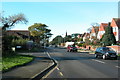
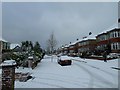
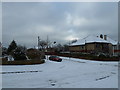
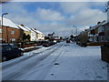
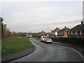
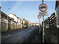
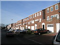
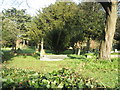
100 photos from this area
Area Information
Key information about the PO6 1AH including its size, population, and administrative classification.
- Area Type
- Postcode
- Area Size
- 2.2 hectares
- Population
- 1667
- Population Density
- 2388 people/km²
House Prices in PO6 1AH
53
Properties
£257,123
Average Sold Price
£32,500
Lowest Price
£515,000
Highest Price
Showing 53 properties
| Address | Type | Beds | Baths | Last Sale Price | Last Sale Date | |
|---|---|---|---|---|---|---|
| 41 Old Rectory Road, Portsmouth, PO6 1AH | Bungalow | 4 | 2 | £515,000 | Apr 2025 | |
| 3 Old Rectory Road, Portsmouth, PO6 1AH | Semi-detached | 3 | 2 | £450,000 | Mar 2025 | |
| 22 Old Rectory Road, Portsmouth, PO6 1AH | Semi-detached | 3 | 2 | £400,000 | Oct 2024 | |
| 36 Old Rectory Road, Portsmouth, PO6 1AH | Bungalow | 3 | 1 | £410,000 | Jul 2023 | |
| 56 Old Rectory Road, Portsmouth, PO6 1AH | house | - | - | £405,000 | Sep 2021 | |
| 58 Old Rectory Road, Portsmouth, PO6 1AH | Semi-detached | 5 | 2 | £425,000 | Aug 2021 | |
| 24 Old Rectory Road, Portsmouth, PO6 1AH | Semi-detached | 3 | 1 | £420,000 | Aug 2020 | |
| 5 Old Rectory Road, Portsmouth, PO6 1AH | house | 3 | 2 | £336,000 | Jul 2020 | |
| 7 Old Rectory Road, Portsmouth, PO6 1AH | Semi-detached | - | - | £140,000 | Mar 2020 | |
| 48 Old Rectory Road, Portsmouth, PO6 1AH | Terraced | 3 | 1 | £335,000 | Oct 2019 |
Page 1 of 6
Energy Efficiency in PO6 1AH
Amenities
Schools
| Rank | School | Type | Entry gender | Ages |
|---|
Explore more schools in this area
Go to Schools tabDemographics
Household Size
Family (3-5 people)
most common
Accommodation Type
Houses
most common
Tenure
71
majority
Ethnic Group
White
most common
Religion
N/A
most common
Household Composition
N/A
most common
Age
47
median
Adults (30-64 years)
most common
Household Deprivation
N/A
with no deprivation
NS-SEC
49
in Lower managerial occupations
Explore more demographic insights in this area
Go to Demographics tabPlanning
Planning Constraints
- Flood RiskPremium
- Ramsar Wetland SitesPremium
- Area of Outstanding Natural BeautyPremium
- Protected Nature ReservePremium
- Protected WoodlandPremium