Area Overview for PO4 9ET
Photos of PO4 9ET
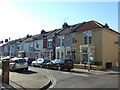
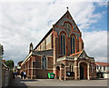
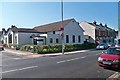
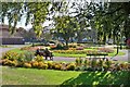

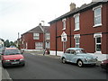
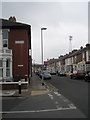
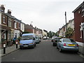
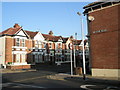
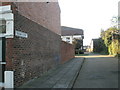
100 photos from this area
Area Information
Key information about the PO4 9ET including its size, population, and administrative classification.
- Area Type
- Postcode
- Area Size
- 9042 m²
- Population
- 1565
- Population Density
- 15048 people/km²
House Prices in PO4 9ET
64
Properties
£193,911
Average Sold Price
£46,000
Lowest Price
£285,000
Highest Price
Showing 64 properties
| Address | Type | Beds | Baths | Last Sale Price | Last Sale Date | |
|---|---|---|---|---|---|---|
| 228 Westfield Road, Southsea, PO4 9ET | Terraced | 2 | 1 | £268,000 | Aug 2025 | |
| 162 Westfield Road, Southsea, PO4 9ET | Terraced | 3 | 1 | £285,000 | Apr 2025 | |
| 216 Westfield Road, Southsea, PO4 9ET | Terraced | 2 | 1 | £245,000 | Feb 2025 | |
| 108 Westfield Road, Southsea, PO4 9ET | Terraced | 3 | 1 | £280,000 | Dec 2024 | |
| 150 Westfield Road, Southsea, PO4 9ET | Terraced | 2 | 1 | £265,000 | May 2024 | |
| 208 Westfield Road, Southsea, PO4 9ET | Terraced | 2 | 1 | £264,500 | Oct 2023 | |
| 206 Westfield Road, Southsea, PO4 9ET | Terraced | 2 | 1 | £260,000 | Aug 2023 | |
| 238 Westfield Road, Southsea, PO4 9ET | Terraced | 3 | 1 | £260,000 | Mar 2023 | |
| 152 Westfield Road, Southsea, PO4 9ET | Terraced | 4 | 4 | £150,000 | Oct 2022 | |
| 230 Westfield Road, Southsea, PO4 9ET | Terraced | 2 | 1 | £256,500 | Feb 2022 |
Page 1 of 7
Energy Efficiency in PO4 9ET
Amenities
Schools
| Rank | School | Type | Entry gender | Ages |
|---|
Explore more schools in this area
Go to Schools tabDemographics
Household Size
Two person
most common
Accommodation Type
Houses
most common
Tenure
61
majority
Ethnic Group
White
most common
Religion
N/A
most common
Household Composition
N/A
most common
Age
47
median
Adults (30-64 years)
most common
Household Deprivation
N/A
with no deprivation
NS-SEC
41
in Lower managerial occupations
Explore more demographic insights in this area
Go to Demographics tabPlanning
Planning Constraints
- Flood RiskPremium
- Ramsar Wetland SitesPremium
- Area of Outstanding Natural BeautyPremium
- Protected Nature ReservePremium
- Protected WoodlandPremium