Area Overview for PO4 9EN
Photos of PO4 9EN
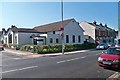
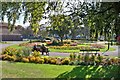

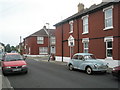
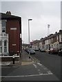
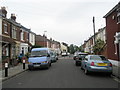
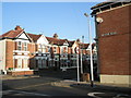
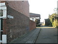
100 photos from this area
Area Information
Key information about the PO4 9EN including its size, population, and administrative classification.
- Area Type
- Postcode
- Area Size
- 8617 m²
- Population
- 1481
- Population Density
- 12969 people/km²
House Prices in PO4 9EN
59
Properties
£193,243
Average Sold Price
£43,000
Lowest Price
£335,000
Highest Price
Showing 59 properties
| Address | Type | Beds | Baths | Last Sale Price | Last Sale Date | |
|---|---|---|---|---|---|---|
| 16 Eastfield Road, Southsea, PO4 9EN | Terraced | 2 | 1 | £263,000 | Sep 2025 | |
| 82 Eastfield Road, Southsea, PO4 9EN | Terraced | 3 | 1 | £275,000 | Jul 2025 | |
| 84 Eastfield Road, Southsea, PO4 9EN | Terraced | 3 | 1 | £295,250 | Jul 2025 | |
| 58 Eastfield Road, Southsea, PO4 9EN | Terraced | 2 | 1 | £210,000 | Aug 2024 | |
| 88 Eastfield Road, Southsea, PO4 9EN | Terraced | 2 | 1 | £270,000 | Jul 2024 | |
| 96 Eastfield Road, Southsea, PO4 9EN | Terraced | 3 | 1 | £280,000 | Dec 2023 | |
| 64 Eastfield Road, Southsea, PO4 9EN | Terraced | 2 | 1 | £260,000 | Aug 2023 | |
| 104 Eastfield Road, Southsea, PO4 9EN | Terraced | 2 | 1 | £268,000 | Jul 2023 | |
| 14 Eastfield Road, Southsea, PO4 9EN | Terraced | 2 | 1 | £229,950 | Jun 2023 | |
| 32 Eastfield Road, Southsea, PO4 9EN | Terraced | 3 | 1 | £335,000 | Dec 2022 |
Page 1 of 6
Energy Efficiency in PO4 9EN
Amenities
Schools
| Rank | School | Type | Entry gender | Ages |
|---|
Explore more schools in this area
Go to Schools tabDemographics
Household Size
Family (3-5 people)
most common
Accommodation Type
Houses
most common
Tenure
74
majority
Ethnic Group
White
most common
Religion
N/A
most common
Household Composition
N/A
most common
Age
47
median
Adults (30-64 years)
most common
Household Deprivation
N/A
with no deprivation
NS-SEC
45
in Lower managerial occupations
Explore more demographic insights in this area
Go to Demographics tabPlanning
Planning Constraints
- Flood RiskPremium
- Ramsar Wetland SitesPremium
- Area of Outstanding Natural BeautyPremium
- Protected Nature ReservePremium
- Protected WoodlandPremium