Area Overview for PO4 8SB
Photos of PO4 8SB


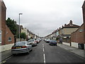
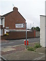
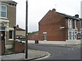
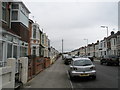
100 photos from this area
Area Information
Key information about the PO4 8SB including its size, population, and administrative classification.
- Area Type
- Postcode
- Area Size
- 7647 m²
- Population
- 2637
- Population Density
- 3881 people/km²
House Prices in PO4 8SB
24
Properties
£211,785
Average Sold Price
£69,995
Lowest Price
£420,000
Highest Price
Showing 24 properties
| Address | Type | Beds | Baths | Last Sale Price | Last Sale Date | |
|---|---|---|---|---|---|---|
| 18 Maylands Avenue, Southsea, PO4 8SB | house | - | - | £420,000 | Mar 2023 | |
| 11 Maylands Avenue, Southsea, PO4 8SB | house | - | - | £280,000 | Feb 2022 | |
| 8 Maylands Avenue, Southsea, PO4 8SB | house | - | - | £168,000 | Mar 2020 | |
| 9 Maylands Avenue, Southsea, PO4 8SB | Terraced | 3 | 1 | £310,000 | Nov 2019 | |
| 22 Maylands Avenue, Southsea, PO4 8SB | Terraced | 3 | 1 | £297,000 | Aug 2017 | |
| 20 Maylands Avenue, Southsea, PO4 8SB | house | 3 | 1 | £205,000 | Feb 2016 | |
| 7 Maylands Avenue, Southsea, PO4 8SB | house | - | - | £217,500 | Nov 2014 | |
| 3 Maylands Avenue, Southsea, PO4 8SB | house | - | - | £220,000 | Jul 2010 | |
| 5 Maylands Avenue, Southsea, PO4 8SB | Terraced | - | - | £197,500 | Aug 2006 | |
| 23 Maylands Avenue, Southsea, PO4 8SB | Semi-detached | - | - | £185,000 | Dec 2005 |
Page 1 of 3
Energy Efficiency in PO4 8SB
Amenities
Schools
| Rank | School | Type | Entry gender | Ages |
|---|
Explore more schools in this area
Go to Schools tabDemographics
Household Size
One person
most common
Accommodation Type
Houses
most common
Tenure
54
majority
Ethnic Group
White
most common
Religion
N/A
most common
Household Composition
N/A
most common
Age
47
median
Adults (30-64 years)
most common
Household Deprivation
N/A
with no deprivation
NS-SEC
30
in Lower managerial occupations
Explore more demographic insights in this area
Go to Demographics tabPlanning
Planning Constraints
- Flood RiskPremium
- Ramsar Wetland SitesPremium
- Area of Outstanding Natural BeautyPremium
- Protected Nature ReservePremium
- Protected WoodlandPremium