Area Overview for PO4 8QN
Photos of PO4 8QN


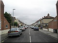
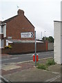
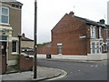
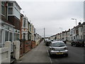
100 photos from this area
Area Information
Key information about the PO4 8QN including its size, population, and administrative classification.
- Area Type
- Postcode
- Area Size
- 7229 m²
- Population
- 2373
- Population Density
- 6819 people/km²
House Prices in PO4 8QN
27
Properties
£172,926
Average Sold Price
£50,000
Lowest Price
£270,000
Highest Price
Showing 27 properties
| Address | Type | Beds | Baths | Last Sale Price | Last Sale Date | |
|---|---|---|---|---|---|---|
| 7 Moorings Way, Southsea, PO4 8QN | Terraced | 3 | 2 | £250,000 | Oct 2024 | |
| 23 Moorings Way, Southsea, PO4 8QN | Semi-detached | 3 | 1 | £270,000 | Mar 2024 | |
| 15 Moorings Way, Southsea, PO4 8QN | Terraced | 3 | 1 | £235,895 | Mar 2021 | |
| 33 Moorings Way, Southsea, PO4 8QN | Terraced | 2 | 1 | £249,500 | Apr 2018 | |
| 43 Moorings Way, Southsea, PO4 8QN | house | - | - | £222,000 | Aug 2016 | |
| 39 Moorings Way, Southsea, PO4 8QN | Terraced | 3 | - | £210,000 | Aug 2016 | |
| 5 Moorings Way, Southsea, PO4 8QN | Terraced | 2 | 1 | £140,000 | Jul 2013 | |
| 45 Moorings Way, Southsea, PO4 8QN | house | - | - | £159,000 | Apr 2013 | |
| 21 Moorings Way, Southsea, PO4 8QN | house | 3 | 1 | £150,000 | Dec 2012 | |
| 41 Moorings Way, Southsea, PO4 8QN | Terraced | - | - | £143,000 | Oct 2006 |
Page 1 of 3
Energy Efficiency in PO4 8QN
Amenities
Schools
| Rank | School | Type | Entry gender | Ages |
|---|
Explore more schools in this area
Go to Schools tabDemographics
Household Size
Family (3-5 people)
most common
Accommodation Type
Houses
most common
Tenure
60
majority
Ethnic Group
White
most common
Religion
N/A
most common
Household Composition
N/A
most common
Age
47
median
Adults (30-64 years)
most common
Household Deprivation
N/A
with no deprivation
NS-SEC
28
in Lower managerial occupations
Explore more demographic insights in this area
Go to Demographics tabPlanning
Planning Constraints
- Flood RiskPremium
- Ramsar Wetland SitesPremium
- Area of Outstanding Natural BeautyPremium
- Protected Nature ReservePremium
- Protected WoodlandPremium