Area Overview for PO4 8NP
Photos of PO4 8NP
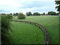
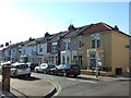
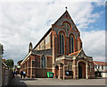

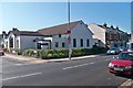


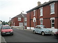
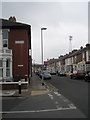
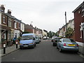
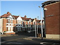
100 photos from this area
Area Information
Key information about the PO4 8NP including its size, population, and administrative classification.
- Area Type
- Postcode
- Area Size
- 2.1 hectares
- Population
- 1369
- Population Density
- 5565 people/km²
House Prices in PO4 8NP
63
Properties
£187,378
Average Sold Price
£53,500
Lowest Price
£350,000
Highest Price
Showing 63 properties
| Address | Type | Beds | Baths | Last Sale Price | Last Sale Date | |
|---|---|---|---|---|---|---|
| 38 Mayles Road, Southsea, PO4 8NP | Terraced | 3 | 1 | £280,000 | May 2025 | |
| 14 Mayles Road, Southsea, PO4 8NP | Terraced | 3 | 2 | £350,000 | Jan 2025 | |
| 58 Mayles Road, Southsea, PO4 8NP | Terraced | 3 | 1 | £327,000 | Jan 2024 | |
| 27 Mayles Road, Southsea, PO4 8NP | house | - | - | £260,000 | Dec 2022 | |
| 26 Mayles Road, Southsea, PO4 8NP | house | - | - | £290,000 | Dec 2022 | |
| 37 Mayles Road, Southsea, PO4 8NP | Terraced | 3 | 1 | £300,000 | Aug 2022 | |
| 40 Mayles Road, Southsea, PO4 8NP | Retail | 3 | 1 | £290,000 | Aug 2022 | |
| 1 Mayles Road, Southsea, PO4 8NP | Retail | 3 | 1 | £315,000 | Aug 2022 | |
| 8 Mayles Road, Southsea, PO4 8NP | Terraced | 3 | 1 | £285,000 | Feb 2022 | |
| 62 Mayles Road, Southsea, PO4 8NP | house | - | - | £262,500 | Jul 2019 |
Page 1 of 7
Energy Efficiency in PO4 8NP
Amenities
Schools
| Rank | School | Type | Entry gender | Ages |
|---|
Explore more schools in this area
Go to Schools tabDemographics
Household Size
Family (3-5 people)
most common
Accommodation Type
Houses
most common
Tenure
81
majority
Ethnic Group
White
most common
Religion
N/A
most common
Household Composition
N/A
most common
Age
47
median
Adults (30-64 years)
most common
Household Deprivation
N/A
with no deprivation
NS-SEC
36
in Lower managerial occupations
Explore more demographic insights in this area
Go to Demographics tabPlanning
Planning Constraints
- Flood RiskPremium
- Ramsar Wetland SitesPremium
- Area of Outstanding Natural BeautyPremium
- Protected Nature ReservePremium
- Protected WoodlandPremium