Area Overview for PO22 0JW
Photos of PO22 0JW
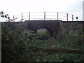
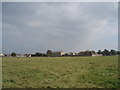
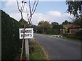
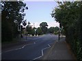
100 photos from this area
Area Information
Key information about the PO22 0JW including its size, population, and administrative classification.
- Area Type
- Postcode
- Area Size
- 1.5 hectares
- Population
- 1643
- Population Density
- 5912 people/km²
House Prices in PO22 0JW
39
Properties
£197,294
Average Sold Price
£52,500
Lowest Price
£369,000
Highest Price
Showing 39 properties
| Address | Type | Beds | Baths | Last Sale Price | Last Sale Date | |
|---|---|---|---|---|---|---|
| 99 Farnhurst Road, Barnham, PO22 0JW | Terraced | 3 | 1 | £267,000 | Dec 2025 | |
| 97 Farnhurst Road, Barnham, PO22 0JW | Terraced | 3 | 1 | £320,000 | Sep 2025 | |
| 56 Farnhurst Road, Barnham, PO22 0JW | Terraced | 3 | 2 | £369,000 | Feb 2025 | |
| 93 Farnhurst Road, Barnham, PO22 0JW | house | - | - | £347,500 | Dec 2021 | |
| 121 Farnhurst Road, Barnham, PO22 0JW | Detached | 4 | 1 | £317,500 | Sep 2020 | |
| 111 Farnhurst Road, Barnham, PO22 0JW | Terraced | 3 | - | £237,500 | Jun 2020 | |
| 64 Farnhurst Road, Barnham, PO22 0JW | house | - | - | £280,000 | Dec 2019 | |
| 119 Farnhurst Road, Barnham, PO22 0JW | Terraced | 3 | 1 | £235,000 | May 2019 | |
| 76 Farnhurst Road, Barnham, PO22 0JW | Terraced | 3 | - | £230,000 | Dec 2015 | |
| 60 Farnhurst Road, Barnham, PO22 0JW | house | - | - | £269,950 | Aug 2015 |
Page 1 of 4
Energy Efficiency in PO22 0JW
Amenities
Schools
| Rank | School | Type | Entry gender | Ages |
|---|
Explore more schools in this area
Go to Schools tabDemographics
Household Size
Two person
most common
Accommodation Type
Houses
most common
Tenure
66
majority
Ethnic Group
White
most common
Religion
N/A
most common
Household Composition
N/A
most common
Age
47
median
Adults (30-64 years)
most common
Household Deprivation
N/A
with no deprivation
NS-SEC
32
in Lower managerial occupations
Explore more demographic insights in this area
Go to Demographics tabPlanning
Planning Constraints
- Flood RiskPremium
- Ramsar Wetland SitesPremium
- Area of Outstanding Natural BeautyPremium
- Protected Nature ReservePremium
- Protected WoodlandPremium