Area Overview for PO22 0ES
Photos of PO22 0ES
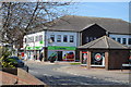
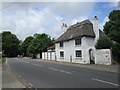
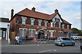
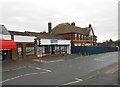
100 photos from this area
Area Information
Key information about the PO22 0ES including its size, population, and administrative classification.
- Area Type
- Postcode
- Area Size
- 1.5 hectares
- Population
- 1643
- Population Density
- 5912 people/km²
House Prices in PO22 0ES
15
Properties
£199,000
Average Sold Price
£93,000
Lowest Price
£360,000
Highest Price
Showing 15 properties
| Address | Type | Beds | Baths | Last Sale Price | Last Sale Date | |
|---|---|---|---|---|---|---|
| Thimbles, 80 Barnham Road, Eastergate, PO22 0ES | Detached | 3 | 2 | £360,000 | Jan 2020 | |
| 18 Barnham Road, Eastergate, PO22 0ES | Terraced | 3 | 2 | £265,000 | Sep 2018 | |
| 78A Barnham Road, Eastergate, PO22 0ES | Flat | - | - | £105,000 | May 2009 | |
| 16 Barnham Road, Eastergate, PO22 0ES | Terraced | 5 | 3 | £172,000 | Aug 2002 | |
| 14 Barnham Road, Eastergate, PO22 0ES | Terraced | 5 | 2 | £93,000 | Mar 2001 | |
| Flat Above, 28 Barnham Road, Eastergate, PO22 0ES | Flat | 1 | 1 | - | - | |
| Flat 2, 42A Barnham Road, Eastergate, PO22 0ES | Flat | 2 | 1 | - | - | |
| The Hollies, 84 Barnham Road, Eastergate, PO22 0ES | Land | 8 | 7 | - | - | |
| 60 Barnham Road, Eastergate, PO22 0ES | Detached | 1 | - | - | - | |
| Wpc Ltd, Unit 2, Barnham Auction Rooms, Barnham Road, Eastergate, PO22 0ES | restaurant_cafe | - | - | - | - |
Page 1 of 2
Energy Efficiency in PO22 0ES
Amenities
Schools
| Rank | School | Type | Entry gender | Ages |
|---|
Explore more schools in this area
Go to Schools tabDemographics
Household Size
Two person
most common
Accommodation Type
Houses
most common
Tenure
66
majority
Ethnic Group
White
most common
Religion
N/A
most common
Household Composition
N/A
most common
Age
47
median
Adults (30-64 years)
most common
Household Deprivation
N/A
with no deprivation
NS-SEC
32
in Lower managerial occupations
Explore more demographic insights in this area
Go to Demographics tabPlanning
Planning Constraints
- Flood RiskPremium
- Ramsar Wetland SitesPremium
- Area of Outstanding Natural BeautyPremium
- Protected Nature ReservePremium
- Protected WoodlandPremium