Area Overview for PO22 0EG
Photos of PO22 0EG
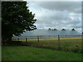
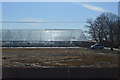
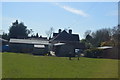
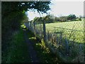
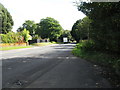
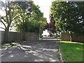
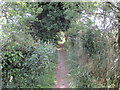
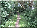
9 photos from this area
Area Information
Key information about the PO22 0EG including its size, population, and administrative classification.
- Area Type
- Postcode
- Area Size
- 9.0 hectares
- Population
- 1841
- Population Density
- 344 people/km²
House Prices in PO22 0EG
26
Properties
£360,854
Average Sold Price
£89,999
Lowest Price
£700,000
Highest Price
Showing 26 properties
| Address | Type | Beds | Baths | Last Sale Price | Last Sale Date | |
|---|---|---|---|---|---|---|
| 15 Downview Road, Barnham, PO22 0EG | Chalet | 4 | 2 | £575,000 | May 2025 | |
| 17 Downview Road, Barnham, PO22 0EG | Bungalow | 3 | 2 | £460,000 | Mar 2025 | |
| 34 Downview Road, Barnham, PO22 0EG | house | - | - | £700,000 | Oct 2021 | |
| 31 Downview Road, Barnham, PO22 0EG | Bungalow | 3 | 1 | £410,000 | Aug 2020 | |
| 22 Downview Road, Barnham, PO22 0EG | Detached | 4 | 2 | £550,000 | Oct 2015 | |
| 30 Downview Road, Barnham, PO22 0EG | Bungalow | 3 | 1 | £350,000 | Jul 2015 | |
| 18 Downview Road, Barnham, PO22 0EG | Bungalow | - | - | £249,950 | Dec 2009 | |
| Durgan, 23 Downview Road, Barnham, PO22 0EG | Bungalow | - | - | £375,000 | May 2009 | |
| 21 Downview Road, Barnham, PO22 0EG | Detached | - | - | £324,000 | Apr 2007 | |
| 27 Downview Road, Barnham, PO22 0EG | Detached | 3 | 1 | £280,000 | Aug 2003 |
Page 1 of 3
Energy Efficiency in PO22 0EG
Amenities
Schools
| Rank | School | Type | Entry gender | Ages |
|---|
Explore more schools in this area
Go to Schools tabDemographics
Household Size
Two person
most common
Accommodation Type
Houses
most common
Tenure
83
majority
Ethnic Group
White
most common
Religion
N/A
most common
Household Composition
N/A
most common
Age
47
median
Adults (30-64 years)
most common
Household Deprivation
N/A
with no deprivation
NS-SEC
37
in Lower managerial occupations
Explore more demographic insights in this area
Go to Demographics tabPlanning
Planning Constraints
- Flood RiskPremium
- Ramsar Wetland SitesPremium
- Area of Outstanding Natural BeautyPremium
- Protected Nature ReservePremium
- Protected WoodlandPremium