Area Overview for PO21 2YQ
Photos of PO21 2YQ

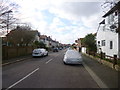
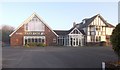
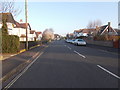
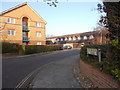
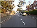
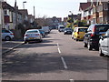
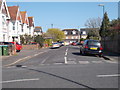
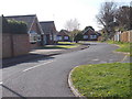
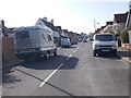
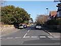
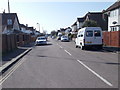
55 photos from this area
Area Information
Key information about the PO21 2YQ including its size, population, and administrative classification.
- Area Type
- Postcode
- Area Size
- 2.2 hectares
- Population
- 1884
- Population Density
- 6745 people/km²
House Prices in PO21 2YQ
23
Properties
£486,857
Average Sold Price
£185,000
Lowest Price
£735,000
Highest Price
Showing 23 properties
| Address | Type | Beds | Baths | Last Sale Price | Last Sale Date | |
|---|---|---|---|---|---|---|
| 180 Aldwick Road, Bognor Regis, PO21 2YQ | Detached | 4 | 1 | £672,000 | Jul 2025 | |
| 162 Aldwick Road, Bognor Regis, PO21 2YQ | Detached | 8 | 4 | £630,000 | Jan 2025 | |
| 178 Aldwick Road, Bognor Regis, PO21 2YQ | Detached | 3 | 1 | £600,000 | Dec 2023 | |
| 156 Aldwick Road, Bognor Regis, PO21 2YQ | Detached | 4 | 2 | £602,000 | Jun 2023 | |
| 198 Aldwick Road, Bognor Regis, PO21 2YQ | Detached | 4 | 1 | £620,000 | Feb 2021 | |
| 194 Aldwick Road, Bognor Regis, PO21 2YQ | Detached | 4 | 2 | £735,000 | Jan 2021 | |
| 168 Aldwick Road, Bognor Regis, PO21 2YQ | Detached | 4 | 2 | £470,000 | Mar 2016 | |
| 188 Aldwick Road, Bognor Regis, PO21 2YQ | Detached | 4 | - | £445,000 | Sep 2014 | |
| 158 Aldwick Road, Bognor Regis, PO21 2YQ | house | 4 | - | £430,000 | Oct 2012 | |
| 164 Aldwick Road, Bognor Regis, PO21 2YQ | Detached | 4 | 2 | £463,000 | Oct 2010 |
Page 1 of 3
Energy Efficiency in PO21 2YQ
Amenities
Schools
| Rank | School | Type | Entry gender | Ages |
|---|
Explore more schools in this area
Go to Schools tabDemographics
Household Size
Two person
most common
Accommodation Type
Houses
most common
Tenure
62
majority
Ethnic Group
White
most common
Religion
N/A
most common
Household Composition
N/A
most common
Age
47
median
Adults (30-64 years)
most common
Household Deprivation
N/A
with no deprivation
NS-SEC
27
in Lower managerial occupations
Explore more demographic insights in this area
Go to Demographics tabPlanning
Planning Constraints
- Flood RiskPremium
- Ramsar Wetland SitesPremium
- Area of Outstanding Natural BeautyPremium
- Protected Nature ReservePremium
- Protected WoodlandPremium