Area Overview for PO21 2NY
Photos of PO21 2NY
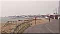
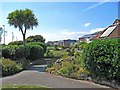
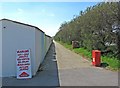
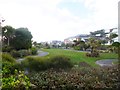
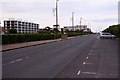
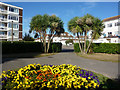
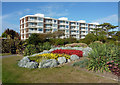
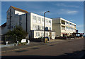
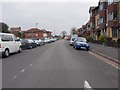
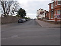

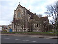
100 photos from this area
Area Information
Key information about the PO21 2NY including its size, population, and administrative classification.
- Area Type
- Postcode
- Area Size
- 1.0 hectares
- Population
- 1652
- Population Density
- 3339 people/km²
House Prices in PO21 2NY
29
Properties
£321,329
Average Sold Price
£62,500
Lowest Price
£800,000
Highest Price
Showing 29 properties
| Address | Type | Beds | Baths | Last Sale Price | Last Sale Date | |
|---|---|---|---|---|---|---|
| 111 Aldwick Road, Aldwick, PO21 2NY | Detached | 5 | 2 | £800,000 | Oct 2022 | |
| 113 Aldwick Road, Aldwick, PO21 2NY | Retail | 3 | 2 | £492,500 | Mar 2022 | |
| 121 Aldwick Road, Aldwick, PO21 2NY | Flat | 2 | 1 | £235,000 | Jun 2021 | |
| 121A Aldwick Road, Aldwick, PO21 2NY | Flat | - | - | £135,000 | Jul 2017 | |
| 129 Aldwick Road, Aldwick, PO21 2NY | house | - | - | £295,000 | Oct 2015 | |
| 105 Aldwick Road, Aldwick, PO21 2NY | Detached | 4 | - | £390,000 | Jul 2015 | |
| 127 Aldwick Road, Aldwick, PO21 2NY | Detached | 3 | 1 | £370,000 | Feb 2015 | |
| 125 Aldwick Road, Aldwick, PO21 2NY | Detached | 3 | - | £290,000 | Mar 2014 | |
| 103 Aldwick Road, Aldwick, PO21 2NY | house | 3 | - | £245,000 | Sep 2011 | |
| 123 Aldwick Road, Aldwick, PO21 2NY | Detached | - | - | £303,000 | Dec 2006 |
Page 1 of 3
Energy Efficiency in PO21 2NY
Amenities
Schools
| Rank | School | Type | Entry gender | Ages |
|---|
Explore more schools in this area
Go to Schools tabDemographics
Household Size
Two person
most common
Accommodation Type
Houses
most common
Tenure
82
majority
Ethnic Group
White
most common
Religion
N/A
most common
Household Composition
N/A
most common
Age
47
median
Elderly (65+ years)
most common
Household Deprivation
N/A
with no deprivation
NS-SEC
34
in Lower managerial occupations
Explore more demographic insights in this area
Go to Demographics tabPlanning
Planning Constraints
- Flood RiskPremium
- Ramsar Wetland SitesPremium
- Area of Outstanding Natural BeautyPremium
- Protected Nature ReservePremium
- Protected WoodlandPremium