Area Overview for PO21 2RB
Photos of PO21 2RB
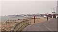
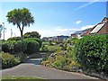
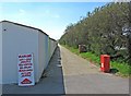
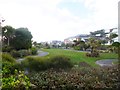
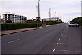
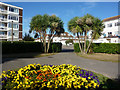
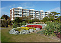
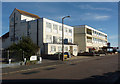
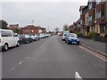
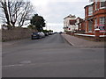

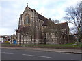
100 photos from this area
Area Information
Key information about the PO21 2RB including its size, population, and administrative classification.
- Area Type
- Postcode
- Area Size
- 1.1 hectares
- Population
- 1652
- Population Density
- 3339 people/km²
House Prices in PO21 2RB
20
Properties
£469,345
Average Sold Price
£139,950
Lowest Price
£725,000
Highest Price
Showing 20 properties
| Address | Type | Beds | Baths | Last Sale Price | Last Sale Date | |
|---|---|---|---|---|---|---|
| 22 Silverston Avenue, Aldwick, PO21 2RB | Detached | 5 | 2 | £725,000 | Jul 2024 | |
| 36 Silverston Avenue, Aldwick, PO21 2RB | Detached | 4 | 3 | £710,000 | Jun 2024 | |
| 1 Silverston Avenue, Aldwick, PO21 2RB | Retail | 3 | 2 | £435,000 | Jun 2022 | |
| 12 Silverston Avenue, Aldwick, PO21 2RB | Detached | 4 | 1 | £545,000 | Jun 2021 | |
| 6 Silverston Avenue, Aldwick, PO21 2RB | Detached | 4 | 1 | £425,000 | Jun 2018 | |
| 26 Silverston Avenue, Aldwick, PO21 2RB | Detached | 4 | 1 | £475,000 | Oct 2017 | |
| 20 Silverston Avenue, Aldwick, PO21 2RB | house | 3 | 1 | £515,000 | Sep 2017 | |
| 16 Silverston Avenue, Aldwick, PO21 2RB | Detached | 4 | - | £348,500 | Feb 2014 | |
| Field End, 38 Silverston Avenue, Aldwick, PO21 2RB | Detached | 5 | 2 | £375,000 | Apr 2004 | |
| 28 Silverston Avenue, Aldwick, PO21 2RB | Detached | 3 | 2 | £139,950 | Nov 1997 |
Page 1 of 2
Energy Efficiency in PO21 2RB
Amenities
Schools
| Rank | School | Type | Entry gender | Ages |
|---|
Explore more schools in this area
Go to Schools tabDemographics
Household Size
Two person
most common
Accommodation Type
Houses
most common
Tenure
82
majority
Ethnic Group
White
most common
Religion
N/A
most common
Household Composition
N/A
most common
Age
47
median
Elderly (65+ years)
most common
Household Deprivation
N/A
with no deprivation
NS-SEC
34
in Lower managerial occupations
Explore more demographic insights in this area
Go to Demographics tabPlanning
Planning Constraints
- Flood RiskPremium
- Ramsar Wetland SitesPremium
- Area of Outstanding Natural BeautyPremium
- Protected Nature ReservePremium
- Protected WoodlandPremium