Area Overview for PO21 2AD
Photos of PO21 2AD

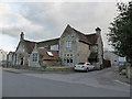
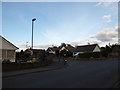
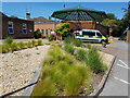
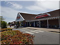
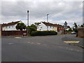

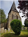
67 photos from this area
Area Information
Key information about the PO21 2AD including its size, population, and administrative classification.
- Area Type
- Postcode
- Area Size
- 1.2 hectares
- Population
- 1748
- Population Density
- 6469 people/km²
House Prices in PO21 2AD
10
Properties
£244,250
Average Sold Price
£96,750
Lowest Price
£410,000
Highest Price
Showing 10 properties
| Address | Type | Beds | Baths | Last Sale Price | Last Sale Date | |
|---|---|---|---|---|---|---|
| 88 Chichester Road, Bognor Regis, PO21 2AD | Retail | 3 | 2 | £410,000 | Oct 2022 | |
| 72 Chichester Road, Bognor Regis, PO21 2AD | house | - | - | £304,000 | Nov 2019 | |
| 78 Chichester Road, Bognor Regis, PO21 2AD | Detached | - | - | £230,000 | May 2008 | |
| 84 Chichester Road, Bognor Regis, PO21 2AD | Detached | - | - | £262,000 | Sep 2007 | |
| 74 Chichester Road, Bognor Regis, PO21 2AD | Bungalow | 4 | 1 | £235,000 | Jul 2007 | |
| 68 Chichester Road, Bognor Regis, PO21 2AD | Detached | - | - | £172,000 | Nov 2001 | |
| 86 Chichester Road, Bognor Regis, PO21 2AD | Detached | - | - | £96,750 | Jul 2000 | |
| 70 Chichester Road, Bognor Regis, PO21 2AD | Bungalow | 2 | 1 | - | - | |
| 76 Chichester Road, Bognor Regis, PO21 2AD | Detached | - | - | - | - | |
| 80 Chichester Road, Bognor Regis, PO21 2AD | Detached | - | - | - | - |
Energy Efficiency in PO21 2AD
Amenities
Schools
| Rank | School | Type | Entry gender | Ages |
|---|
Explore more schools in this area
Go to Schools tabDemographics
Household Size
Family (3-5 people)
most common
Accommodation Type
Houses
most common
Tenure
60
majority
Ethnic Group
White
most common
Religion
N/A
most common
Household Composition
N/A
most common
Age
47
median
Adults (30-64 years)
most common
Household Deprivation
N/A
with no deprivation
NS-SEC
25
in Lower managerial occupations
Explore more demographic insights in this area
Go to Demographics tabPlanning
Planning Constraints
- Flood RiskPremium
- Ramsar Wetland SitesPremium
- Area of Outstanding Natural BeautyPremium
- Protected Nature ReservePremium
- Protected WoodlandPremium