Area Overview for PO20 3SE
Photos of PO20 3SE
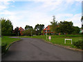
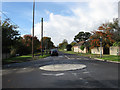
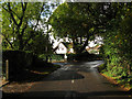
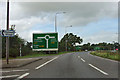

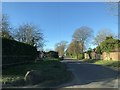

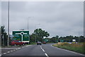
13 photos from this area
Area Information
Key information about the PO20 3SE including its size, population, and administrative classification.
- Area Type
- Postcode
- Area Size
- 10.3 hectares
- Population
- 1841
- Population Density
- 344 people/km²
House Prices in PO20 3SE
16
Properties
£708,417
Average Sold Price
£133,000
Lowest Price
£1,112,500
Highest Price
Showing 16 properties
| Address | Type | Beds | Baths | Last Sale Price | Last Sale Date | |
|---|---|---|---|---|---|---|
| Dell House, Wandleys Lane, Eastergate, PO20 3SE | house | 6 | 5 | £1,112,500 | Jun 2024 | |
| Nuthatch, Wandleys Lane, Eastergate, PO20 3SE | Bungalow | - | - | £820,000 | Jun 2021 | |
| BARNCROFT, WANDLEYS LANE, Fontwell, Eastergate, PO20 3SE | Flat | 1 | - | £675,000 | Apr 2021 | |
| Arun House, Wandleys Lane, Eastergate, PO20 3SE | house | 4 | 4 | £740,000 | Feb 2015 | |
| Wanley House, Wandleys Lane, Eastergate, PO20 3SE | Detached | - | - | £770,000 | Apr 2003 | |
| Wanley Lodge, Wandleys Lane, Eastergate, PO20 3SE | Detached | - | - | £133,000 | Sep 1998 | |
| 2, Fontwell Cottage, Wandleys Lane, Eastergate, PO20 3SE | Flat | 4 | 3 | - | - | |
| Barncroft Place, Wandleys Lane, Eastergate, PO20 3SE | Detached | 4 | 3 | - | - | |
| Woodfield Place, Wandleys Lane, Eastergate, PO20 3SE | Detached | 4 | 3 | - | - | |
| 7, Wandleys Lane Caravan Park, Wandleys Lane, Eastergate, PO20 3SE | Mobile Home | 2 | 1 | - | - |
Page 1 of 2
Energy Efficiency in PO20 3SE
Amenities
Schools
| Rank | School | Type | Entry gender | Ages |
|---|
Explore more schools in this area
Go to Schools tabDemographics
Household Size
Two person
most common
Accommodation Type
Houses
most common
Tenure
83
majority
Ethnic Group
White
most common
Religion
N/A
most common
Household Composition
N/A
most common
Age
47
median
Adults (30-64 years)
most common
Household Deprivation
N/A
with no deprivation
NS-SEC
37
in Lower managerial occupations
Explore more demographic insights in this area
Go to Demographics tabPlanning
Planning Constraints
- Flood RiskPremium
- Ramsar Wetland SitesPremium
- Area of Outstanding Natural BeautyPremium
- Protected Nature ReservePremium
- Protected WoodlandPremium