Area Overview for BN18 0ZD
Photos of BN18 0ZD
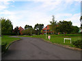
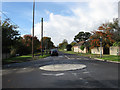
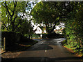
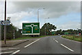

13 photos from this area
Area Information
Key information about the BN18 0ZD including its size, population, and administrative classification.
- Area Type
- Postcode
- Area Size
- 1.5 hectares
- Population
- 1841
- Population Density
- 344 people/km²
House Prices in BN18 0ZD
48
Properties
£352,272
Average Sold Price
£310,000
Lowest Price
£499,950
Highest Price
Showing 48 properties
| Address | Type | Beds | Baths | Last Sale Price | Last Sale Date | |
|---|---|---|---|---|---|---|
| 11 Connemara Crescent, Fontwell, BN18 0ZD | house | - | - | £354,950 | Jun 2024 | |
| 9 Connemara Crescent, Fontwell, BN18 0ZD | house | - | - | £350,000 | Apr 2024 | |
| 5 Connemara Crescent, Fontwell, BN18 0ZD | house | - | - | £350,000 | Apr 2024 | |
| 7 Connemara Crescent, Fontwell, BN18 0ZD | house | - | - | £310,000 | Apr 2024 | |
| 21 Connemara Crescent, Fontwell, BN18 0ZD | house | - | - | £499,950 | Mar 2024 | |
| 33 Connemara Crescent, Fontwell, BN18 0ZD | house | - | - | £310,000 | Mar 2024 | |
| 8 Connemara Crescent, Fontwell, BN18 0ZD | house | - | - | £360,527 | Feb 2024 | |
| 45 Connemara Crescent, Fontwell, BN18 0ZD | house | - | - | £320,000 | Feb 2024 | |
| 39 Connemara Crescent, Fontwell, BN18 0ZD | Semi-detached | 3 | 2 | £320,000 | Feb 2024 | |
| 43 Connemara Crescent, Fontwell, BN18 0ZD | Semi-detached | 3 | 2 | £320,000 | Feb 2024 |
Page 1 of 5
Energy Efficiency in BN18 0ZD
Amenities
Schools
| Rank | School | Type | Entry gender | Ages |
|---|
Explore more schools in this area
Go to Schools tabDemographics
Household Size
Two person
most common
Accommodation Type
Houses
most common
Tenure
83
majority
Ethnic Group
White
most common
Religion
N/A
most common
Household Composition
N/A
most common
Age
47
median
Adults (30-64 years)
most common
Household Deprivation
N/A
with no deprivation
NS-SEC
37
in Lower managerial occupations
Explore more demographic insights in this area
Go to Demographics tabPlanning
Planning Constraints
- Flood RiskPremium
- Ramsar Wetland SitesPremium
- Area of Outstanding Natural BeautyPremium
- Protected Nature ReservePremium
- Protected WoodlandPremium