Area Overview for PO17 5QG
Photos of PO17 5QG
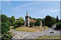
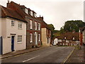
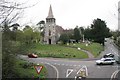
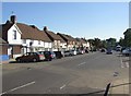
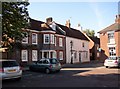
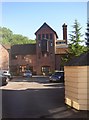
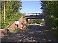
100 photos from this area
Area Information
Key information about the PO17 5QG including its size, population, and administrative classification.
- Area Type
- Postcode
- Area Size
- 5.5 hectares
- Population
- 1607
- Population Density
- 286 people/km²
House Prices in PO17 5QG
69
Properties
£496,221
Average Sold Price
£342,000
Lowest Price
£699,950
Highest Price
Showing 69 properties
| Address | Type | Beds | Baths | Last Sale Price | Last Sale Date | |
|---|---|---|---|---|---|---|
| 29 Draper Road, Wickham, PO17 5QG | house | - | - | £437,000 | Mar 2025 | |
| 40 Draper Road, Wickham, PO17 5QG | Semi-detached | 3 | 2 | £392,500 | Dec 2024 | |
| 25 Draper Road, Wickham, PO17 5QG | house | - | - | £445,000 | Dec 2024 | |
| 44 Draper Road, Wickham, PO17 5QG | house | - | - | £379,950 | Sep 2024 | |
| 33 Draper Road, Wickham, PO17 5QG | house | - | - | £555,000 | Sep 2024 | |
| 57 Draper Road, Wickham, PO17 5QG | house | - | - | £655,000 | Jun 2024 | |
| 42 Draper Road, Wickham, PO17 5QG | Terraced | 3 | 2 | £400,000 | May 2024 | |
| 80 Draper Road, Wickham, PO17 5QG | house | - | - | £395,000 | Apr 2024 | |
| 78 Draper Road, Wickham, PO17 5QG | Terraced | 3 | 2 | £400,000 | Apr 2024 | |
| 53 Draper Road, Wickham, PO17 5QG | house | - | - | £699,950 | Apr 2024 |
Page 1 of 7
Energy Efficiency in PO17 5QG
Amenities
Schools
| Rank | School | Type | Entry gender | Ages |
|---|
Explore more schools in this area
Go to Schools tabDemographics
Household Size
One person
most common
Accommodation Type
Houses
most common
Tenure
56
majority
Ethnic Group
White
most common
Religion
N/A
most common
Household Composition
N/A
most common
Age
47
median
Adults (30-64 years)
most common
Household Deprivation
N/A
with no deprivation
NS-SEC
33
in Lower managerial occupations
Explore more demographic insights in this area
Go to Demographics tabPlanning
Planning Constraints
- Flood RiskPremium
- Ramsar Wetland SitesPremium
- Area of Outstanding Natural BeautyPremium
- Protected Nature ReservePremium
- Protected WoodlandPremium