Area Overview for PO17 5HW
Photos of PO17 5HW
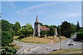
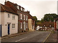
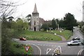
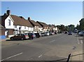
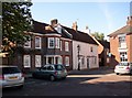
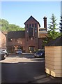
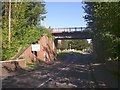
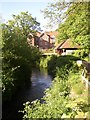
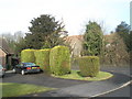
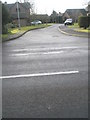
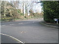
100 photos from this area
Area Information
Key information about the PO17 5HW including its size, population, and administrative classification.
- Area Type
- Postcode
- Area Size
- 1.5 hectares
- Population
- 1607
- Population Density
- 286 people/km²
House Prices in PO17 5HW
25
Properties
£252,950
Average Sold Price
£30,900
Lowest Price
£475,000
Highest Price
Showing 25 properties
| Address | Type | Beds | Baths | Last Sale Price | Last Sale Date | |
|---|---|---|---|---|---|---|
| 1 The Circle, Wickham, PO17 5HW | Retail | 4 | 3 | £475,000 | Aug 2022 | |
| 24 The Circle, Wickham, PO17 5HW | house | - | - | £415,000 | Jul 2022 | |
| 17 The Circle, Wickham, PO17 5HW | Semi-detached | 3 | 1 | £300,000 | Jun 2020 | |
| 19 The Circle, Wickham, PO17 5HW | Semi-detached | 3 | 2 | £327,500 | Mar 2020 | |
| 25 The Circle, Wickham, PO17 5HW | house | - | - | £322,000 | Mar 2019 | |
| 18 The Circle, Wickham, PO17 5HW | Terraced | 3 | 1 | £310,000 | Feb 2018 | |
| 13 The Circle, Wickham, PO17 5HW | Terraced | 4 | 2 | £250,000 | Aug 2016 | |
| 10 The Circle, Wickham, PO17 5HW | house | - | - | £174,950 | Jun 2009 | |
| 7 The Circle, Wickham, PO17 5HW | Semi-detached | - | - | £190,000 | Mar 2006 | |
| 12 The Circle, Wickham, PO17 5HW | Semi-detached | - | - | £197,000 | Jun 2005 |
Page 1 of 3
Energy Efficiency in PO17 5HW
Amenities
Schools
| Rank | School | Type | Entry gender | Ages |
|---|
Explore more schools in this area
Go to Schools tabDemographics
Household Size
One person
most common
Accommodation Type
Houses
most common
Tenure
56
majority
Ethnic Group
White
most common
Religion
N/A
most common
Household Composition
N/A
most common
Age
47
median
Adults (30-64 years)
most common
Household Deprivation
N/A
with no deprivation
NS-SEC
33
in Lower managerial occupations
Explore more demographic insights in this area
Go to Demographics tabPlanning
Planning Constraints
- Flood RiskPremium
- Ramsar Wetland SitesPremium
- Area of Outstanding Natural BeautyPremium
- Protected Nature ReservePremium
- Protected WoodlandPremium