Area Overview for PO15 5PR
Photos of PO15 5PR
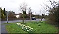
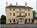
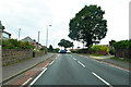
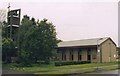
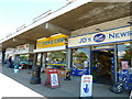
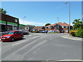
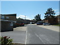
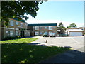
46 photos from this area
Area Information
Key information about the PO15 5PR including its size, population, and administrative classification.
- Area Type
- Postcode
- Area Size
- 1.1 hectares
- Population
- 1659
- Population Density
- 2145 people/km²
House Prices in PO15 5PR
18
Properties
£210,136
Average Sold Price
£126,000
Lowest Price
£319,000
Highest Price
Showing 18 properties
| Address | Type | Beds | Baths | Last Sale Price | Last Sale Date | |
|---|---|---|---|---|---|---|
| 181 Highlands Road, Fareham, PO15 5PR | Semi-detached | 3 | 1 | £319,000 | Sep 2024 | |
| 183 Highlands Road, Fareham, PO15 5PR | Semi-detached | 3 | 1 | £250,000 | Jun 2019 | |
| 161 Highlands Road, Fareham, PO15 5PR | Bungalow | - | - | £198,000 | Feb 2016 | |
| 179 Highlands Road, Fareham, PO15 5PR | house | - | - | £214,000 | Aug 2015 | |
| 159 Highlands Road, Fareham, PO15 5PR | Semi-detached | 3 | - | £200,000 | May 2015 | |
| 175 Highlands Road, Fareham, PO15 5PR | house | - | - | £222,000 | Aug 2010 | |
| 169 Highlands Road, Fareham, PO15 5PR | house | - | - | £207,000 | Sep 2004 | |
| 173 Highlands Road, Fareham, PO15 5PR | Detached | - | - | £258,000 | Aug 2004 | |
| 167 Highlands Road, Fareham, PO15 5PR | house | - | - | £188,000 | Apr 2004 | |
| 185 Highlands Road, Fareham, PO15 5PR | Semi-detached | - | - | £129,500 | Jun 2001 |
Page 1 of 2
Energy Efficiency in PO15 5PR
Amenities
Schools
| Rank | School | Type | Entry gender | Ages |
|---|
Explore more schools in this area
Go to Schools tabDemographics
Household Size
Two person
most common
Accommodation Type
Houses
most common
Tenure
89
majority
Ethnic Group
White
most common
Religion
N/A
most common
Household Composition
N/A
most common
Age
47
median
Adults (30-64 years)
most common
Household Deprivation
N/A
with no deprivation
NS-SEC
34
in Lower managerial occupations
Explore more demographic insights in this area
Go to Demographics tabPlanning
Planning Constraints
- Flood RiskPremium
- Ramsar Wetland SitesPremium
- Area of Outstanding Natural BeautyPremium
- Protected Nature ReservePremium
- Protected WoodlandPremium