Area Overview for PO15 5PF
Photos of PO15 5PF
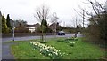

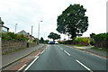
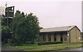
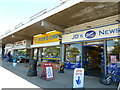
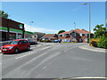
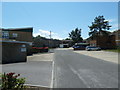
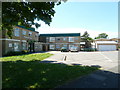
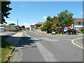
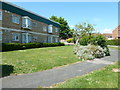
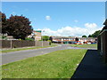
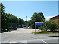
46 photos from this area
Area Information
Key information about the PO15 5PF including its size, population, and administrative classification.
- Area Type
- Postcode
- Area Size
- 2.4 hectares
- Population
- 1659
- Population Density
- 2145 people/km²
House Prices in PO15 5PF
36
Properties
£276,748
Average Sold Price
£74,000
Lowest Price
£500,000
Highest Price
Showing 36 properties
| Address | Type | Beds | Baths | Last Sale Price | Last Sale Date | |
|---|---|---|---|---|---|---|
| 74 Abbeyfield Drive, Fareham, PO15 5PF | Detached | 2 | 3 | £500,000 | Jul 2025 | |
| 104 Abbeyfield Drive, Fareham, PO15 5PF | Semi-detached | 3 | 1 | £338,000 | Jun 2025 | |
| 48 Abbeyfield Drive, Fareham, PO15 5PF | Bungalow | 3 | 1 | £395,000 | May 2025 | |
| 44 Abbeyfield Drive, Fareham, PO15 5PF | Semi-detached | 3 | 1 | £350,000 | Mar 2025 | |
| 40 Abbeyfield Drive, Fareham, PO15 5PF | Bungalow | 2 | 1 | £342,000 | Mar 2025 | |
| 72 Abbeyfield Drive, Fareham, PO15 5PF | Semi-detached | 3 | 2 | £425,000 | Jun 2024 | |
| 86 Abbeyfield Drive, Fareham, PO15 5PF | Semi-detached | 3 | 2 | £325,000 | Feb 2024 | |
| 90 Abbeyfield Drive, Fareham, PO15 5PF | Semi-detached | 4 | 2 | £470,000 | Jun 2023 | |
| 54 Abbeyfield Drive, Fareham, PO15 5PF | Semi-detached | 3 | - | £420,000 | Nov 2022 | |
| 102 Abbeyfield Drive, Fareham, PO15 5PF | house | - | - | £283,500 | Apr 2021 |
Page 1 of 4
Energy Efficiency in PO15 5PF
Amenities
Schools
| Rank | School | Type | Entry gender | Ages |
|---|
Explore more schools in this area
Go to Schools tabDemographics
Household Size
Two person
most common
Accommodation Type
Houses
most common
Tenure
89
majority
Ethnic Group
White
most common
Religion
N/A
most common
Household Composition
N/A
most common
Age
47
median
Adults (30-64 years)
most common
Household Deprivation
N/A
with no deprivation
NS-SEC
34
in Lower managerial occupations
Explore more demographic insights in this area
Go to Demographics tabPlanning
Planning Constraints
- Flood RiskPremium
- Ramsar Wetland SitesPremium
- Area of Outstanding Natural BeautyPremium
- Protected Nature ReservePremium
- Protected WoodlandPremium