Area Overview for PO10 7TH
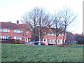
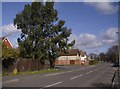
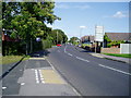
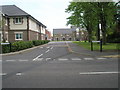
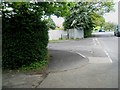
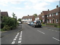
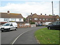
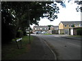
Photos of PO10 7TH

Area Information
Living in PO10 7TH offers a settled residential experience within a compact cluster of 2.2 hectares. This small postcode supports a population of 1,774 people, creating a neighbourhood where residents know one another. The area sits in England and functions as a specific residential pocket rather than a sprawling suburb. You will find the community is dominated by houses, which defines the street scene and garden plots you can expect. The density reaches 80,335 people per square kilometre, a figure that reflects the concentrated nature of this housing group. Daily life here revolves around access to local services and commuting links that serve the wider Emsworth region. You move through an environment built for stability, where the housing stock is largely permanent and owned by those who reside within its boundaries. The layout is practical, designed to accommodate a mature demographic seeking a quiet home life. Whether you prioritise proximity to rail stations or direct access to local shops, PO10 7TH provides a grounded setting. The area acts as a quiet anchor for families and retirees alike, offering a slice of suburban England that prioritises consistency over rapid change.
- Area Type
- Postcode
- Area Size
- 2.2 hectares
- Population
- 1774
- Population Density
- 1973 people/km²
The property market in PO10 7TH is defined by a strong tendency towards home ownership, with 83% of properties resident-owned. This high rate indicates a community where residents have invested in permanent homes rather than short-term tenancies. Houses form the primary accommodation type, meaning the street scene consists of semi-detached or detached homes with private gardens. You will not find apartment complexes or flats within this specific postcode cluster. The housing stock caters to buyers who value established properties over new developments or shared-ownership schemes. This market structure makes the area less volatile for investment compared to high-rental zones, as owners tend to stay put for longer periods. For prospective buyers, the environment is one of established ownership where neighbours often know each other well. Price fluctuations are likely dampened by the mix of owner-occupied families. If you are looking for a home to stay in for years, this market structure offers security. The lack of rental properties means the local economy is driven by local spending rather than transient service industries targeting tourists or commuters.
House Prices in PO10 7TH
Showing 40 properties
| Address | Type | Beds | Baths | Last Sale Price | Last Sale Date | |
|---|---|---|---|---|---|---|
| 30 Greville Green, Emsworth, PO10 7TH | house | - | - | £305,000 | Aug 2025 | |
| 8 Greville Green, Emsworth, PO10 7TH | Detached | 3 | 1 | £375,120 | Apr 2024 | |
| 24 Greville Green, Emsworth, PO10 7TH | Semi-detached | 2 | - | £235,000 | Feb 2023 | |
| 21 Greville Green, Emsworth, PO10 7TH | house | - | - | £222,000 | Jan 2013 | |
| 15 Greville Green, Emsworth, PO10 7TH | house | - | - | £224,000 | Sep 2012 | |
| 3 Greville Green, Emsworth, PO10 7TH | house | - | - | £180,000 | Sep 2011 | |
| 18 Greville Green, Emsworth, PO10 7TH | house | - | - | £60,000 | Jul 2007 | |
| 13 Greville Green, Emsworth, PO10 7TH | Semi-detached | - | - | £235,000 | May 2007 | |
| 32 Greville Green, Emsworth, PO10 7TH | house | - | - | £164,500 | Sep 2004 | |
| 27 Greville Green, Emsworth, PO10 7TH | Detached | - | - | £200,000 | Jun 2003 |
Energy Efficiency in PO10 7TH
Residents of PO10 7TH enjoy convenient access to a range of retail and transport options nearby. Within practical reach, you can visit Co-op Emsworth, Budgens Emsworth, and M&S Emsworth BP for your weekly shopping needs. These five retail outlets are located close enough for frequent trips without requiring a long journey. For travel, five rail stations serve the area, including Emsworth Railway Station, Warblington Railway Station, and Havant Railway Station. These links integrate you with the national rail network efficiently. Additionally, four ferry landings such as Bosham Hoe, West Itchenor, and Hayling Island provide access to waterways and nearby coastal towns. This mix of rail and ferry options gives you multiple ways to commute or take day trips. Daily life involves a short walk or drive to essentials, eliminating the need for a heavy car dependency for small tasks. The combination of local supermarkets and transport hubs creates a balanced lifestyle where work and leisure remain accessible.
Amenities
Schools
Families in PO10 7TH have St James Church of England Controlled Primary School serving as their main educational option. This primary school holds a good Ofsted rating, signalling a standard of education that meets government expectations. The school serves children within the immediate vicinity, feeding directly into the local residential clusters. Because the data only lists one specific primary institution, families typically rely on this single nearby option for early years education. There are no secondary schools listed within the immediate data scope for this postcode, suggesting older children may travel to schools in nearby large towns like Havant or Langstone. The presence of a Church of England primary school ensures a curriculum with religious education elements suitable for Christian families. You must check catchment boundaries carefully, as one school does not always guarantee a place for all local residents. The educational landscape is currently focused on early years, with higher education likely accessed through further travel.
| Rank | School | Type | Entry gender | Ages |
|---|
Explore more schools in this area
Go to Schools tabDemographics
The community in PO10 7TH is characterised by a mature demographic profile, with a median age of 47 years. Most residents fall into the age range of 30 to 64 years, indicating a stable population of working professionals and families with children. This age distribution suggests an active community where residents are often at peak earning potential yet have the life experience to value stability. Homeownership stands at 83%, creating a neighbourhood where most people have long-term roots rather than transient tenancies. Houses form the predominant accommodation type, shaping the local character with gardens and driveway spaces rather than high-rise blocks. The ethnic composition is predominantly White, which mirrors the general demographic trends of the surrounding south Hampshire sites. Deprivation indicators are not detailed in current records, but the high ownership rate suggests financial stability among residents. This demographic mix means the local shops and schools cater to adults who have likely raised families or are near retirement. You will encounter neighbours who value privacy, garden space, and established locations. The area appeals to those who prefer a settled life over the pace of major urban centres.
Household Size
Accommodation Type
Tenure
Ethnic Group
Religion
Household Composition
Age
Household Deprivation
NS-SEC
Explore more demographic insights in this area
Go to Demographics tabPlanning
Planning Constraints
- Flood RiskPremium
- Ramsar Wetland SitesPremium
- Area of Outstanding Natural BeautyPremium
- Protected Nature ReservePremium
- Protected WoodlandPremium